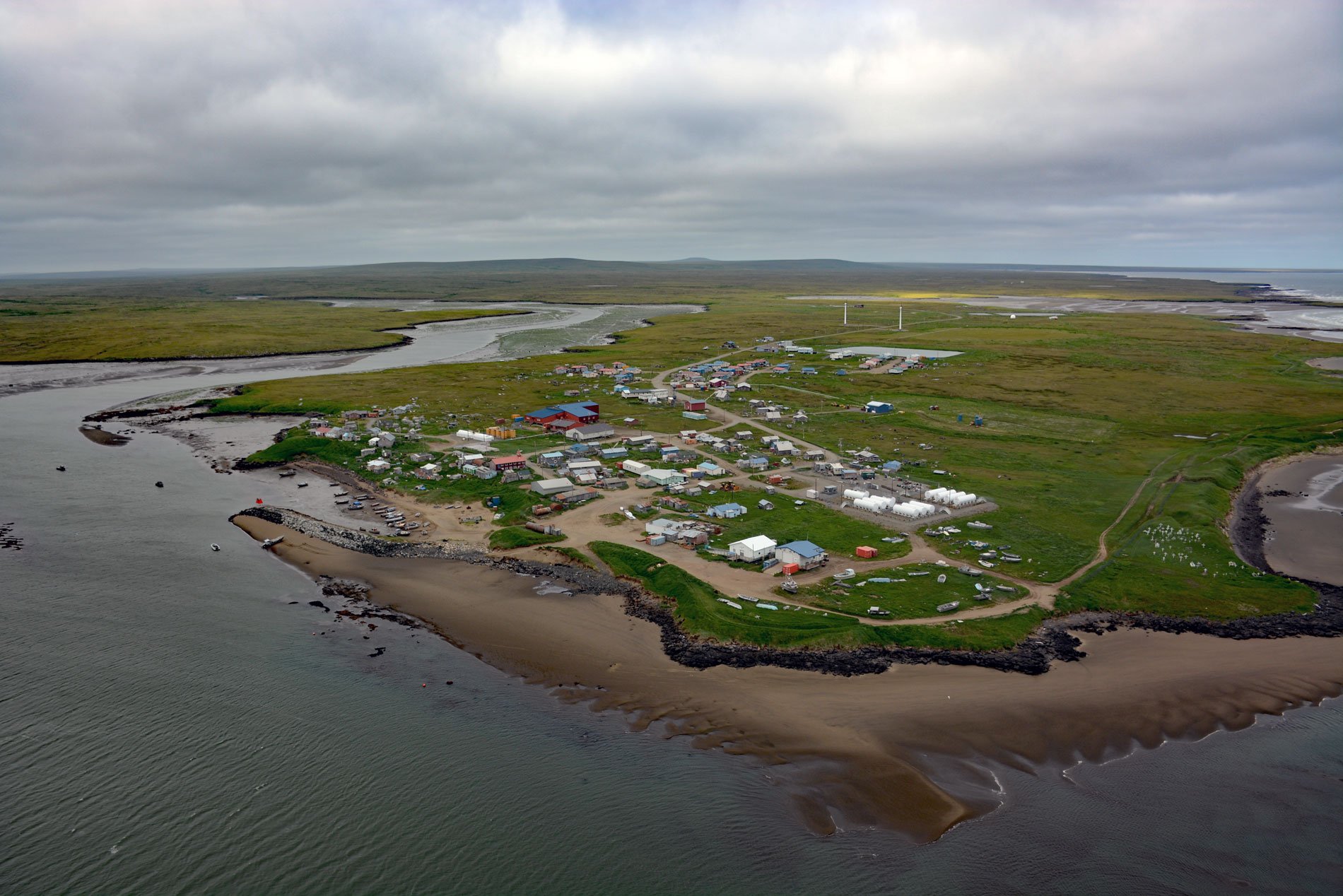
Mekoryuk is a community situated at the western entrance to Shoal Bay on the northern shore of Nunivak Island in the Bering Sea, about 153 miles (246 km) west-southwest of Bethel and 80 miles (129 km) south of Hooper Bay, Alaska. Mekoryuk is the only community on the island. Nunivak Island is separated from the Yukon-Kuskokwim Delta by Etolin Strait, only 19 miles (31 km) wide but currents can reach 1.6 feet per second (50 cm/s) making the crossing dangerous for small boats. The island is volcanic in origin dominated by a Quaternary volcanic plateau overlying Cretaceous sedimentary rocks. The island is dotted with about sixty cinder cones and four maars. Much of the exposed surface consists of thin flows of pahoehoe lava from small shield volcanoes that last erupted during the Pleistocene or about 300,000 years ago. The youngest flows are exposed at sea cliffs on the eastern coast of the island. Nunivak Island is covered with tundra and shallow lakes where permafrost is ubiquitous. The southern coast of the island is characterized by coastal bluffs 100 to 450 feet (31-137 m) high and immense sand dunes up to 100 feet (31 m) high backing sandy beaches. An area of about 599,972 acres (242,800 ha) is in the Nunivak Island Wilderness Area managed as part of the Yukon Delta National Wildlife Refuge.
The earliest evidence of humans along the Bering Sea coast dates to about 2500 years ago and marks the beginning of the Norton tradition inhabiting western Alaska including offshore islands such as Nunivak. The Norton people represent the first humans to focus their subsistence on coastal resources, bringing with them the development of distinctive pottery, house form, tools, and fishing and sea mammal hunting technology such as harpoon heads, while still maintaining a reliance on seasonally available terrestrial resources. In 1821, Captain Mikhail N. Vasilyev of the Russian-American Company was the first known European to visit Nunivak. Vasilev reported 400 people living in about 16 villages distributed along the coast subsisting on fish, seal, caribou, berries, and other local foods. They are Central Alaskan Yup’ik but speak a different dialect called Cup’ig. The island is called Nunivar in the Cup’ig dialect and the people call themselves Nunivak Cup’ig or Nunivaarmiut. In 1900, an epidemic wiped out the island population, leaving only four families alive. In the early 1900s, the first school on the island was established at Nash Harbor, traditionally called Qimugglugpagmiut, on the northwestern coast about 28 miles (45 km) southwest of present-day Mekoryuk.
Up to the 1940s, the traditional Cup’ig lifestyle, ceremonies and religious beliefs were practiced. The women and children lived in semi-subterranean sod houses called barabaras, while men lived in a ‘kazgi‘, or a male communal house. Unmarried males resided in the communal house, but it was also the social center of the village, and served as the town hall, bath house, and dancing pavilion. In the 1930s, the Evangelical Covenant Church was built at Mekoryuk, followed by a school in 1939. People moved to the village from other areas of the island to be near the church and school. In the mid-1900s, the village at Nash Harbor was abandoned and Mekoryuk became the only permanent population center on the island. Reindeer herding was introduced in 1920 and a slaughterhouse was built in 1945. In 1934, 34 musk oxen from Greenland were transferred to Nunivak Island to save the species from extinction. Today, the musk-ox herd numbers around 500, and calves from this herd have been relocated and introduced to other areas of Alaska. Read more here and here. Explore more of Mekoryuk and Nunivak Island here:

