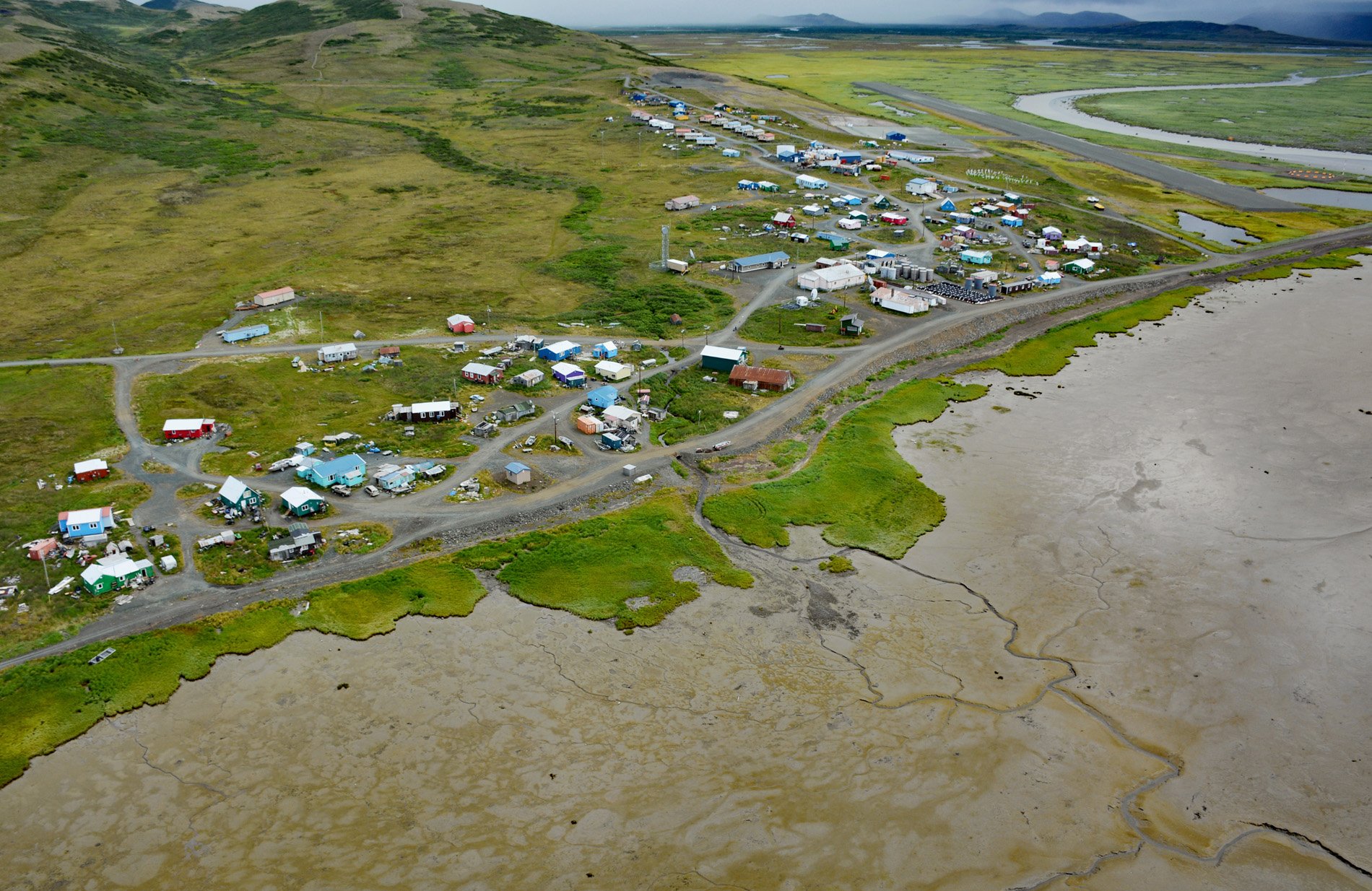
Goodnews Bay is a Central Yup’ik village at the mouth of the Goodnews River where it enters Goodnews Bay, about 117 miles (189 km) south of Bethel and 12 miles (19 km) northeast of Platinum, Alaska. The embayment is about 30 miles (48 km) northeast of Cape Newenham and extends southwest for about 10 miles (16 km) from the mouth of the Goodnews River to Kuskokwim Bay between North and South Spits. The name is a translation by the U.S. Coast and Geodetic Survey of the Russian ‘Port Dobrykh Vestey’, which in turn, is a translation from the French ‘Bonnes Nouvelles Baie’ that originated in 1836 from Captain Friedrich von Lütke. The village was settled when residents from the former village of Mumtraq, who refer to themselves as Mumtrahamiut, moved here and a government school was founded by the Bureau of Indian Affairs. The community has historically been devastated by storms and related flooding from storm surges, which forced the village to relocate to higher ground in the 1920s; however, the new site is still threatened by flooding mostly caused by storm surges.
The Goodnews River starts from the outlet of Goodnews Lake at an elevation of 400 feet (122 m) in the Ahklun Mountains and flows generally southwest for 44 miles (71 km), draining a watershed of 482,000 acres (195,059 ha) when combined with the Middle Fork and South Fork Goodnews rivers that merge near the estuary. The mouth of the river and the Goodnews Bay area have been inhabited continuously for at least 2,000 years and a nearby archaeological site has evidence of human habitation dating to 4,000 or 5,000 years ago. The original inhabitants of the coastal area were known as the Kukowogamiut, and the area may also have been used by the Togiagamiut. In 1778, Captain James Cook was the first European to make contact with the Yup’ik peoples of this region. Russian fur traders established a trading post in the region in the early 19th century. Following the Alaska Purchase in 1867, gold and mineral discoveries in the Goodnews Bay area brought a flood of miners to the region. Platinum was first discovered in the Goodnews Bay area in 1926 and supported several small-scale placer mining operations. In 1937, the Goodnews Bay Mining Company began large-scale commercial operations and continued to mine in the area until 1979. During this time the company recovered over 500,000 ounces (14,174 kg) of platinum along with small amounts of gold.
The residents of Goodnews Bay practice a mostly traditional subsistence lifestyle that involves hunting, trapping, and fishing. A wide variety of fish and wildlife are present in and around Goodnews Bay including birds, seals, whales, walruses and many varieties of fish. The bay and offshore waters are a major herring fishery, drawing residents from many other villages during the height of the season. The community has a long history of flooding due to storm surges, and in the 1920s had to relocate from the surrounding lowlands to the hillside. As is typical with numerous other communities in the region, critical infrastructure such as the airport and sewage lagoon are located in low-lying areas near the coast. Storm surge and wind-driven waves at high tide are the primary cause of flooding, and have repeatedly inundated the village airport runway and eroded the bluff fronting the community that is composed primarily of unconsolidated quaternary alluvial deposits. The community mitigates erosion of the bluff fronting the community with a revetment of loose rock. Homes and the power generation facility are located near the armored bluff edge, and records indicated that homes have been damaged by storm surge flooding, but not erosion. Read more here and here. Explore more of Goodnews Bay village and Goodnews Bay here:

