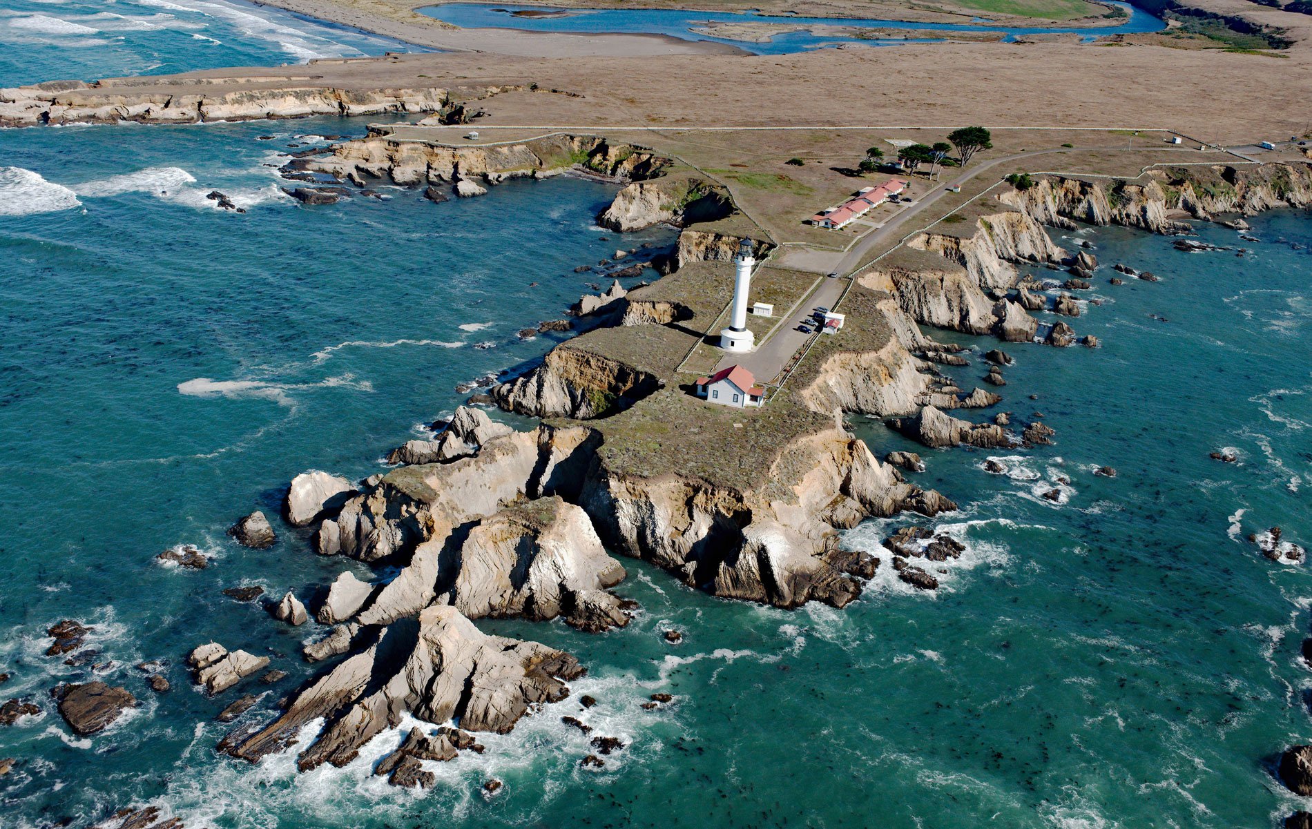
Point Arena is a narrow headland about 0.5 miles (0.8 km) long with a historical lighthouse that marks a significant change in the orientation of the Mendocino Coast, about 34 miles (55 km) south of Fort Bragg and 4 miles (6.4 km) northwest of the community of Point Arena, California. The San Andreas Fault runs out to sea at Point Arena, and the area is seismically active. This area was originally inhabited by the Pomo people that lived in small groups or bands of independent hunter-gatherer communities and are known for their tradition of intricate basketry. The first European to record Point Arena was Spaniard Bartolomé Ferrer in 1543, who named it Cabo de Fortunas. In 1775, the cape was renamed Punta Delgado by Lieutenant Juan Francisco de la Bodega y Quadra during an expedition sent by Antonio María de Bucareli y Ursúato from New Spain to map and claim the north coast of Alta California for Spain. The point and the small harbor town south of it were called Barra de Arena, meaning “sand bar”, and finally became known as Point Arena, meaning “sand point”. The sand bar at the point created a natural hazard to ship traffic carrying redwood lumber from Northern California to San Francisco in the 1850s and 1860s, which justified the need for a new lighthouse and fog signal.
A lighthouse was built on Point Arena in 1869 and commissioned in 1870. The brick and concrete lighthouse stood 100 feet (30 m) tall and a first-order Fresnel lens was installed in the lantern room at a height of 150 feet (46 m) above the ocean. Near the base of the tower, a large two-and-a-half-story brick dwelling was built to house four lightkeepers and their families. In 1871, additional funding was appropriated for a fog signal building with a steam whistle close to the tip of the point. In 1895, the fog signal building was replaced because cliff erosion was so severe that the building was in danger of being destroyed. Water for the steam whistle and the inhabitants of the station was pumped from a spring by a windmill and then stored in a tank and delivered through a galvanized iron pipe. In 1906, the San Francisco earthquake severely damaged both the tower and the dwelling and both had to be removed. In 1908, four new residences were built for the lightkeepers and a new tower that stands 115 feet (35 m) tall with a Fresnel lens over 6 feet (1.8 m) in diameter and weighing more than 6 tons (5443 kg). The light station was automated in 1977 and in 1984 a nonprofit organization called the Point Arena Lighthouse Keepers acquired the light station.
The rock formation or terrane that created Point Arena is comprised of steeply dipping interbedded sandstone and mudstone with layers of clay. The geologic term “terrane” refers to a large fault-bounded packet of rocks with a geologic makeup and history distinctly different from surrounding rocks. The Point Arena Terrane is comprised of sedimentary rocks of a Miocene age that are believed to have traveled several hundred miles northwest over millions of years along the San Andreas Fault. These sedimentary rocks formed flat-topped marine terraces by wave erosion during periods of high sea level. The eroded terraces were then elevated above present sea levels by either the land rising, as is occurring along the tectonically active California coast, or by a drop in sea level. In California, the majority of marine terraces are underlain by marine sandstones, siltstones, and mudstones, which are topped by a relatively thin layer of poorly- to unlithified sands, gravels, and cobbles. Coastal cliffs are formed in the steep, erosional face of the elevated terraces and the rates of cliff erosion are greatest at promontories and headlands where wave energy is topographically focused. At Point Arena, wave erosion has created several sea caves and littoral sinkholes. A littoral sinkhole forms when the roof of a sea cave collapses creating an opening to the surface. A large littoral sinkhole is evident at the tip of Point Arena, and a sea cave 467 feet (142 m) in length called the Cave of Lost Soles is at the base of the headland. Read more here and here, and see a live webcam view here. Explore more of Point Arena and the Mendocino coast here:

