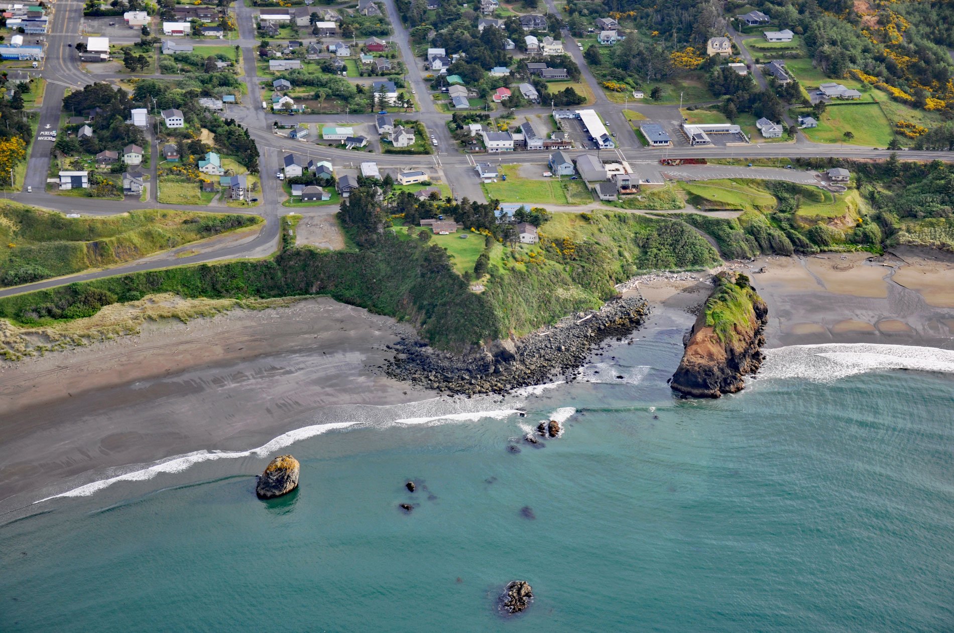
Battle Rock is a large sea stack connected to the mainland by a narrow rocky ridge, situated 500 feet (152 m) southeast of Fort Point at the head of Port Orford, a shallow embayment or bight, about 23 miles (37 km) north of Gold Beach and adjacent to the community of Port Orford, Oregon. Battle Rock is named for a skirmish between Euro-American settlers and a band of Native Americans from the Rogue River. Before the arrival of Euro-American settlers, this area was inhabited for thousands of years by Tututni people, one of the historical Lower Rogue River Athabascan tribes from southwestern Oregon that traditionally lived near the Pacific Coast between the Coquille River to the north and Chetco River to the south. In 1543, the Spanish explorer Juan Rodríguez Cabrillo and his pilot Bartolomé Ferrer mapped Cape Blanco about 7 miles (11 km) north of Port Orford. In 1792, Captain George Vancouver of the Royal Navy named it Cape Orford, after his friend George Walpole, the 3rd Earl of Orford. However, the original name of Cape Blanco had become well known and Vancouver’s name for the cape languished. In 1850, the U.S. Congress passed the Oregon Donation Land Law that allowed white settlers to lay claim to native lands in Western Oregon. Port Orford, which is named after the cape, claims to be the oldest town site on the Oregon coast, dating to 1851.
On June 9, 1851, nine men under the command of Captain Kirkpatrick were dropped off by Captain William Tichenor on the steamship Sea Gull. They were armed with muskets and a four-pound cannon. After the men disembarked with their weapons and supplies, Tichenor sailed south to San Francisco for more supplies intending to return in two weeks. The men climbed a rock at the edge of the beach and set up camp. Accounts of what transpired differ. According to the settlers, the Natives reacted to the newcomers by attacking them. Twenty-three natives were killed, and two of Kilpatrick’s men were wounded by arrows in the ensuing conflict. Soon afterward, a truce was called between the two groups, when the settlers told the natives that they would be leaving in 14 days and for the next two weeks, the settlers did not see any members of the local tribe. However, Captain Tichenor did not return in two weeks because Sea Gull was impounded in San Francisco due to debts. After the 14th day, an even larger band of natives attacked and during the battle, the chief of the tribe was killed. Retreating with their dead chief, the tribe set up camp nearby. Under the cover of darkness, the settlers decamped and traveled north on foot until they arrived at a settlement on the Umpqua River. The nine men eventually found their way back to Portland. In 1932, a different account was published from the tribe’s perspective. When word reached the Rogue River that the Sea Gull was at Port Orford, the chiefs of the Tututni tribes and many others journeyed north to pay their respects to Captain Tichenor who they knew to be friendly. When the Rogue River group reached Port Orford the Sea Gull had already departed and the encamped settlers were unfamiliar with the Tututni people, their language, and customs. The Natives held a dance around a large bonfire on the beach as a part of their ceremony as they had done in the past, and later a group started to the camp of Captain Kirkpatrick on Battle Rock. Captain Kirkpatrick and his party misunderstood the intent of the visit and through fear and excitement, he and his men fired on the Natives when they were in range of the small cannon and many were killed. Later in the summer, Tichenor returned with a larger contingent of men recruited in San Francisco who set about building a stockade with two blockhouses on Fort Point.
In the 1850s, gold was discovered along the southern Oregon coast. Miners combed the beaches, rivers, and coastal mountains searching for prospects and with little regard for native camps, fishing or hunting sites, and often leaving damaged streams and fish runs. Tension mounted and fighting broke out in several places in 1855 to 1856 which was called the Rogue River War. This ended with the surrender of Chief John and his band. Tecumtum, meaning Elk Killer, also known as Chief John, was chief of the Etch-ka-taw-wah, a band of Natives who lived along the Applegate River in southwestern Oregon. Tecumtum’s band was the last group of Rogue River Indians to surrender to the United States after the Rogue River War. In the fall of 1855, one of Tecumtum’s sons and another member of his band were lynched by a mob in Eureka, California. In response, Tecumtum gathered his people and fled to the mountains, where he fought the invading settlers for over a year. Tecumtum surrendered in the summer of 1856 when it became clear that victory over the settlers and the U.S. Army was impossible. He and more than two hundred of his people were forced to abandon their ancestral lands, walking 125 miles (201 km) north to their new home on the Coast Reservation, which later became the Siletz Reservation. Read more here and here. Explore more of Battle Rock and Port Orford here:

