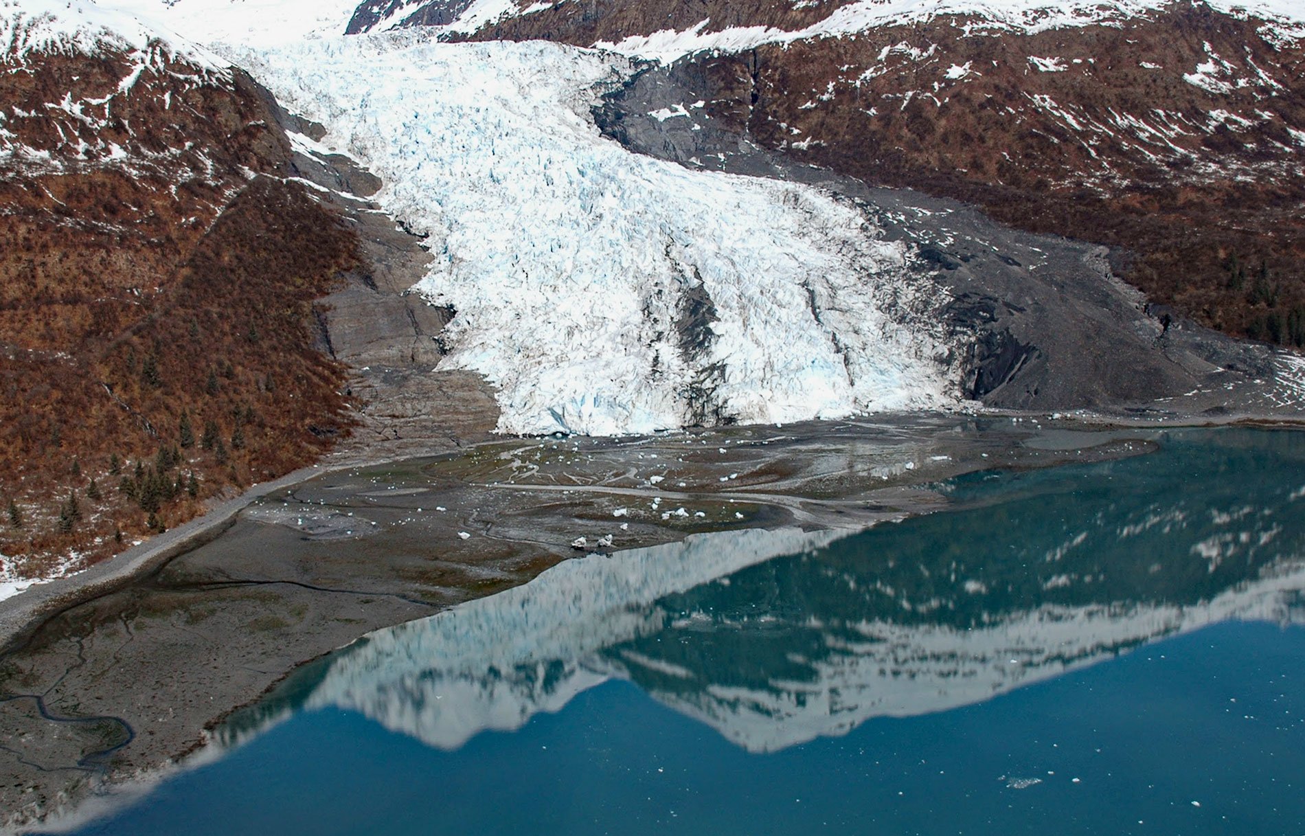
Wellesley Glacier flows for about 4.5 miles (7 km) from the Chugach Mountains and terminates at a lagoon on the west side of College Fjord, about 55 miles (89 km) west of Valdez and 40 miles (64 km) northeast of Whittier, Alaska. It was named for Wellesley College in Massachusetts. College Fjord is about 37 miles (60 km) long and 3-4 miles (5-6.5 km) wide in the northwestern sector of Prince William Sound. Prince William Sound is on the Gulf of Alaska, located on the east side of the Kenai Peninsula. The sound is ringed by the steep and glaciated Chugach Mountains, and most of the land is part of the Chugach National Forest, the second-largest national forest in the United States. College Fjord was discovered in 1899 during the Harriman Alaska expedition. The fjord contains five tidewater glaciers, five large valley glaciers, and dozens of smaller glaciers. The two largest tidewater glaciers in the fjord are Harvard and Yale Glaciers. They are derived from the same snowfields in the Chugach Mountains that connect with the snowfields of Columbia Glacier. Four other glaciers in the fjord including Wellesley, Vassar, Bryn Mawr, and Smith Glaciers descend the west wall of the fjord to the sea. Members of the Harriman Expedition whimsically named the glaciers after renowned U.S. east coast colleges.
Captain James Cook entered Prince William Sound in 1778 and initially named it Sandwich Sound, after his patron the Earl of Sandwich. Later that year, the sound was named to honor Prince William Henry, the son of King George III. In 1786, John Meares, a British fur trader, then with the Bengal Fur Company, sailed into Prince William Sound with the Nootka and anchored in Snug Corner Cove on September 25. A local Chugach chief then guided the Nootka up to the head of Port Fidalgo. By mid-November, the ship was iced in and food was getting scarce with many of the crew becoming sick. In May 1787, half the men were dead and the rest were close to death when they were rescued by George Dixon and his crew on Queen Charlotte. In 1790, the Spanish explorer Salvador Fidalgo entered the sound, naming many of its features. Some places in the sound still bear the names given by Fidalgo, as Port Valdez, Port Gravina, and Cordova. The explorer landed on the actual site of Cordova and took possession of the land in the name of the king of Spain. In 1793, the Lebedev-Lastochkin Company established the first stockaded trading post in Prince William Sound at Nuchek called Fort Konstantine. It was visited by George Vancouver in June 1794. In 1849, Mikhail Dmitrievich Tebenkov, the director of the Russian American Company and governor of Russian America, commissioned Illarion Arkhimandritov to survey and map Prince William Sound. In 1899, the Harriman Alaska expedition explored the coast from Seattle to Alaska and Siberia. It was organized by wealthy railroad magnate Edward Harriman, who brought with him an elite community of scientists, artists, photographers, and naturalists to explore and document the Alaskan coast. The geologist Grove Karl Gilbert participated in the Harriman Expedition and wrote the first description of College Fjord, and the geographer Henry Gannett made detailed maps.
During the summer of 1905, 1908, and 1909, the U.S. Geological Survey examined the ore deposits and the general geology of Prince William Sound, including many of the glaciers. In the course of this work, all the tidewater glaciers and many other glaciers near tidewater were seen and some notes, photographs, and maps were made. This work was hurriedly done and was secondary to the study of the bedrock geology and the ore deposits, but has since provided a valuable baseline for subsequent studies of the fluctuations of these ice streams. For example, in 1991, a study by the U.S. Army Cold Regions Research and Engineering Laboratory found that the smaller glaciers in College Fjord reached their maximum advance positions at the end of the 19th century, as did Yale Glacier. Since that time, they have undergone modest retreat punctuated by small advances. Around 1910, Wellesley, Vassar, Bryn Mawr and Smith Glaciers experienced a small advance. In the mid-1930s, Bryn Mawr and Wellesley Glaciers experienced another small advance, and in the 1960s, these two glaciers along with Smith Glacier experienced a third advance. More recent observations suggest that Bryn Mawr Glacier has advanced since 1976, while the others have shown little change. In general, the terminus positions of tidewater glaciers are thought to be the result of a complex interaction of fjord depth, ice thickness, and ice calving rate. Recognition of a distinct cycle of dynamically controlled advance and retreat of tidewater glaciers consists of three phases. The first is a period of slow advance during which the glacier moves down the fjord through deep water by maintaining a submarine moraine shoal in front of the terminus. This shoal, which is moved in front of the glacier by continuous erosion on the proximal side and deposition on the distal side, greatly reduces iceberg calving, thereby maintaining the glacier in a positive mass balance. The second phase is a period of relative stability during which the terminus is nearly stationary, terminating in shallow water on a submarine moraine. The third phase is a period of rapid retreat during which the glacier terminus retreats off its submarine moraine shoal into deep water. This produces calving at a dramatic rate which causes the terminus to retreat up the fjord. The high rate of calving overwhelms the ability of the glacier to supply ice to the terminus, and the retreat continues until the glacier stabilizes on another submarine shoal or becomes grounded at the head of the fiord, which is the current condition of Wellesley Glacier. Read more here and here. Explore more of Wellesley Glacier and College Fjord here:

