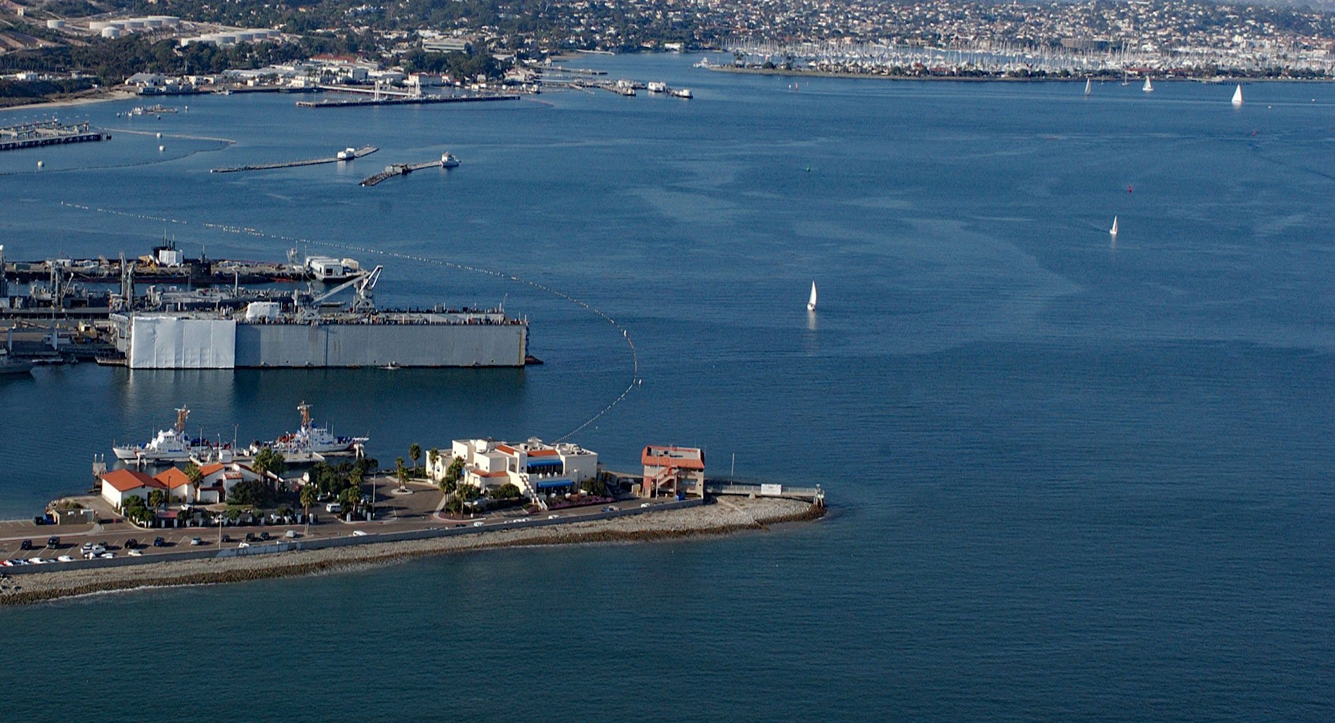
Ballast Point is a peninsula that extends northwest for 0.44 miles (0.7 km) from the Point Loma Peninsula at the mouth of San Diego Bay, about 11 miles (18 km) south of La Jolla and 4 miles (6 km) southwest of downtown San Diego, California. The Spanish called the point Punta de Los Guijarros, meaning the point of cobblestones. Ballast Point was reputedly named for the historical practice of merchant sailing ships using these stones for ballast when returning to east coast cities by way of Cape Horn. Point Loma Peninsula is bordered on the west by the Pacific Ocean, on the east by the San Diego Bay, and on the north by the San Diego River. San Diego Bay is a natural harbor and deepwater port, 12 miles (19 km) long and 1 to 3 miles (1.6 to 4.8 km) wide. It is the third-largest of the natural bays on the California coast after San Francisco Bay and Humboldt Bay. The highly urbanized land adjacent to the bay includes the city of San Diego and four other cities including National City, Chula Vista, Imperial Beach, and Coronado. The bay serves as the base headquarters for U.S. Navy ships including several aircraft carriers and submarines, and Ballast Point is part of Naval Base Point Loma.
The Kumeyaay people inhabited the bay area, with a population centered at the village of Cosoy, before the arrival of Europeans. In 1542, Juan Rodríguez Cabrillo sailed north from the Port of Navidad (now Acapulco) and was the first European to drop anchor inside present-day Ballast Point and named the bay San Miguel. The bay was not visited again until 1602 when Sebastián Vizcaíno anchored and named the harbor San Diego. By 1769, Spain occupied the vast territory of Alta California and had well-established cattle ranches surrounding the military fort at San Diego Presidio on Presidio Hill on the San Diego River north of the bay. The Mission San Diego de Alcala was founded by Friar Junipero Serra on Presidio Hill only two months after the fort was established. In 1793, Captain George Vancouver visited San Diego to evaluated the bay from a military standpoint. In 1795, a fort was built at Ballast Point called Fort Guijarros, which served as the first harbor defense work. It included an adobe magazine and barracks surrounded by a battery with sloping walls 20 feet (6 m) thick and 10 cannons. The fort was involved in two skirmishes. The first was in March 1803, when the Spanish defenders traded fire with the American brig Lelia Byrd, which was attempting to escape the harbor with a load of contraband sea otter pelts. The second was in 1828, after Mexican independence from Spain in 1821, when shots were exchanged with the American ship Franklin which was also involved in illegal trade. Under Mexican rule, the fort deteriorated and was abandoned by 1838. In 1848, during the Mexican-American war, the American frigate USS Cyane landed U.S. Marines at nearby La Playa to raise the American flag. Abandoned guns from Fort Guijarros were used by the marines to lay siege to San Diego Presidio. In 1858, a shore whaling station was established at Ballast Point that operated until 1886. Next to the whaling station was a Chinese encampment. Three different companies hunted migrating gray whales that were killed with exploding harpoons, towed to shore and the whale blubber was rendered into oil. In 1873, the U.S. Army took over Ballast Point and built gun batteries to defend San Diego from potential naval attacks. The Fort at Ballast Point was renamed Fort Rosecrans in 1899 after Major General William S. Rosecrans and transferred to the U.S. Navy Department in 1959, which operates today as Naval Base Point Loma.
In 1890, a lighthouse was built on Ballast Point. The original lighthouse buildings at the station consisted of a two-story wooden bell tower, a boathouse, and two dwellings, one of which was attached to a square wooden light tower. On August 5, 1960, the old dwellings were torn down leaving the tower free-standing; however, during repairs to the tower it was found to be unstable due to the failure of the brick and mortar foundation. It was decided to relocate the light on top of the fog signal building and demolish the old tower. A new three-bedroom and a four-bedroom residence, completely furnished for lightkeepers and their families was built adjacent to the light structure. The combination tower was only in service for a short time when a new structure was built in 1961 that consists of an automated light and a day marker on a piling off the end of Ballast Point pier. Watch a short video about the lighthouse here. The U.S. Coast Guard operates an adjacent facility for the USCG Cutter Sea Otter and the USCG Cutter Haddock. The cutter missions include combating drug smuggling, illegal immigration, marine fisheries enforcement, and search and rescue support. The vessel is designed so that a rigid hull inflatable boat can be launched while the vessel is underway through a stern launching ramp. See a short video on the vessel here. Read more here and here. Explore more of Ballast Point and San Diego Bay here:

