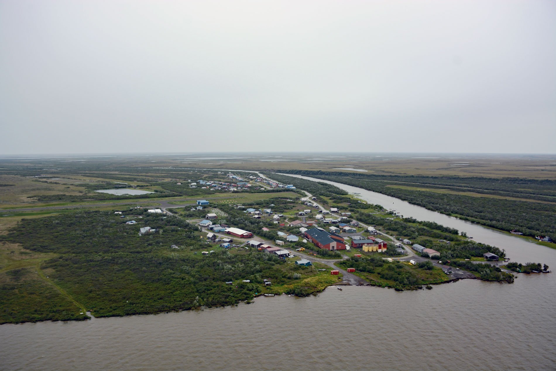
Napakiak is a village located on an island situated between the Kuskokwim River to the south and Johnson Slough to the north, about 167 miles (269 km) southeast of Emmonak and 10 miles (16 km) southwest of Bethel, Alaska. Johnson Slough diverts some of the Kuskokwim River to the Johnson River. The Johnson River starts in the Portage Lakes on the Yukon-Kuskokwim Portage between Russian Mission on the Yukon River and Kalskag on the Kuskokwim River and flows generally southwest for about 215 miles (346 km) to the Kuskokwim River about 5 miles (8 km) downstream and southwest of Napakiak. Johnson River and Johnson Slough were named in 1949 by the U.S. Coast and Geodetic Survey for a prospector named Eric Johnson. The village of Napakiak was first reported as ‘Napahaiagamute’ by Edward W. Nelson of the U.S. Army Signal Corp who explored much of the Yukon-Kuskokwim Delta by dogsled between 1878-1879. The Yukon-Kuskokwim Delta is the largest riverine delta in western North America. The delta consists of poorly or unconsolidated sediments, ranging from silt to coarse-gravel, deposited mostly in the last 2.5 million years during the Quaternary period on the geological time scale. The Yukon-Kuskokwim Delta is the largest sediment source surrounding the Bering Sea and much of the sediment load is transported northward to the Arctic Ocean by surface currents in the Bering and Chukchi Seas. The geomorphology of the delta is characterized by a water-dominated plain of lakes, marshes, and interlaced streams. The soils are shallow and cover permafrost, and are consistently wet during the summer and frozen during the nine months of winter. The tundra plant communities consist primarily of sedge mats, moss, and low-growing shrubs with alder, willows, and scattered stunted spruce and birch growing along the major streams.
Archaeological excavations at Cape Denbigh on Norton Sound indicate human inhabitants more than 4,000 years ago. These early people were nomadic, living in temporary camps and hunting for seals and small tundra mammals. Roughly 2,500 years would pass before fishing was integrated into their subsistence economy. Navigational hazards in the Yukon-Kuskokwim Delta and the coastal environment are extreme and likely responsible for the region remaining largely ‘unexplored’ and sparsely populated for much of the nineteenth century. With the advent of fishing, the nomadic lifestyle gave way to that of the modern Yup’ik culture. This lifestyle involves seasonal movements of families between semipermanent hunting and fishing camps. Winter villages were centrally located between food gathering camps. Today, these villages are permanent communities along the lower Yukon and Kuskokwim Rivers and the complex kinship and social relationships that have evolved remain the heart of the traditional Yup’ik culture. Present-day inhabitants of the delta are mostly of Yup’ik descent and live in small isolated villages of 100-500 people located primarily along the lower 39 miles (62 km) of the delta. The intricate Yup’ik partnership between ‘land and man’ is intact and is illustrated by the geographic and economic orientation of the people relative to the river and its salmon resources. In most families, annual cash incomes are earned in commercial salmon fishing and supplemented by subsistence activities involving plant materials including driftwood, fish, mammals, and waterfowl. It is fitting that the Yup’ik people refer to themselves as the Kwikpagmiut meaning ‘people of the big river’. The name reflects an acknowledgment by the Yup’ik of the societal link between the people, the rivers, and the living resources of the Yukon-Kuskokwim Delta.
The Yup’ik people have lived in the area of Napakiak for at least 1,000 years and probably much longer, but different names were historically used for several villages that moved over time but were probably occupied by the same people or their descendants. In 1878, Edward Nelson reported the village as ‘Napahaiagamute’, although it was then further downriver at the mouth of the Johnson River. The village was moved between 1878 and 1884 when Moravian missionaries mention Napakiak as being close to the village of Napaskiak, about 7 miles (11 km) east of present-day Napakiak. The landscape of the Yukon-Kuskokwim Delta is a highly dynamic environment due to tidal fluctuations and storm surges, erosion and deposition along channels and shorelines, changing topography and hydrology, sedimentation, varying salinity from riverine and marine flooding, and vegetation succession. The Yukon-Kuskokwim Delta differs from most of the world’s deltas by having permafrost, and the dominant processes affecting change on the delta are permafrost degradation and subsequent increasing channel erosion, vegetation colonization of mudflats, and lake drainage. Rates of change over the last six decades have increased dramatically for permafrost degradation which coincides with increased storm frequency and increasing air temperatures. Due to the combination of very low ground elevations, the projected increase in sea level, reduced sea-ice, accelerated permafrost degradation, the Yukon-Kuskokwim Delta is one of the most vulnerable regions in the Arctic to climate warming. Napakiak is experiencing severe erosion along the Kuskokwim River and the village has developed a retreat plan. The riverbank has eroded over 800 feet (244 m) in the last 22 years or about 36 feet (11 m) per year. This extreme rate of erosion is due to several contributing factors including the village location, unstable and readily erodible soil type, all exacerbated by permafrost degradation. In 2013, concern was expressed by residents for the safety of the school, which at that time was only 400 feet away from the Kuskokwim River. Fuel storage tanks were even closer, at 350 feet away from the river, and with the current erosion rates, the site is expected to be eroded by 2023. Read more here and here. Explore more of Napakiak and the Yukon-Kuskokwim Delta here:

