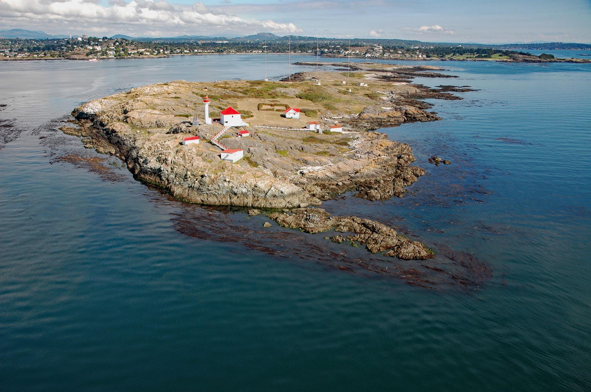
Staines Point is the southern tip of the Trial Islands which comprise two islets separated by a narrow channel situated in the Strait of Juan de Fuca about 0.5 miles (0.8 km) offshore from the southern end of Vancouver Island at McNeill Bay, about 3.5 miles (5.6 km) southeast of Victoria and 2 miles (3.2 km) south-southeast of Oak Bay, British Columbia. The point is named after Reverend Robert J. Staines who arrived at Fort Victoria in 1849 as a pioneer priest and became a political agitator. Staines departed in 1854 on the Duchess of San Lorenzo, bound for San Francisco, but the vessel sank off Cape Flattery and all aboard were lost. The islands are reputedly named for the 19th-century practice of sending Royal Navy ships out to the islands and back from Esquimalt for sea trials after they were refitted at the Pacific Station.
In 1813, the British Pacific Squadron was established in Valparaíso, Chile to support British interests in the eastern Pacific Ocean. In 1842, HMS Pandora was sent north from Valparaíso to survey the coast of Vancouver Island and found a sheltered anchorage with size and depth suited for use by the Royal Navy, and was also near a seemingly inexhaustible supply of timber for shipbuilding and spar-making. By 1865, Esquimalt was recognized as the base headquarters of the Pacific Station. Trial Island Light Station was constructed in 1906 at Staines Point near the highest elevation on the southern island. The station included a diaphone fog alarm and a square two-story keepers’ dwelling with a square lantern room centered on its roof. In 1970, a cylindrical concrete tower with a lantern and galley was built a few feet away from the keeper’s dwelling, replacing the original light. It stands 42 feet (13 m) tall, with a focal plane of 93 feet (28 m), and flashes a green light every 5 seconds. The old lantern room and Fresnel lens were dismantled and reassembled in downtown Victoria at Bastion Square, where the historic light still flashes but is no longer a navigational aid.
The islands are part of the Trial Islands Ecological Reserve, a 57 acres (23 ha) area established in 1990 to protect plants and animals on the rocky islands. Southeastern Vancouver Island comprises mostly volcanic and sedimentary rocks such as mudstone or argillite, greywacke, radiolarian chert, tuff, and greenstone associated with the Wrangellia terrane. The ecological reserve represents the northern limit for many plant species, and 9 plant communities have been described, including the red-listed Garry Oak-California Brome association. The islands also provide roosting sites for birds and haul-out sites for marine mammals. The reserve protects the greatest number of endangered and vulnerable species in a single ecological reserve in British Columbia. Read more here and here. Explore more of Staines Point and Trial Islands here:

