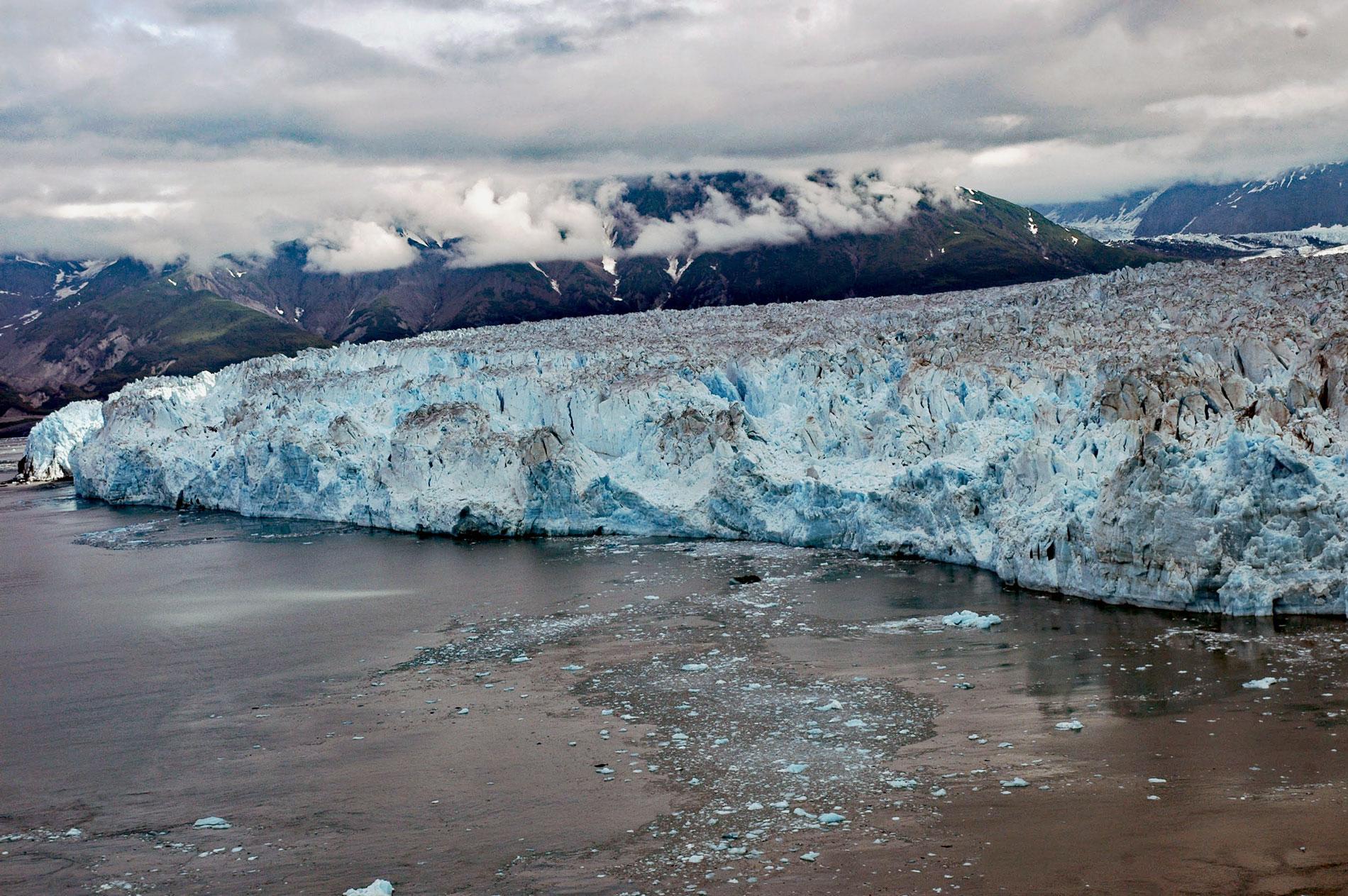
Hubbard Glacier originates from icefields at an elevation of around 11,000 feet (3,400 m) in the Centennial Range of the Saint Elias Mountains in Kluane National Park and Reserve and flows about 48 miles (77 km) to the Alaska border and then continues for another 28 miles (45 km) through Wrangell-Saint Elias National Park to its terminus in Disenchantment Bay, about 220 miles (355 km) east-southeast of Cordova and 32 miles (52 km) north-northeast of Yakutat, Alaska. The glacier was named in 1890 by Israel C. Russell of the U.S. Geological Survey, for Gardiner G. Hubbard, a regent of the Smithsonian Institution, and founder and first president of the National Geographic Society. Geologically, the Saint Elias Mountains consists of a collage of seven tectonostratigraphic terranes that formed south in the equatorial Pacific Ocean and rafted northward on oceanic plates, eventually accreting to Alaska and the North American continent. The most interior is the Windy McKinley terrane, followed by the Peninsular, Wrangellia, Alexander, Chugach, Prince William, and the most recent is the Yakutat terrane that arrived about 26 million years ago and still actively accreting to the continent. Each terrane features a distinct stratigraphy and is separated from neighboring terranes by major strike-slip or thrust faults. The icefield covers most of the bedrock and what little is exposed near the terminus of the Hubbard Glacier represents rocks of the Valdez Group in the Chugach terrane that developed during the Late Cretaceous and comprise gneiss and schist. The mountain peaks that penetrate the icefield represent igneous intrusions of monzonite granite.
Gardiner Hubbard was interested in the exploration of Alaska, and helped to instigate exploratory expeditions which were sponsored jointly by the National Geographic Society and the U.S. Geological Survey. Russell was a geologist who represented the U.S. Geological Survey in 1889 on an expedition to establish a portion of Alaska’s eastern boundary led by the U.S. Coast and Geodetic Survey and based on the U.S. Revenue Cutter Thomas Corwin, under the command of Captain Calvin L. Hooper, which was the first vessel to navigate Disenchantment Bay north of Haenke Island and take hydrographic soundings. During the next two years, Russell and a team established a series of base camps and ventured out on foot and by canoe to explore the slopes of Mount Saint Elias, Malaspina Glacier, and made the first observations of the many glaciers that descend to Yakutat Bay including Hubbard Glacier. He noted that the Hubbard Glacier is joined by the Valerie Glacier about 6 miles (10 km) from the composite terminus and based partially on his detailed descriptions, it is now known that the Hubbard Glacier ice margin has continued to advance for the last century which runs counter to many thinning and retreating glaciers nearby in Alaska and around the world. In 1892, Russell became professor of geology at the University of Michigan. In 1902, Marcus Baker of the U.S. Geological Survey named Russell Fjord in his honor.
The Hubbard Glacier’s advance is due to its large snow accumulation zone at a high elevation. The glacier is also building a large terminal moraine, shoveling sediment, rock, and other debris onto the glacier’s leading edge. The moraine at the front gives the glacier stability and allows it to advance more easily because the ice does not need to be as thick to stay grounded. The Hubbard Glacier is a surging glacier and it takes about 400 years for ice to traverse the entire length. A surge in May 1986, caused the glacier terminus to cross and block the entrance to Russell Fjord, an embayment that extends southeast from the head of Disenchantment Bay. The dammed meltwater from surrounding glaciers raised the fjord’s water level by 82 feet (25 m) before the ice dam failed on October 8, 1986. In spring 2002, the Hubbard Glacier surged again and closed the opening between Disenchantment Bay and Russell Fjord. The level of the ice-dammed fjord increased by nearly 66 feet (20 m) before the dam broke on August 14, 2002, reestablishing the connection to the bay. A major surge of the Hubbard could again block Russell Fjord and cause an overflow that would potentially endanger the village of Yakutat. Read more here and here. Explore more of Hubbard Glacier and Disenchantment Bay here:

