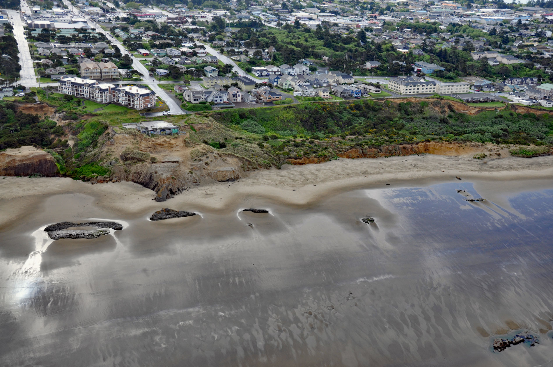
Nye Beach is situated in Newport between Agate Beach to the north and Yaquina Beach to the south, and historically was demarcated at the north end by a rocky point with a sea stack known as Jump-Off Joe, about 22 miles (35 km) south of Lincoln City and 1.9 miles (3 km) north of Yaquina Bay, Oregon. The beach and adjacent neighborhood were named after John Nye who homesteaded the area in 1866. The beach is backed by wave-cut cliffs that rise to about 80 feet (24 m) and are actively slumping resulting in the loss of residential property and abrupt road terminations. In the winter of 1942-1943, a block of about 16 acres (6.5 ha) with 15 houses slumped and slid towards the sea. In 1982, a condominium was built on the bluff but within three years the slope had retreated causing the foundation to fail and the structure was abandoned. The subsiding area consists of loosely consolidated Pleistocene terrace sands and underlying Miocene sediments, and affects an area about 2,000 feet (610 m) long and 200 feet (61 m) wide. The Miocene sediments are sandy shales and argillaceous sandstones of the Astoria Formation and mudstones of the Nye Formation. Land movement has been attributed to groundwater flow and slippage along bedding planes between these rock formations.
The coast between Cape Foulweather to the north and Beaver Creek to the south was the traditional territory of the Yaqo’n people. They were a hunter-gatherer culture traveling on foot to hunt game, fish for salmon, and gather foods from the shore and coastal forests. Like many Pacific Northwest tribes, the Yaqo’n practiced head flattening of the upper classes, believing this would distinguish them from lower classes in the afterlife. They used wooden pressers on the heads of infants to flatten their foreheads over a period of 6 months. Their neighbors to the south were the Alsea people and to the north were the Tillamook. In the late 1700s, contact with European explorers and fur trappers introduced diseases that decimated the Indigenous Peoples who had no natural immunities to smallpox, measles, tuberculosis, and other diseases. In 1855, President Franklin Pierce issued an executive order creating the Coast Indian Reservation along 110 miles (177 km) of coast and 20 miles (32 km) inland between Cape Lookout to the north and Fort Umpqua to the south for the relocation of indigenous peoples of the Oregon Territory. The Yaqo’n people did not need to move and remained around Yaquina Bay until 1865, when the federal government began opening the land to settlers. In 1866, John Nye staked and claimed 160 acres (65 ha) that included the bluffs overlooking the beach. In the 1880s, the property was purchased by Sam Irvin. In the 1890s, tourists began coming by train to Yaquina Bay, and Nye Creek provided access to the beach via a boardwalk. In 1905, Irvin built a hotel to accommodate visitors. By 1926, the Oregon Coast Highway was established replacing several earlier state highways, and in the 1936, bridges across the Rogue River, Alsea River, Yaquina Bay, Coos Bay, and Umpqua River were all complete and the Oregon coast, including the beaches, was fully accessible to automobile traffic and one of the major attractions was Jump-off Joe.
Jump-Off Joe was a massive sea stack 100 feet (30 m) tall at the north end of Nye Beach composed of middle Miocene concretionary sandstone. It formed sometime before the 1880s when it was connected to the mainland and was a major impediment to walking the beach. It was a well-known tourist attraction and early travelers would have to jump off the side to get over it, hence the name. Through the years Jump-Off Joe has been a much-photographed feature, and its rapid erosion is well documented. The earliest photographs, taken in the late 1800s, show the promontory still connected to the bluff. A later photo shows its erosion and separation from the mainland in the 1890s, possibly accelerated by the construction of jetties at the Yaquina Bay entrance. The largest arch eventually collapsed in 1916, and the resulting stack continued to erode. After the loss of the original promontory, the name Jump-Off Joe was adopted for the point, and later for the general area and has also been used to refer to the landslide that developed in the 1910s. Between 1920 and 1970, the majority of the sea stack eroded and collapsed, and by 1990 it had been entirely washed away. Only a trace of it remains today, mostly buried by sand. Read more here and here. Explore more of Nye Beach and Newport here:

