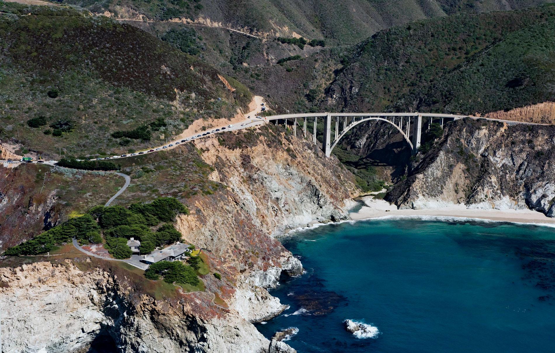
Bixby Creek starts at the confluence of Mill Creek and Turner Creek that flow from an elevation of 2,500 feet (762 m) on the west flank of Skinner Ridge for a total run of about 7 miles (11 km) through the Santa Lucia Mountains to the Big Sur coast, between Hurricane Point to the south and Division Knoll to the north, about 16 miles (26 km) south of Monterey and 9 miles (15 km) northwest of the community of Big Sur, California. The creek is named after Charles H. Bixby who arrived in California in 1852 and filed a land patent in 1889 for 160 acres (65 ha) south of the creek and later bought additional tracts north to Palo Colorado Canyon. The Santa Lucia Mountains are part of the Coast Ranges, and at Bixby Creek, the geology is dominated by the Salinian Block that comprise granitic and metamorphic rocks, in contrast to surrounding areas underlain by the Franciscan Complex and more prone to land sliding. The granitic rocks in the Bixby Creek watershed are mostly quartz diorite or granodiorite and the metamorphic rocks are mostly grey biotite schist and gneiss. The lower western slopes of the Santa Lucia Mountains are subjected to a marine climate, with precipitation confined to the winter months. Coast redwoods dominate the bottoms of canyons on seaward facing slopes and tanbark oaks occur at all elevations in the watershed.
Before the arrival of Europeans, the Big Sur coast was inhabited by the Esselen people, a hunter gatherer culture that seasonally followed local food sources. During the winter they lived near the coast and subsisted on marine mammals and intertidal invertebrates such as mussels, limpets, and abalone. In the summer they moved inland to harvest acorns from the black oak, canyon live oak and tanbark oak. During the Spanish Franciscan mission period from 1769 to 1833, the Esselen were conscripted for labor and relocated to the missions at San Carlos, Nuestra Señora de la Soledad, and San Antonio de Padua. Their population was virtually extinguished in the 19th century from diseases, hard labor, and intermarriage. Following the Mexican War of Independence in 1821, the mission lands were secularized, and land grants were given to distinguished citizens and military veterans. Rancho San José y Sur Chiquito extended north from Palo Colorado Creek to the Carmel River, and Rancho El Sur was granted from the Little Sur River south to the Big Sur River. The land in between the Little Sur River and Palo Colorado Creek remained vacant until Bixby arrived and built a sawmill to cut redwood logs into shakes, shingles, railroad ties, and trench posts. He also harvested the bark of the tanbark oak, which was used for tanning cow hides. There was no safe boat landing at the creek mouth, so he built a lumber chute to transfer the products to coastal lumber schooners anchored off the rocks. Bixby also discovered limestone deposits in the creek watershed. In 1906, Bixby sold the land to the Monterey Lime Company and lime kilns were built 3 miles (4.8 km) up Bixby Canyon and operated until 1911. In 1919, U.S. Army Captain Howard G. and Frida Sharpe bought the Bixby Creek canyon property that included an old ranch house, barn, corral, dance hall, stable, numerous out-buildings, and several cabins that they rented to visitors.
The Old Coast Road is a road that preceded the current Big Sur Coast Highway. It was initially a trail created by Rumsen and Esselen people to travel along the coast. The trail was improved by settlers to facilitate horse drawn wagons and in 1855, Monterey County declared it a public road. In 1886, Charles Bixby improved the road between his ranch and Monterey, and William B. Post extended it further south to his ranch. The road was impassable in winter, and even under good weather conditions, the road could not be used to transport goods, so coastal schooners and steamers were chartered to ship bulk products. In 1920, the 26 miles (42 km) from Carmel to Bixby Creek in a wagon pulled by two horses could be completed in about 11 hours. The road went inland at Palo Colrado Creek and Bixby Creek because the canyons were to deep. In 1932, the Bixby Creek Bridge was completed and is one of the tallest single-span concrete bridges in the world. The bridge and new highway bypassed the lodge on Bixby Creek operated by Sharpe, and he built a new lodge on the western shoulder of the highway immediately north of the bridge. The former lodge in the canyon bottom was abandoned and the land was eventually subdivided and sold. Today, the region is protected by the Big Sur Local Coastal Plan of 1986, regarded as one of the most restrictive land-use management plans. The program protects viewsheds from the highway and many vantage points, and severely restricts the density of development. About 60 percent of the coastal region is owned by governmental or private agencies that do not allow the development of any kind. Read more here and here. Explore more of Bixby Creek and the Big Sur coast here:

