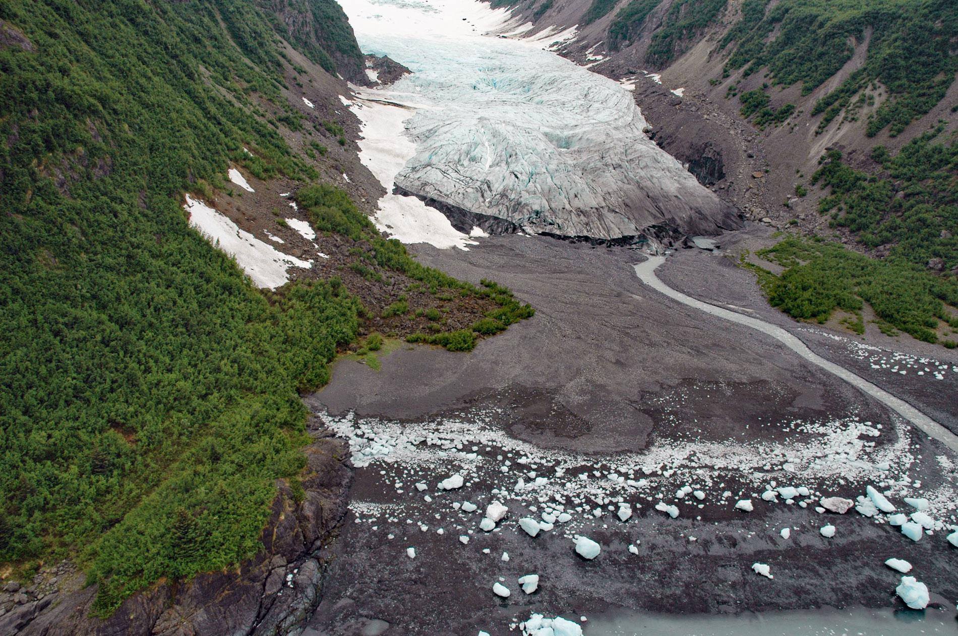
Tigertail Glacier starts at an elevation of about 2,850 feet (869 m) in the Sargent Icefield on the Kenai Peninsula and flows generally northeast for 3.3 miles (5.3 km) and terminates 0.2 miles (0.3 km) from the western shore of Nassau Fjord, which is a northern arm of Icy Bay in western Prince William Sound, about 36 miles (58 km) east-northeast of Seward and 36 miles (58 km) south-southeast of Whittier, Alaska. The glacier was named in 1909 by George W. Perkins and refers to the larger Tiger Glacier about 3 miles (4.8 km) to the southwest. Nassau Fjord is about 4 miles (6.5 km) long and includes the Chenega Glacier which terminates at tidewater, and the Princeton and Tigertail glaciers that terminate on shore. The bedrock exposed by the retreating glaciers represents one of the world’s largest accretionary complexes called the Southern Margin composite terrane. The terrane is formed by several component groups and the rocks surrounding Prince William Sound are part of the Valdez Group that developed during the Late Cretaceous and the Orca Group that developed from the late Paleocene to middle Eocene. These groups comprise similar sedimentary rocks but are separated by the Johnstone Bay Fault that is roughly aligned with the axis of Icy Bay, with the Valdez Group west of the fault and the Orca Group to the east. The sedimentary rocks are mostly greywacke sandstone, siltstone, mudstone, slate, and some conglomerate. Structures such as graded bedding, crossbedding, and ripple marks, along with flute, groove, and load casts, indicate that the sediments were deposited from turbidity currents.
The first account of glaciers in Icy Bay was in 1789 when Nathaniel Portlock visited Prince William Sound, and although he did not actually see the glacier front in Icy Bay because of fog, he did encounter large amounts of drift ice and heard the distant rumbling of calving ice. The first visual description of the glacier filling Icy Bay was made in 1794 by Lieutenant Joseph Whidbey on the Vancouver Expedition, and his map shows the ice front across Icy Bay near the entrance to Nassau Fjord. The western coast of Prince William Sound became better known through the explorations of Samuel Applegate in the private schooner Nellie Juan in 1887. Applegate never published his narrative, but it was carefully studied and summarized by George Davidson, who subsequently made a map which is the earliest reference for many Prince William Sound glaciers. In 1898, an army expedition led by Captain Edwin F. Glenn visited this area, and their map shows the glacier in Icy Bay in approximately the same position as that shown by Whidbey in 1794. In 1908, Ulysses S. Grant and Daniel F. Higgins visited Icy Bay and were able to run a boat 10 miles (16 km) into the bay. They also noted the separate ice streams in Nassau Fjord. In 1909, George W. Perkins, a wealthy industrialist and partner of J.P. Morgan, leased the SS Yucatan, a flagship of the Alaska Steamship Company which was owned by the Alaska Syndicate, to bring 18 members of his family to Alaska to view the holdings of the Guggenheim family. The party named and photographed the Princeton, Nassau, and Tigertail glaciers, as well as Nassau Fjord. In 1910, Ralph S. Tarr and Lawrence Martin, on an expedition funded by the National Geographic Society, found the positions of the ice fronts to be unchanged from those of the previous year. They studied the vegetation in Icy Bay and found trees from 24 to 32 inches (61-81 cm) in diameter with annual rings indicating ages between 110 and 120 years old.
Tigertail Glacier is located in the northwestern part of Nassau Fjord about 0.5 miles (0.8 km) south of the Chenega Glacier terminus. During the most recent major ice advance in southern Alaska, about 10,000 years before the present, many of the glacier ice margins advanced to their maximum extent. A minor advance began in about the year 1300 AD when the Princeton Glacier merged with Chenega and Tigertail glaciers and advanced to the mouth of Nassau Bay. In 1957, core samples extracted from trees beyond the terminal moraine at the mouth of Nassau Fjord indicated that this position had not been exceeded by the ice front since at least 1675 AD. At that time, the coalesced Princeton-Chenega-Tigertail ice front remained at the mouth of Nassau Fiord until about 1857 to 1882. There is evidence that between 1898 and 1908 the Chenega Glacier retreated over 2 miles (3.2 km) which opened Nassau Fjord and the glaciers separated into individual ice streams. Since 1908, Tigertail Glacier has reduced in volume and retreated from tidewater. It is a small glacier with an area of 1,728 acres (700 ha) confined between the narrow walls of a steep valley. The terminus is now relatively stable and has receded less than 330 feet (100 m) since 1908. Read more here and here. Explore more of Tigertail Glacier and Nassau Fjord here:

