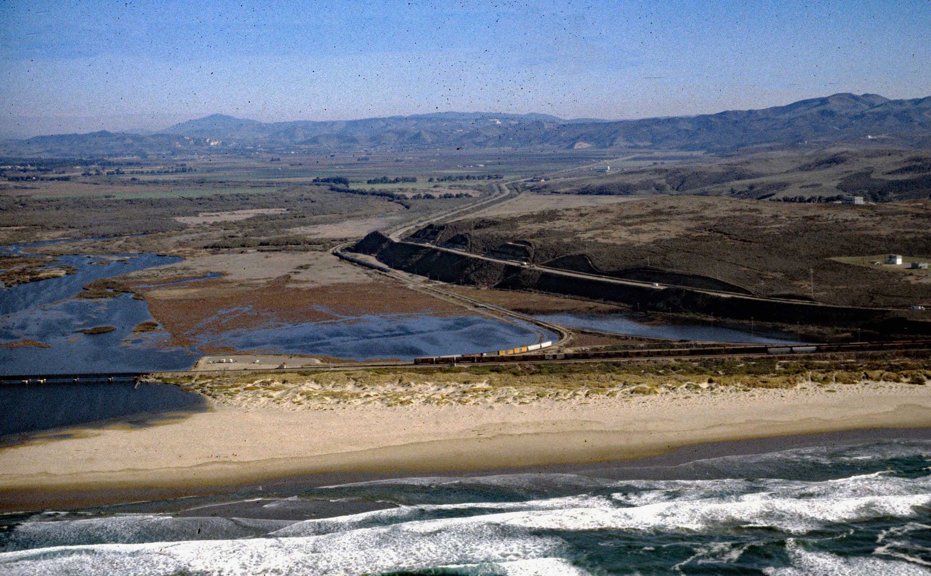
Surf Beach is within Vandenberg Space Force Base and extends south-southwest for about 4.5 miles (7.3 km) from the mouth of the Santa Ynez River estuary to Spring Canyon, about 31 miles (50 km) south of Pismo Beach and 9 miles (14.5 km) west-northwest of Lompoc, California. Santa Ynez River starts on the north flank of the Santa Ynez Mountains and flows generally west for 92 miles (148 km) through the Santa Ynez Valley draining a watershed of 573,440 acres (232,062 ha). Surf Beach is named after the historical community of Surf, a Southern Pacific Railroad station built in 1900 and that grew to accommodate the personnel needed to maintain the trains and tracks. The population of the town peaked at 40, with most residents being employed by the railroad. As trains modernized, Surf experienced depopulation to the point where Southern Pacific was only operating a telegraph station. The telegraph station closed in 1985, and the unstaffed Surf Amtrak station is currently the only remaining structure.
The Chumash were a hunter-gatherer people that inhabited a territory between the Santa Ynez Mountains and the Pacific coast. The first contact with Europeans was in 1542 when the Spaniard Juan Cabrillo visited this area. In 1769, the Portolà expedition camped at the river mouth and named the river. Franciscan missionaries built the Mission La Purísima in 1787 near present-day Lompoc and conscripted the Chumash people for laborers and many were baptized. After the Mexican War of Independence in 1821, the mission lands were secularized, and land grant were given to prominent citizens and military veterans. Rancho Lompoc was a land grant of 42,085 acres (17,031 ha) given in 1837 by Governor Juan B. Alvarado to Joaquín Carrillo and José Antonio Carrillo. The grant extended from present-day Lompoc west to the Pacific coast. There are about 30 recorded shipwrecks along the Surf Beach coast. In 1907, the schooner Sibyl Marston was launched by W.A. Boole & Sons of Oakland, California, and was the largest wooden steam schooner built on the U.S. west coast. In 1909, Sybil Marston ran aground in a storm about 1 mile (1.6 km) south of the Surf railroad station. The ship was carrying 1,100,000 board feet (3,000 cu m) of lumber. Lompoc residents salvaged the lumber and used it to begin a town lumberyard. Several houses built in Lompoc used lumber from the shipwreck. During low tides, portions of the wreck can still be seen buried in the sand. In 1941, the U.S. Army acquired approximately 86,000 acres (35,000 ha) of open ranch lands between Lompoc and Santa Maria for a training area. In 1956, the Army transferred 64,000 acres (26,000 ha) to the Air Force for use as a missile launch and training base named Vandenberg Air Force Base, and in 2021, it was renamed Vandenberg Space Force Base.
Sections of Surf Beach are closed every summer during the nesting season of the western snowy plover, a bird that has been living on the Pacific Coast for thousands of years but was listed in 1993 under the Endangered Species Act due to low population and decreased habitat. During the breeding season, March through September, plovers can be seen nesting along the shores, peninsulas, offshore islands, bays, estuaries, and rivers of the United States’ Pacific Coast. Plover nests usually contain three small eggs, which are camouflaged to look like sand and barely visible to even the most well-trained trained eye. Plovers will use almost anything they can find on the beach to make their nests, including kelp, driftwood, shells, rocks, and even human footprints. Snowy plovers have natural predators such as falcons, owls, raccoons, and coyotes. There are also predators that humans have introduced or whose populations they have helped to increase, including crows and ravens, red fox, and domestic dogs. Humans can be thought of as predators too, because people drive vehicles, ride bikes, fly kites, and bring their dogs to beaches where the western snowy plover lives and breeds. In 2019, after Lompoc community members raised environmental justice concerns, the California Coastal Commission, U.S. Fish and Wildlife Service, and Vandenburg Space Force Base began an experimental program with designated restricted areas that enabled access to Surf Beach all summer. Read more here and here. Explore more of Surf Beach and Santa Ynez River here:

