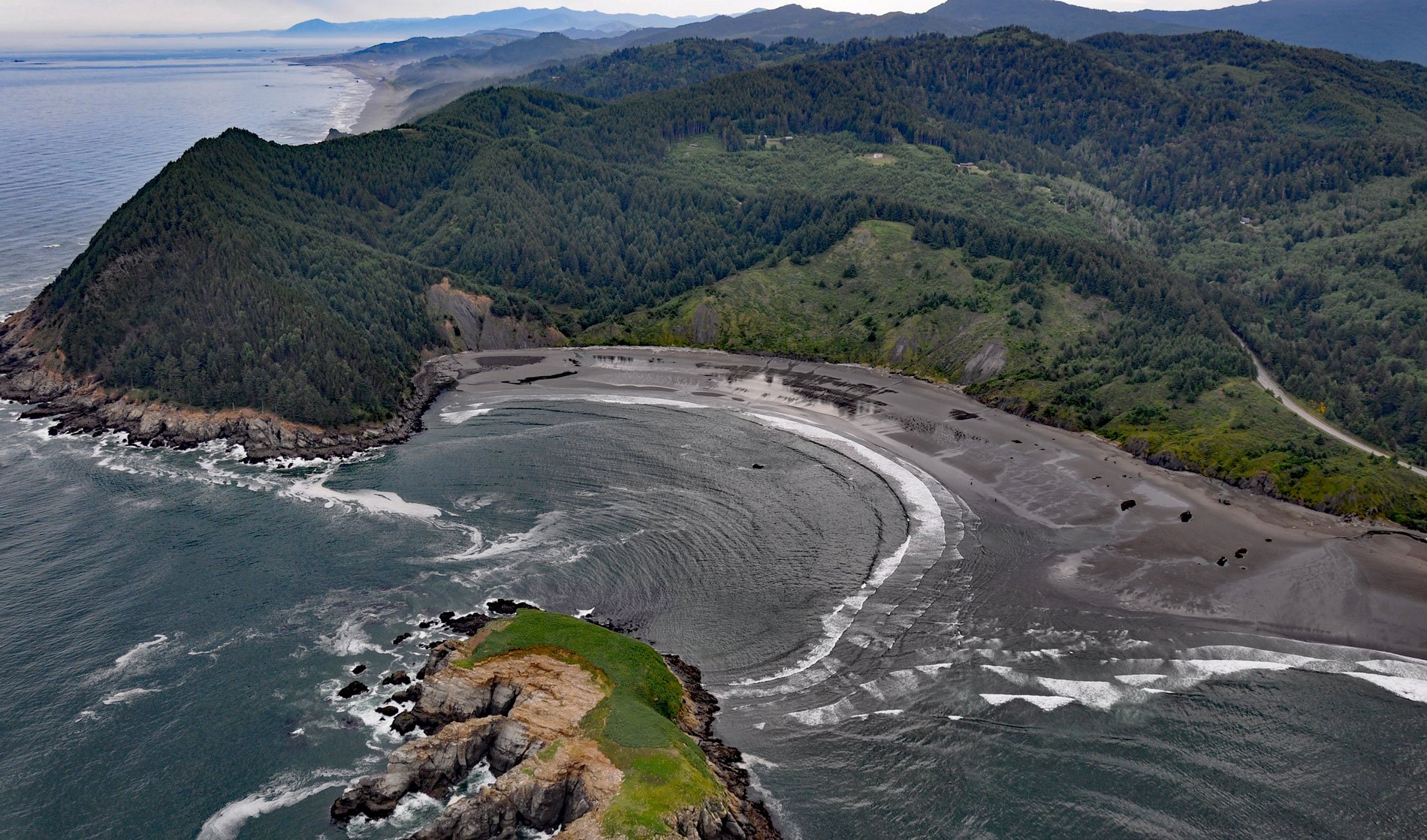
Hunters Cove is on the south side of Cape Sebastian, a prominent headland in Cape Sebastian State Scenic Corridor, about 20 miles (32 km) north-northwest of Brooking and 6.3 miles (10 km) south of Gold Beach, Oregon. The name for the cove reputedly originates from when sea otters were hunted from small boats and the cove provided protection during stormy weather along a coast with few safe harbors. Hunters Island is a small grass-topped islet at the cove entrance. Cape Sebastian is formed by a sequence of sedimentary rocks that developed during the Cretaceous. The sequence is topped by the Hunter Cove Formation which is exposed in the eroding backshore of the cove and consists of alternating layers of mudstone and sandstone with a combined thickness of 700 to 1000 feet (213-305 m) overlying Cape Sebastian sandstone. Cape Sebastian sandstone is the principal bedrock forming the cape and consists of conglomerate and sandstone with a combined thickness of 800 feet (244 m). Rocks representing the Houstenaden Creek Formation are exposed on the north side of the cape and consist of turbidites with interbedded siltstone and mudstone representing deposition in a deep ocean basin where turbidity currents dominated first followed by more pelagic conditions.
The coast between Cape Sebastian to the north and Crook Point to the south was the traditional territory of the Chetleshin people, who were Tututni’ Athabaskans with a village called Chetlessenten located at the former mouth of the Pistol River. Although Russian fur traders had been active in Alaska since 1743, the Northwest Coast fur trade began in 1788, when the sloop Lady Washington, commanded by Captain Robert Gray, traded with local people for sea otter skins just north of Yaquina Bay. The Columbia Rediviva under Captain John Kendrick carried the furs to Macao and Canton as part of the maritime fur trade. By 1790, an estimated 250,000 sea otter pelts worth $50 million had been taken from Pacific Northwest coastal waters. In 1852, gold was discovered in the Rogue River Valley and contact between the Chetleshins and the multitudes of miners and settlers increased. Conflicts soon arose over the use of territory and traditional food resources resulting in a series of skirmishes called the Rogue River Wars. By 1856, Athapaskan warriors had burned at least 60 homes of settlers along the southern Oregon coast and killed the local Indian agent. In retaliation, the village of Chetlessenten was raided and burned to the ground by Euro-American settlers but had already been abandoned. Eventually, the surviving Chetleshins were forced to march to the newly established Coast Reservation.
Sea otters once ranged from Baja California up through Alaska and across into the waters off Siberia and northern Japan. Bones in middens excavated on the Oregon Coast indicate that sea otters were once abundant. Heavy hunting pressure in the 18th and 19th centuries caused a near extinction of the species, and by the 1920s only small isolated populations remained. The last known Oregon sea otter was shot in 1906 at Otter Rock near Newport. In 1911, sea otters and northern fur seals were given protection under the North Pacific Fur Seal Convention signed by Great Britain, Russia, Japan, and the United States. In 1972, the Marine Mammal Protection Act reinforced their protection in U.S. waters. In 1967, sea otters were captured from Amchitka Island in the central Aleutians and brought to release sites in Southeast Alaska, Washington, and Oregon. In 1970, a century after being hunted to extinction on the Oregon coast, the first release of 29 sea otters occurred at Cape Blanco. An additional 64 sea otters were released in 1971 at Port Orford and Simpson Reef off Coos Bay; however, the reintroduction was not successful, and the small population faded away over a nine-year period. Read more here and here. Explore more of Hunters Cove and Cape Sebastian here:

