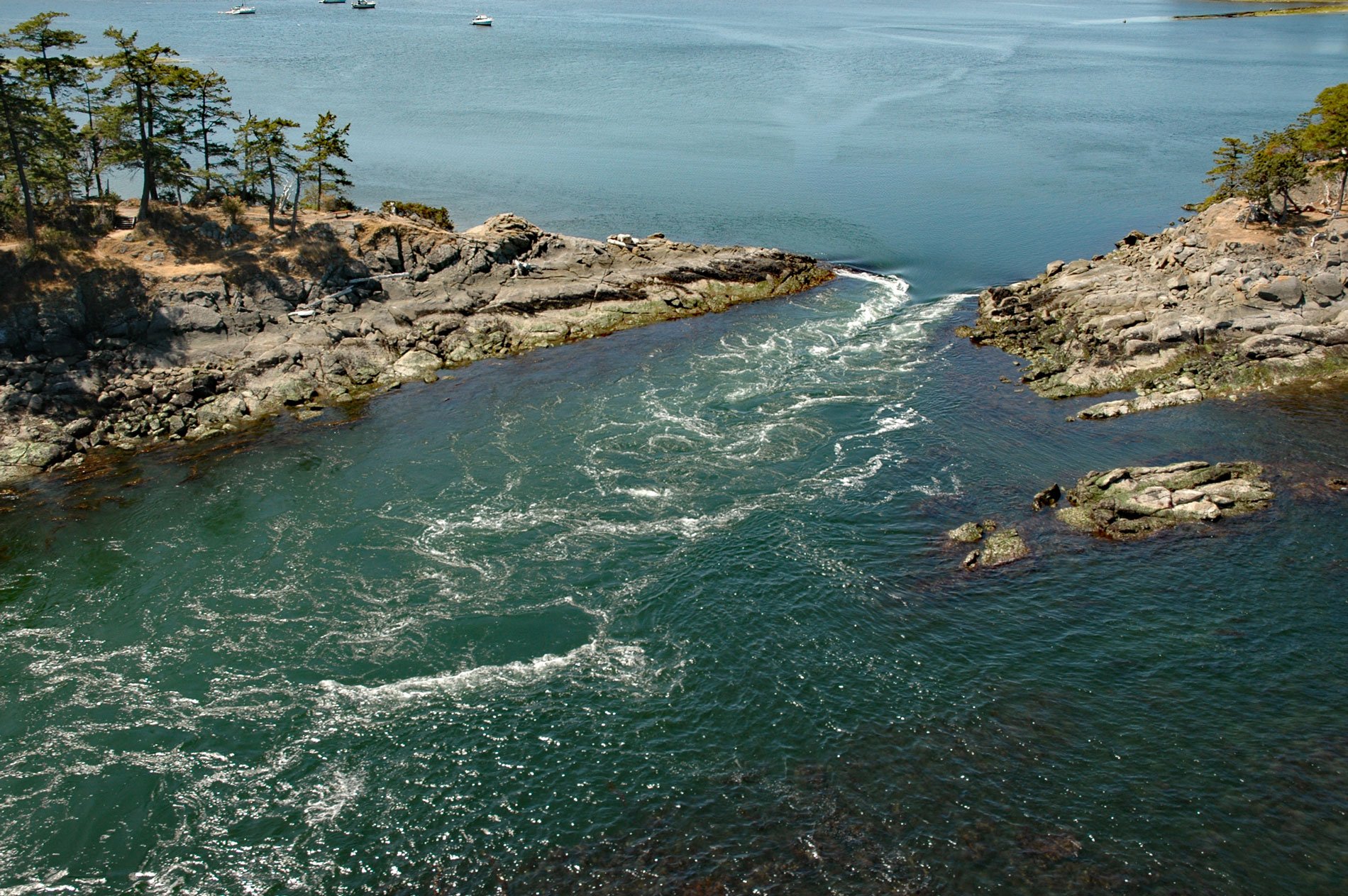
Boat Pass is a channel between Saturna Island and Samuel Island that provides a passage for small boats between Winter Cove and the Strait of Georgia, about 32 miles (52 km) south-southwest of Vancouver and 15 miles (24 km) northeast of Sidney, British Columbia. Strong tidal currents that exceed 5 knots (2.6 m/sec) during spring tides can be hazardous. The pass was reputedly used by rumrunners during the American prohibition. The Strait of Georgia, also known as the Salish Sea, is between Vancouver Island and the mainland of British Columbia.
Samuel Island is a private island of about 328 acres located between Mayne Island and Saturna Island. The island was named in 1859 after Royal Navy Surgeon Samuel Campbell of the HMS Plumper. In 1857, the Plumper was refitted as a hydrographic survey ship and under the command of Captain George Henry Richards surveyed the coast of British Columbia, in particular the Fraser River, Burrard Inlet, Howe Sound, Sunshine Coast, Victoria, and Esquimalt. The Plumper was involved in the Pig War crisis between the United States and Britain in 1859, and along with HMS Tribune and HMS Satellite, was sent to prevent American soldiers from erecting fortifications on San Juan Island and bringing in reinforcements.
Saturna Island was originally used by Indigenous Coast Salish who called the island “Long Nose” due to the island’s long north-east tapering shoreline that ends at East Point. The name Saturna comes from the Spanish naval schooner Santa Saturnina, that together with the longboat of the Spanish naval packet ship San Carlos, explored the island’s coast in an excursion under the overall command of Francisco de Eliza in 1791. The first European settlers to the island came in the 1800s, but the island was slow to develop due to its relative isolation and mountainous topography. In 2002, about 19 acres (7.8 ha) of ecologically sensitive land on Saturna Island was donated to the Gulf Island National Park Reserve by Ulla Ressner and John Fry, and today over half of the island is parkland. This is one of the newest national parks in Canada and provides representation of the Strait of Georgia Lowlands and includes 8,960 acres (3,625 ha) of islets, reefs, and 15 larger islands. Read more here and here. Explore more of Boat Pass and Saturna Island here:

