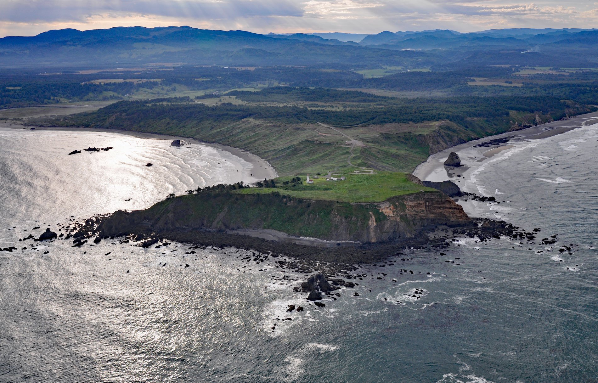
Cape Blanco is a prominent headland that extends 1.5 miles (2.4 km) into the Pacific Ocean with cliffs 200 feet (61 m) high, and the site of the SS South Portland shipwreck, about 205 miles (331 km) southwest of Portland and 7 miles (11 km) north-northwest of Port Orford, Oregon. The cape is the westernmost point of land in Oregon and part of Cape Blanco State Park. The cape was named for its chalky white appearance by Spanish explorer Martín de Aguilar in 1603. In 1775, Juan Francisco de la Bodega y Quadra named the point Cabo Diligensias. It was later renamed Cape Orford by Captain George Vancouver in 1792, but Cape Blanco became the more commonly used name.
The cape was first settled by Patrick Hughes, a native of Ireland, who came here in 1860 and developed an extensive dairy farm, which spread into bottomland along the Sixes River on the north side of the cape. The spacious house that Hughes built for his large family overlooking the Sixes estuary in 1898 is all that remains of the ranch complex. The U.S. Lighthouse Board built a lighthouse here in 1870 to warn ships away from the Blanco Reefs, a group of irregular rocks and ledges that are from 2 to 5 miles (3 to 8 km) offshore and are up to 149 feet (45 m) high. The site was originally covered with a dense spruce forest that had to be cleared to make the light more visible. There were no roads, so the materials required to construct the lighthouse had to be landed at the cape through the surf, and bricks for the tower were fired in a kiln on site. A powerful radio beacon for navigators was also constructed at Cape Blanco. The Hughes Ranch was purchased in 1971 and became part of Oregon State Parks.
On the afternoon of October 19, 1903, the 900-ton SS South Portland, bound for San Francisco from Portland with 14 passengers, 25 crew members, a cargo of wheat, and one stowaway struck a reef off Cape Blanco in heavy seas and dense fog. Captain James B. McIntyre ordered the lifeboats lowered and abandoned ship. One of the lifeboats capsized soon after clearing the ship and was seen floating away in the fog. The captain’s lifeboat also capsized in the turbulent waters, but 7 of its 12 occupants were able to clamber back aboard. Equipped with only one oar and a piece of broken mast, it took the captain over 12 hours to reach shore. Eighteen souls perished from drowning or exposure in the disaster, and Captain McIntyre was subsequently found criminally negligent for leaving the ship too soon. Read more here and here. Explore more of Cape Blanco here:

