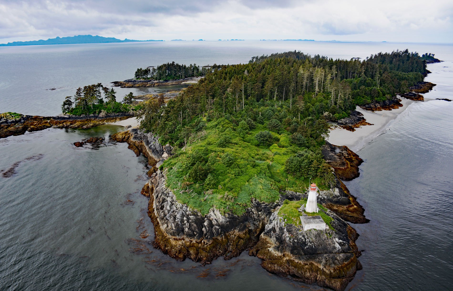
The Lucy Islands is a small group of islets and reefs situated 26 miles (42 km) south of the Alaska border at the intersection of Brown Passage and Chatham Sound, about 83 miles (134 km) southeast of Ketchikan and 12 miles (19 km) west of Prince Rupert, British Columbia. Chatham Sound is located between Dundas and Stephens Islands and the Tsimpsean Peninsula and is part of the Inside Passage that extends from Portland Inlet in the north to Porcher Island in the south. The sound may have been named in 1788 by British Captain Charles Duncan after John Pitt, 2nd Earl of Chatham, who was First Lord of the Admiralty at that time. The Lucy Islands are named after the largest, highest, and easternmost island in the archipelago that was named Lucy Island in 1862 by Captain George Henry Richards of HMS Hecate in honor of Lucy McNeill, the daughter of Captain William H. McNeill who was an official with the Hudson’s Bay Company. The Tsimshian name for the islands is Lax Spinna meaning ‘on shoulders’. The islands are low-lying and heavily forested and constitute a provincially protected conservancy area that contains a nationally significant seabird population, a prominent lighthouse, and some of the oldest archeological sites on the northern British Columbia coast.
Archeological evidence from shell middens and house pits suggest that this remote site was inhabited about 2500 years ago, and recent work indicates that occupation may have occurred as early as 9500 years ago. At that time, sea levels were higher and the evidence is located well above the modern shoreline. Lucy Islands are within the traditional territory of the Tsimshian, a name that translates to ‘Inside the Skeena River’. At one time they lived on the upper reaches of the Skeena River near present-day Hazelton. According to their oral history, after a series of disasters befell the people, a chief led a migration away from the interior lands to the coast, where they founded Kitkatla Village, the first of three Southern Tsimshian villages. Traditionally, the Lucy Islands are included in the territory of the Gitwilgyoots, a Tsimshian tribe that wintered in the Prince Rupert area at the time of European contact. The Gitwilgyoots, meaning ‘people of the kelp’, is one of nine tribes that make up the Coast Tsimshian First Nations. In late spring, the Gitwilgyoots moved to the outer islands west of Prince Rupert for a period of marine fishing, shellfish gathering, and sea mammal hunting before returning to the Skeena River in early summer for the salmon runs. Since 1834, they have been based at the village of Lax Kw’alaams, formerly called Port Simpson which was the historical location of Fort Simpson, a Hudson’s Bay Company trading post. Today, the Coast Tsimshian includes both the Metlakatla and Lax Kw’alaams First Nations.
In 1904, a lighthouse for Lucy Islands was requested and funds were appropriated in 1905. Lumber and material for the lighthouse were shipped north from Victoria aboard the steamship Cascade and the lighthouse was put in operation on January 1, 1907. The original lighthouse consisted of a rectangular wooden dwelling, painted white with a red roof. The light tower was 36 feet (10.9 m) high from its base to the top of the ventilator on the lantern. A fourth-order lens was installed in 1924, and in 1927, an air diaphone, housed in a frame building next to the lighthouse, was placed in operation. In 1960, the lighthouse was replaced with an octagonal concrete tower and the light station had two light keeper residences with all the buildings linked together by a boardwalk 1,969 feet (600 m) long. The light was automated in 1988 and the lightkeeper dwellings were burned. In 2008, Lucy Islands was designated as a conservancy following recommendations from the North Coast Land and Resource Management Plan. The conservancy includes 69 acres (28 ha) of land in the island archipelago as well as 440 acres (178 ha) of marine habitat out to 656 feet (200 m) from shore to protect critical seabird nesting habitat and support marine food harvesting. The islands are the sixth-largest colony in the province of breeding rhinoceros auklets that dig long burrows for their nests. In 1983, about 25,300 nesting pairs were present representing about 5.4% of the global population. The conservancy is collaboratively managed by BC Parks with the Metlakatla and Lax Kw’alaams First Nations. Read more here and here. Explore more of Lucy Islands here:

