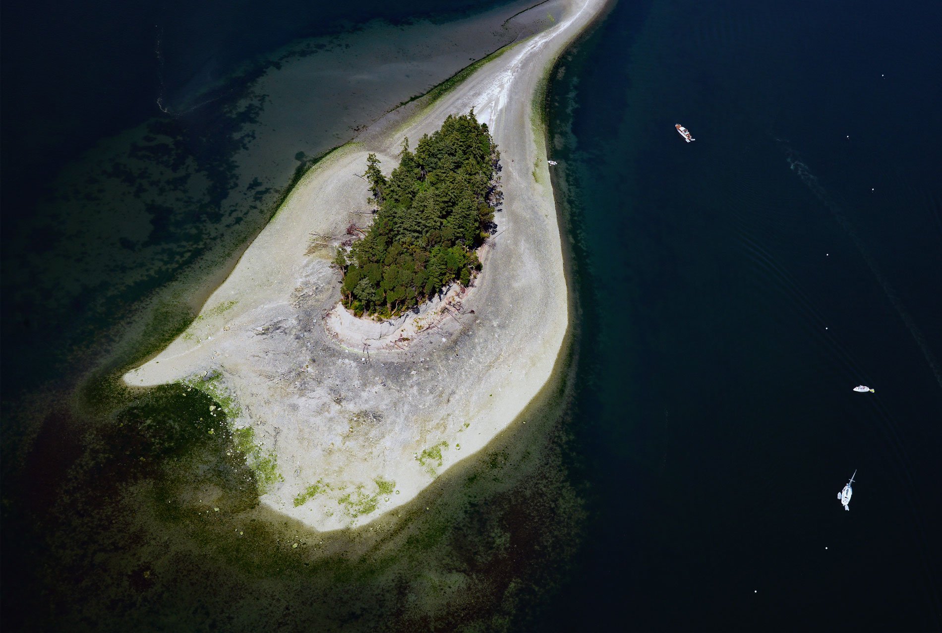
Cutts Island is a state park about 300 feet (91 m) wide and 600 feet (183 m) long, with a distinctive sand spit extending 2,000 feet (610 m) north that nearly reaches Raft Island, and is situated about 0.5 miles (0.8 km) off the eastern shore of Carr Inlet in South Puget Sound, about 12 miles (19 km) northwest of Tacoma, and 5 miles (8 km) west of Gig Harbor, Washington. The island is a vegetated butte eroded by locally generated wind waves forming a teardrop-shaped beach at low tide. The butte comprises Vashon till, a grey to tan mixture of unsorted clay, silt, sand, and gravel deposited directly by glacial ice during the last advance of the Fraser Glaciation about 16,950 to 16,850 years ago. Cutts Island has also been known as ‘Crow Island’ after the crows found in abundance on the island in 1792 by Lieutenant Peter Puget who served on Captain George Vancouver‘s explorations of the Pacific Northwest. In 1841, Lieutenant Charles Wilkes with the U.S. Exploring Expedition named it ‘Scotts Island’ after the quartermaster Thomas Scott, and Carr Inlet was named for Lieutenant Overton Carr. The island has been locally known as ‘Deadmans Island’ reputedly because the island once served as a Native American burial ground. The earliest European explorers to the Northwest Coast observed that the Coast Salish put their dead in a canoe or on a platform placed in a tree, often on islands. Once the body had decomposed, the bones were wrapped in blankets and buried in the ground. In 1977, the U.S. Board of Geographic Names officially designated the island as ‘Cutts Island’, without further explanation.
In 1854, the Treaty of Medicine Creek was an agreement between the Washington Territory of the United States and nine tribes and bands of native Americans occupying the lands and water of South Puget Sound. The tribes listed on the treaty are Nisqually, Puyallup, Steilacoom, Squawskin (Squaxin Island), S’Homamish, Stehchass, T’Peeksin, Squi-aitl, and Sa-heh-wamish. The treaty was signed by the chiefs, headmen, and delegates of the stated tribes and Governor Isaac I. Stevens who was also the Superintendent of Indian Affairs of the territory at the time. The treaty granted 2,240,000 acres (906,496 ha) of land to the United States in exchange for the establishment of three reservations, cash payments over a period of twenty years, and recognition of traditional native fishing and hunting rights. The exact nature of those rights was disputed until the Boldt Decision in 1974 which clarified that the tribes named in the treaty had a recognized right to half of the fish caught on traditional lands. The Squaxin Island Tribe are the descendants of the Coast Salish people that lived along the shores of the southernmost seven inlets of Puget Sound. Each embayment was home to a different ancestral clan with the S’Hotl-Ma-Mish clan principally inhabiting Carr Inlet. These clans subsisted on the abundant resources of South Puget Sound including marine mammals, shellfish, herring, and Chinook, coho, chum, and sockeye salmon using fish traps, weirs, gillnets, and spears.
Harbor seals in South Puget Sound haulout on a variety of substrate materials including intertidal beaches, reefs, sandbars, log booms, and floats. There are five main haulout areas including the mouth of the Nisqually River, Cutts Island, Gertrude Island, Eagle Island, and Woodard Bay. Based on periodic aerial and boat surveys, each of these sites regularly supports a population of over 100 seals. Cutts Island and Eagle Island are currently used regularly by harbor seals but experience high levels of disturbance because of access for human use and recreational boat traffic. Cutts Island State Park is part of a marine protected area of 351 acres (142 ha). Washington has 127 marine protected areas managed by eleven different federal, state, and local agencies. These sites occur in Puget Sound and on the outer coast and cover approximately 644,000 acres (260,618 ha) of shoreline. Though camping is not permitted on or around Cutts Island, mooring buoys are available for boats. During seal pupping season, pups will rest on the beach during low tide. The beach on Cutts island is popular for collecting butter clams. Native littleneck clams and horse clams can also be found in pockets of sand and gravel throughout the beach. Read more here and here. Explore more of Cutts Island and Carr Inlet here:

