Beaches
Recent Articles
More Articles
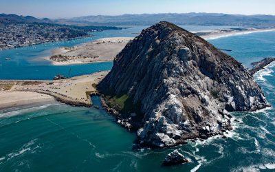
Morro Rock, Morro Bay
Morro Rock is a volcanic plug with an elevation of 576 feet (176 m), connected to the mainland by a causeway that forms the entrance channel to Morro Bay, about 102 miles (164 km) southeast of Monterey and 21 miles (34 km) northwest of Pismo Beach, California.
Point Franklin, Peard Bay
Point Franklin is the site of several whaling shipwrecks at the end of a barrier spit that extends 13 miles (21 km) northeast from the Arctic Coastal Plain, and together with the Seahorse Islands, separates Peard Bay from the Chukchi Sea, about 54 miles (87 km) southwest of Utqiaġvik and 33 miles (53 km) northeast of Wainwright, Alaska.
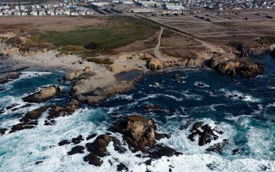
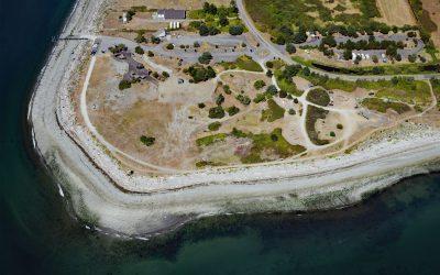
Glass Beach, Noyo Headlands Park
Glass Beach is situated in the northern section of Noyo Headlands Park in the community of Fort Bragg, which is between Pudding Creek to the north and Noyo River to the south, about 95 miles (153 km) south-southeast of Eureka and 10 miles (16 km) north of Mendocino, California.
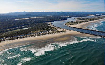
Siuslaw River, Florence
Siuslaw River starts at an elevation of 636 feet (194 m) in the Coast Range and flows generally west-northwest for 110 miles (177 km) to the Pacific Ocean at Florence, draining a watershed of 494,720 acres (200,206 ha), about 53 miles (85 km) west of Eugene and 43 miles (69 km) south of Newport, Oregon.
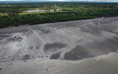
Corea Creek, Clam Gulch
Corea Creek drains a fen at an elevation of 200 feet (60 m) on the Kenai Peninsula and flows generally southwest for 2.4 miles (4 km) to the eastern shore of Cook Inlet and the site of a historic shipwreck, about 37 miles (60 km) north of Homer and 5 miles (8 km) south-southwest of Clam Gulch, Alaska.
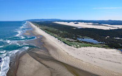
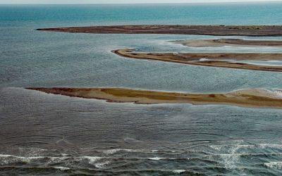
Siltcoos River, Oregon Coastal Dunes
Siltcoos River begins at the outlet of Siltcoos Lake and meanders generally west for 3 miles (4.8 km) through the Oregon Coastal Dunes to the Pacific Ocean, about 8 miles (13 km) south of Florence and 13 miles (21 km) north of Reedsport, Oregon.
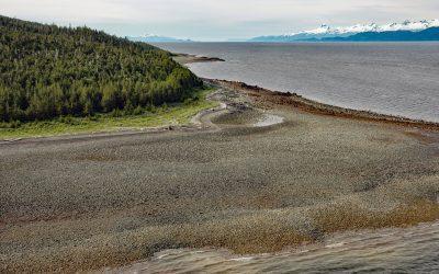
Point Sherman, Lynn Canal
Point Sherman is the site of a historic lighthouse and now a navigational aid marking a shallow ledge that extends 1,600 feet (488 m) from the eastern shore of Lynn Canal and a reef called Sherman Rock situated 2,640 feet (805 m) to the southwest, about 46 miles (74 km) northwest of Juneau and 30 miles (48 km) south-southeast of Haines, Alaska.
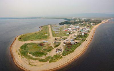
Golovin, Norton Sound
Golovin is a community on the northern shore of Norton Sound in the Bering Sea and situated on a sand spit between Golovnin Lagoon to the north and Golovnin Bay to the south, about 71 miles (114 km) east of Nome and 24 miles (38 km) west-southwest of Elim, Alaska.
Point Roberts, Strait of Georgia
Point Roberts is a community situated on 3,136 acres (1,269 ha) of the southern tip of the Tsawwassen Peninsula and represents an exclave of the United States in the Strait of Georgia, about 32 miles (52 km) northwest of Bellingham and 15 miles (24 km) west of Blaine, Washington.
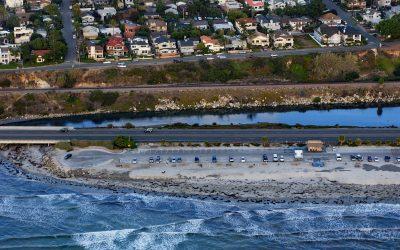
San Elijo Lagoon, Cardiff
San Elijo Lagoon is 915 acres (370 ha) of tidal wetlands formed by Escondido Creek that drains a watershed of 54,000 acres (22,000 ha) and flows generally southwest for 26 miles (42 km) to the Pacific Ocean at Cardiff, or Cardiff-by-the-Sea, a beach community in Encinitas, about 89 miles (144 km) southeast of Los Angeles and 21 miles (34 km) north-northwest of San Diego, California.
About the background graphic
This ‘warming stripe’ graphic is a visual representation of the change in global temperature from 1850 (top) to 2019 (bottom). Each stripe represents the average global temperature for one year. The average temperature from 1971-2000 is set as the boundary between blue and red. The colour scale goes from -0.7°C to +0.7°C. The data are from the UK Met Office HadCRUT4.6 dataset.
Click here for more information about the #warmingstripes.