
British Columbia
Recent Articles
More Articles

Scotia River, Great Bear Rainforest
Scotia River starts at an elevation of 5,023 feet (1,531 m) in the Coast Range and flows generally north-northwest for 14 miles (22 km) through the Great Bear Rainforest, draining a watershed of 33,360 acres (13,500 ha) to the southern shore, or left bank, of the Skeena River, about 49 miles (79 km) southwest of Terrace and 29 miles (47 km) east-southeast of Prince Rupert, British Columbia.
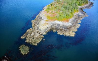
Halibut Island, Haro Strait
Halibut Island is about 0.4 miles (0.7 km) long and 0.1 miles (0.2 km) wide and 9.67 acres (3.9 ha), located off the east coast of Sidney Island in Haro Strait, about 14 miles (23 km) north-northeast of Victoria and 6 miles (10 km) east-southeast of Sidney, British Columbia.

Ecstall River, Kitimat Ranges
Ecstall River starts from a cirque glacier at an elevation of roughly 3100 feet (945 m) in the Kitimat Ranges of the Coast Mountains and flows generally north-northwest for about 68 miles (110 km), draining a watershed of 207,568 acres (84,000 ha), to the lower tidal reach of the Skeena River, about 60 miles (97 km) west-southwest of Terrace and 18 miles (29 km) southeast of Prince Rupert, British Columbia.

Kitlope River, Gardner Canal
Kitlope River starts from the Kitimat Ranges and flows generally northwest to the head of Gardner Canal, about 125 miles (202 km) southeast of Prince Rupert and 75 miles (121 km) north of Bella Bella, British Columbia.

Blubber Bay, Texada Island
Blubber Bay is a community and an embayment on the northern tip of Texada Island, between the Strait of Georgia to the west and Malaspina Strait to the east, and the site of a historical shore whaling station and present-day limestone mine, about 76 miles (122 km) northwest of Vancouver and 5 miles (8 km) southwest of Powell River, British Columbia.
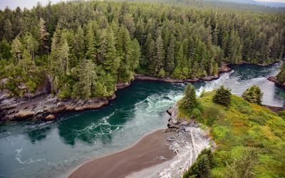
Whyac, Nitinat Narrows
Whyac is a historical Ditidaht First Nation village on the southern shore beside Nitinat Narrows, a tidal channel about 1.9 miles (3 km) long that connects Nitinat Lake to the Pacific Ocean on the north shore of the Strait of Juan de Fuca on Vancouver Island, about 22 miles (35 km) northwest of Port Renfrew and 17 miles (27 km) southeast of Bamfield, British Columbia.
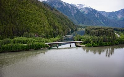
Kasiks River, Skeena River
Kasiks River is a tributary that enters the Skeena River about 55 miles (89 km) upstream from Chatham Sound, about 37 miles (60 km) east of Prince Rupert and 36 miles (58 km) southwest of Terrace, British Columbia.

Lawson Harbour, Lewis Island
Lawson Harbour was a historical community on Lewis Island between Chismore Passage to the west and Arthur Passage to the east near the mouth of the Skeena River, about 75 miles (121 km) southwest of Terrace and 20 miles (32 km) south of Prince Rupert, British Columbia.

Telegraph Point, Skeena River
Telegraph Point is the historical site of a telegraph station on the north bank of the Skeena River, about 48 miles (77 km) southwest of Terrace and 28 miles (45 km) southeast of Prince Rupert, British Columbia.
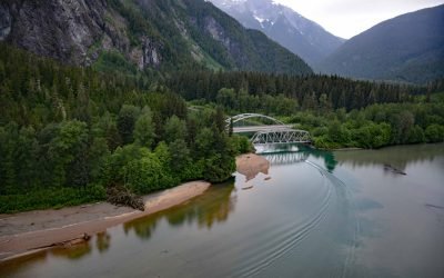
Exchamsiks River Provincial Park, Skeena River
Exchamsiks River Provincial Park is in the Coast Mountains at the mouth of the Exchamsiks River on the north side of the Skeena River, about 42 miles (68 km) east of Prince Rupert and 31 miles (50 km) southwest of Terrace, British Columbia.
About the background graphic
This ‘warming stripe’ graphic is a visual representation of the change in global temperature from 1850 (top) to 2019 (bottom). Each stripe represents the average global temperature for one year. The average temperature from 1971-2000 is set as the boundary between blue and red. The colour scale goes from -0.7°C to +0.7°C. The data are from the UK Met Office HadCRUT4.6 dataset.
Click here for more information about the #warmingstripes.