Canneries
Recent Articles
More Articles
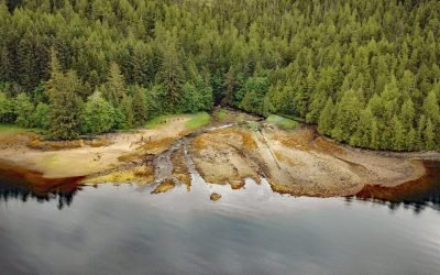
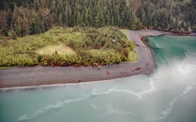
Cape Fox Packing Company Cannery, Boca de Quadra
The Cape Fox Packing Company operated a cannery from 1883 to 1886 on the north shore of Boca de Quadra, a fjord on the Portland Peninsula, about 59 miles (95 km) north-northwest of Prince Rupert and 36 miles (58 km) southeast of Ketchikan, Alaska.
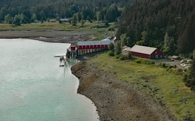
Letnikof Cove, Chilkat Inlet
Letnikof Cove is a small embayment about 0.5 miles (0.8 km) across on the eastern shore of Chilkat Inlet, approximately 70 miles (113 km) north-northwest of Juneau and 5 miles (8 km) south-southeast of Haines, Alaska.
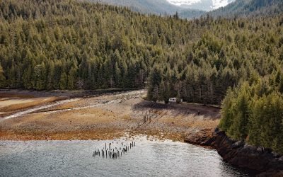
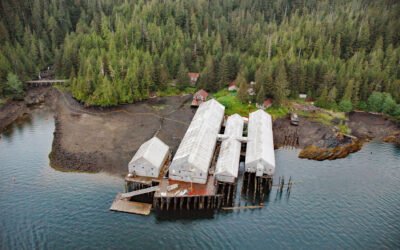
Union Bay Cannery, Ernest Sound
Union Bay is located on the lower Cleveland Peninsula at the southern entrance to Ernest Sound, between Lemesurier Point to the west and Union Point to the east, about 3 miles (4.8 km) northeast of Meyers Chuck and 34 miles (55 km) northwest of Ketchikan, Alaska.
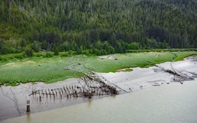
Haysport, Skeena River
Haysport is the site of a historical community and salmon cannery on the north shore of the Skeena River adjacent to the Grand Trunk Railroad, about 61 miles (100 km) southwest of Terrace and 16 miles (26 km) southeast of Prince Rupert, British Columbia.
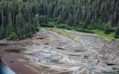
Shepard Point, Orca Inlet
Shepard Point is an alluvial fan on the eastern shore of Orca Inlet in Prince William Sound at Nelson Bay, which is an estuary mostly formed by the Rude River, about 41 miles (66 km) southeast of Valdez and 7 miles (11.3 km) north-northeast of Cordova, Alaska.
George Inlet, Revillagigedo Island
George Inlet is a deglaciated fjord that extends generally north into Revillagigedo Island for about 19 miles (31 km) from Revillagigedo Channel to Salt Lagoon, with a historical cannery situated on the western shore, about 87 miles (140 km) northwest of Prince Rupert and 9 miles (15 km) east-northeast of Ketchikan, Alaska.
Dundas Bay, Glacier Bay National Park and Preserve
Dundas Bay is located on the north shore of Icy Strait in Glacier Bay National Park and Preserve, about 24 miles (39 km) west of Gustavus and 11 miles (18 km) north of Elfin Cove, Alaska.
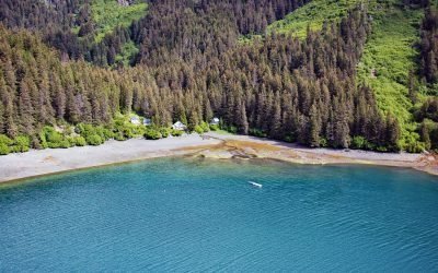
San Juan Cove, Tutka Bay
San Juan Cove is a small embayment on the north shore of Tutka Bay, a deglaciated fjord on the southern shore of Kachemak Bay in the Kenai Mountains in Kachemak Bay State Park, about 13 miles (21 km) south-southeast of Homer and 11 miles (18 km) east-northeast of Seldovia, Alaska.
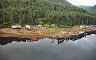
Chatham Cannery, Sitkoh Bay
Chatham is a historical salmon cannery and village on the west shore of Sitkoh Bay on Chichagof Island in the Alexander Archipelago of Southeast Alaska, about 58 miles (93 km) south-southwest of Juneau and 13 miles (21 km) west of Angoon, Alaska.
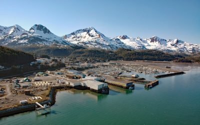
Cordova, Orca Inlet
Cordova is a community on the southeastern shore of Orca Inlet across from Hawkins Island in eastern Prince William Sound, about 100 miles (160 km) east-southeast of Whittier and 45 miles (72 km) south-southeast of Valdez, Alaska.
About the background graphic
This ‘warming stripe’ graphic is a visual representation of the change in global temperature from 1850 (top) to 2019 (bottom). Each stripe represents the average global temperature for one year. The average temperature from 1971-2000 is set as the boundary between blue and red. The colour scale goes from -0.7°C to +0.7°C. The data are from the UK Met Office HadCRUT4.6 dataset.
Click here for more information about the #warmingstripes.