Canneries
Recent Articles
More Articles
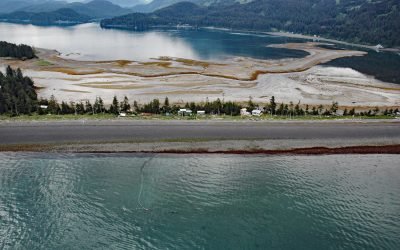
Claxton, Telegraph Passage
Claxton is a historical salmon cannery and community at the mouth of Claxton Creek on the eastern shore of Telegraph Passage in the Skeena River estuary, about 66 miles (106 km) southwest of Terrace and 19 miles (31 km) south-southeast of Prince Rupert, British Columbia.
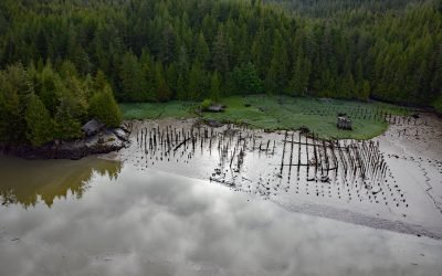
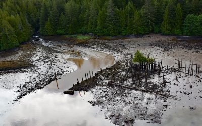
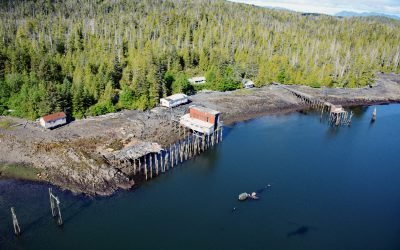
Carlisle Cannery, Skeena River
Carlisle is a historical remote salmon cannery on the east bank at the mouth of the Skeena River, about 66 miles (106 km) southwest of Terrace and 17 miles (27 km) southeast of Prince Rupert, British Columbia.
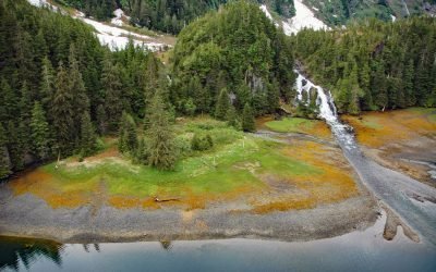
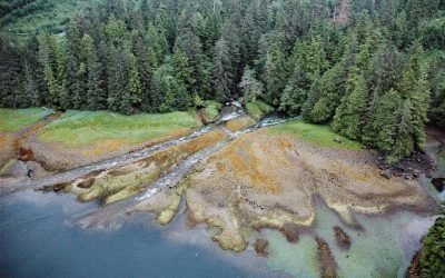
Cliff Falls, Deep Cove
Cliff Falls is the outlet for Cliff Lake situated at the head of Deep Cove, an embayment on the east coast of Baranof Island with an entrance about 1.1 miles (1.8 km) west of Patterson Point, about 41 miles (66 km) south-southeast of Sitka and 17.5 miles (28 km) north-northwest of Port Armstrong, Alaska.
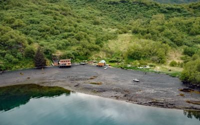
Mush Bay, East Arm Uganik Bay
Mush Bay is on the western shore of East Arm Uganik Bay, on the west coast of Kodiak Island, 22 miles (35 km) northeast of Larsen Bay and 40 miles (65 km) west-southwest of Kodiak, Alaska.
Humpback Bay, Porcher Island
Humpback Bay is an embayment on the north coast of Porcher Island off Malacca Passage, about 15 miles (24 km) south of Prince Rupert, British Columbia.
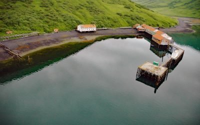
Chip Cove Cannery, Moser Bay
Chip Cove is an embayment between Luchek Mountain to the south and Peak 2001 to the north, and the site of a historical salmon cannery on the western shore of Moser Bay near Olga Narrows on the southwestern coast of Kodiak Island, about 83 miles (131 km) southwest of Kodiak and 6 miles (10 km) north of Akhiok, Alaska.
Copper Harbor, Hetta Inlet
Copper Harbor is an embayment on Prince of Wales Island on the eastern shore of Hetta Inlet, and the site of the historical Coppermount mine, about 38 miles (61 km) west-southwest of Ketchikan and 8.6 miles (14 km) east-northeast of Hydaburg, Alaska.
Ford Arm, Chichagof Island
Ford Arm is an embayment about 0.3 miles (483 m) across and 4 miles (6.5 km) long, on the west coast of Chichagof Island, about 44 miles (71 km) north-northwest of Sitka and 28 miles (44 km) south-southeast of Pelican, Alaska.
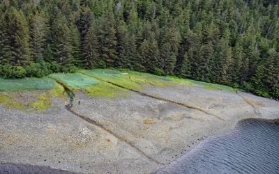
MacDonald Spit, Kasitsna Bay
MacDonald Spit is a sediment deposition feature about 1 mile (1.6 km) long, caused by longshore drift from west to east, which forms the northwestern shore of Kasitsna Bay on the south coast of Kachemak Bay on the Kenai Peninsula, about 5 miles (8 km) northeast of Seldovia, Alaska.
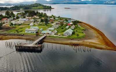
Lindenberger Cannery, Craig Island
The Lindenberger Packing Company is a historical salmon cannery on Craig Island in the present-day community of Craig at the south end of Klawock Inlet adjacent to Fish Egg Island and now connected to Prince of Wales Island by a causeway, about 58 miles (93 km) west-northwest of Ketchikan and 6 miles (10 km) south-southwest of Klawock, Alaska.
About the background graphic
This ‘warming stripe’ graphic is a visual representation of the change in global temperature from 1850 (top) to 2019 (bottom). Each stripe represents the average global temperature for one year. The average temperature from 1971-2000 is set as the boundary between blue and red. The colour scale goes from -0.7°C to +0.7°C. The data are from the UK Met Office HadCRUT4.6 dataset.
Click here for more information about the #warmingstripes.