Canneries
Recent Articles
More Articles
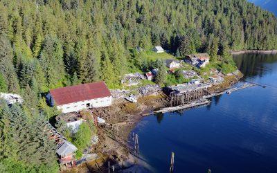
Butedale, Princess Royal Island
Butedale is a historical salmon cannery and community located on a small embayment adjacent to Butedale Falls along the Inside Passage on the northeast side of Princess Royal Island across from Work Island on the southern shore of Fraser Reach, which is part of Princess Royal Channel, about 103 miles (166 km) southeast of Prince Rupert and 59 miles (95 km) south of Kitimat, British Columbia.
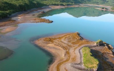
Kukak Cannery, Katmai National Park and Preserve
Kukak Bay is the site of a historical razor clam cannery on the western shore of Shelikof Strait, in Katmai National Park and Preserve, about 132 miles (212 km) southwest of Homer and 77 miles (124 km) northwest of Kodiak, Alaska.
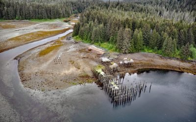
Bay of Pillars, Kuiu Island
Bay of Pillars is on the west coast of Kuiu Island and 1.5 miles (2.4 km) across between Point Sullivan to the north and Point Ellis to the south, about 52 miles (84 km) southeast of Sitka and 52 miles (84 km) west-southwest of Petersburg, Alaska.
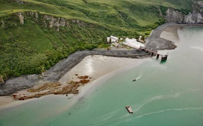
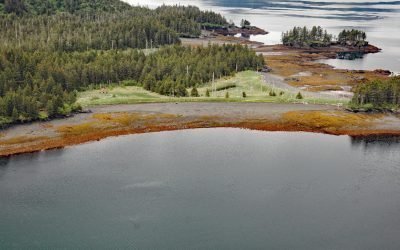
Snug Harbor, Chisik Island
Snug Harbor is a historical cannery located along a bight on the west coast of Chisik Island, at the southern end of Tuxedni Channel, on the western shore of Cook Inlet, about 51 miles (82 km) northwest of Homer and 56 miles (90 km) southwest of Kenai, Alaska.
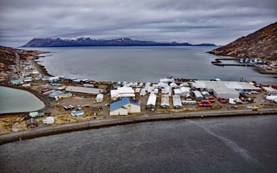
King Cove, Alaska Peninsula
King Cove is a small community on the Alaska Peninsula located partially on a spit separating King Cove Bay and King Cove Lagoon, about 18 air miles (29 km) southeast of the village of Cold Bay, Alaska.
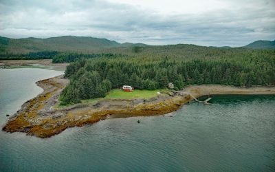
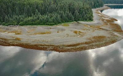
Funter Bay, Admiralty Island
Funter Bay is on the west coast of the Mansfield Peninsula on Admiralty Island, about 32 miles (52 km) southeast of Gustavus and 14 miles (23 km) southwest of Juneau, Alaska.
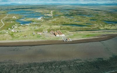
Pilot Point, Ugashik Bay
Pilot Point is a community on the eastern shore of Ugashik Bay, on the north coast of the Alaska Peninsula, 83 miles (134 km) south-southwest of King Salmon and 7 miles (11 km) northwest of Ugashik, Alaska.
Todd Cannery, Peril Strait
Todd is an abandoned cannery and a historical settlement on Lindenberg Harbor in Peril Strait, on the southern coast of Chichagof Island, 9 miles (15 km) west of Chatham Strait and 32 air miles (52 km) north-northeast of Sitka, Alaska.
Portlock Cannery, Port Chatham
Portlock is a historical salmon cannery in Port Chatham, an embayment on the southern coast of the Kenai Peninsula, about 102 miles (164 km) north-northeast of Kodiak and 10 miles (16 km) south-southeast of Port Graham, Alaska.
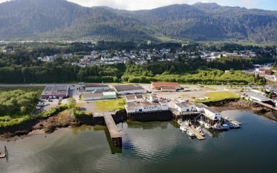
Canadian Fishing Company, Prince Rupert
The Canadian Fishing Company operates fish processing plants on Prince Rupert Harbour at Seal Cove and at George Hills Way, about 89 miles (143 km) southeast of Ketchikan and 72 miles (116 km) west-southwest of Terrace, British Columbia.
About the background graphic
This ‘warming stripe’ graphic is a visual representation of the change in global temperature from 1850 (top) to 2019 (bottom). Each stripe represents the average global temperature for one year. The average temperature from 1971-2000 is set as the boundary between blue and red. The colour scale goes from -0.7°C to +0.7°C. The data are from the UK Met Office HadCRUT4.6 dataset.
Click here for more information about the #warmingstripes.