Canneries
Recent Articles
More Articles
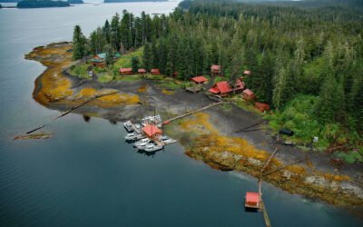
Cannery Cove, Pybus Bay
Cannery Cove is an embayment on the western shore of Pybus Bay in the Kootznoowoo Wilderness, on the southern coast of Admiralty Island, about 70 miles (113 km) south of Juneau and 24 miles (39 km) north-northwest of Kake, Alaska.
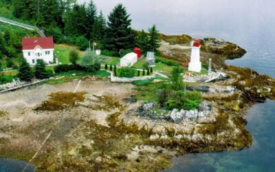
Dryad Point, Campbell Island
Dryad Point is on the northeastern point of Campbell Island and is the site of a historic lighthouse that marks the intersection of Lama Passage to the east and Seaforth Channel to the north on the Inside Passage, about 173 miles (278 km) southeast of Prince Rupert and 2 miles (3.2 km) northeast of Bella Bella, British Columbia.
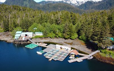
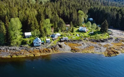
Little Port Walter, Baranof Island
Little Port Walter is an embayment and research facility on the southern shore of Port Walter, situated on the southeastern coast of Baranof Island and the western shore of Chatham Strait, about 53 miles (85 km) south-southeast of Sitka and 9 miles (14.5 km) north of Port Alexander, Alaska.
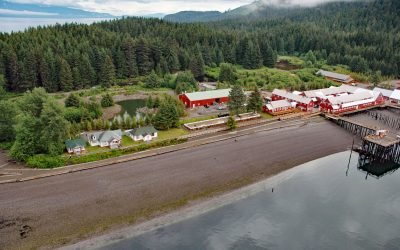
Icy Strait Point, Port Frederick
Icy Strait Point is a restored historic salmon cannery situated on Cannery Point, on the south shore of Icy Strait and on the eastern shore at the mouth of Port Frederick, a deep embayment on the northeast coast of Chichagof Island, about 22 miles (35 km) south-southeast of Gustavus and 1.6 miles (2.6 km) north-northwest of Hoonah, Alaska.
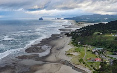
Winema Beach, Oretown
Winema Beach, a coastal strip adjacent to Winema Lake, was once the site of a town platted as Wi‑Ne‑Ma near Oretown in southern Tillamook County, about 15 miles (24 km) north of Lincoln City and 4 miles (6 km) south of Pacific City, Oregon.
Metlakatla, Annette Island
Metlakatla is a Tsimshian community situated on Port Chester, an embayment on the west coast of Annette Island, about 75 miles (121 km) northwest of Prince Rupert and 16 miles (26 km) south-southeast of Ketchikan, Alaska.
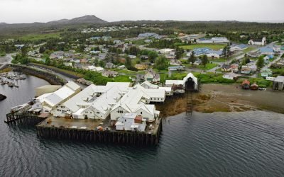
Loring, Naha Bay
Loring is a small community at the site of a historical salmon cannery on the west coast of Revillagigedo Island, at the head of Naha Bay and near the mouth of the Naha River, about 66 miles (106 km) south-southeast of Wrangell and 17 miles (27 km) north of Ketchikan, Alaska.
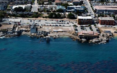
Cannery Row, Monterey
Cannery Row is the Monterey waterfront between San Carlos Beach and Cabrillo Beach, or between the Monterey Harbor Marina and the Monterey Bay Aquarium, where several historical Pacific sardine canneries once operated, about 25 miles (40 km) south-southeast of Santa Cruz and 1 mile (1.6 km) southeast of Pacific Grove, California.
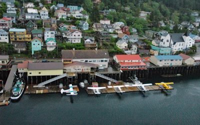
Ketchikan, Revillagigedo Island
Ketchikan is a coastal community and U.S. port of entry on the north shore of Tongass Narrows, on the southern coast of Revillagigedo Island, about 88 miles (142 km) northwest of Prince Rupert and 84 miles (135 km) south-southeast of Wrangell, Alaska.

Big Port Walter, Baranof Island
Port Walter is a fjord 3.7 miles (6 km) long that opens into Chatham Strait on the southeast coast of Baranof Island, about 91 miles (146 km) west of Wrangell and 51 miles (82 km) south-southeast of Sitka, Alaska.
About the background graphic
This ‘warming stripe’ graphic is a visual representation of the change in global temperature from 1850 (top) to 2019 (bottom). Each stripe represents the average global temperature for one year. The average temperature from 1971-2000 is set as the boundary between blue and red. The colour scale goes from -0.7°C to +0.7°C. The data are from the UK Met Office HadCRUT4.6 dataset.
Click here for more information about the #warmingstripes.