
by CoastView | Aug 25, 2025 | 2025, Alaska, Coastal Features, Embayments, Glaciers, Natural History
Listen to the article here https://coastview.org/wp-content/uploads/2025/06/Barry-Glacier.mp3 Barry Glacier flows southwest for 16 miles (25 km) to Barry Arm of Harriman Fjord in northwestern Prince William Sound, about 33 miles (53 km) northeast of Whittier and 58...

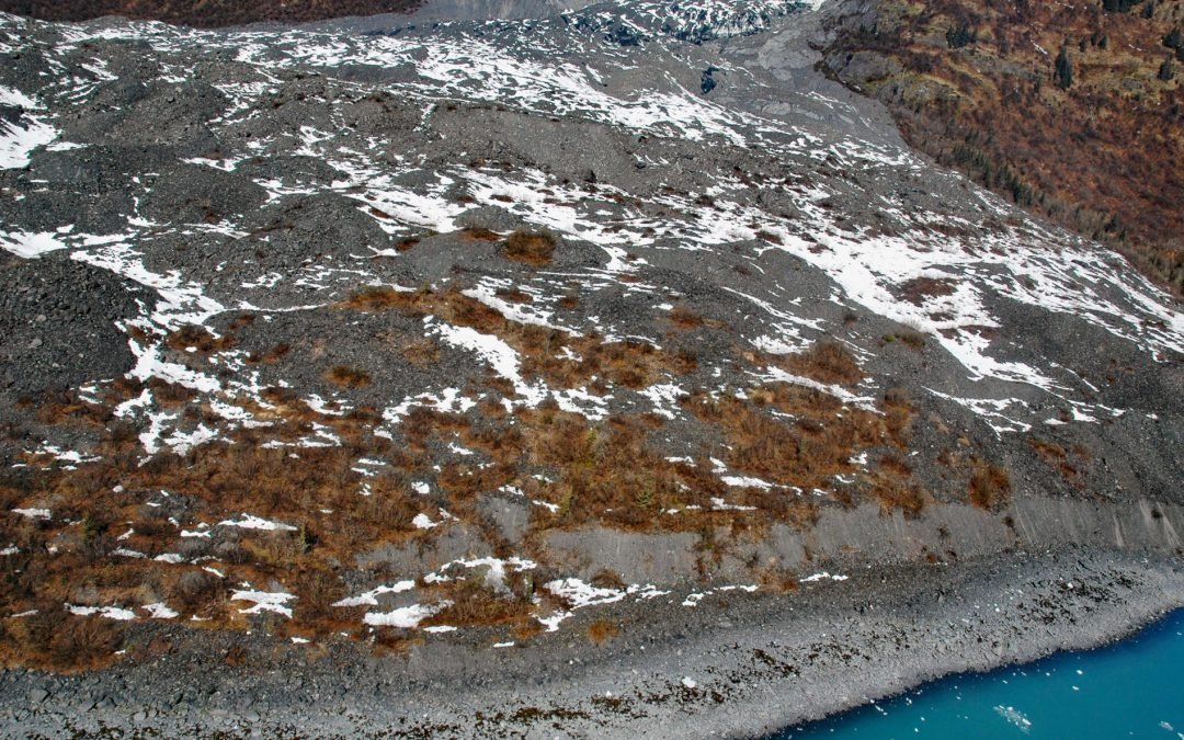
by CoastView | Aug 16, 2025 | 2025, Alaska, Climate Change, Coastal Features, Embayments, Glaciers, Kachemak, Land Use, Natural History, Parks
Listen to the article here https://coastview.org/wp-content/uploads/2025/06/Mallard-Bay.mp3 Mallard Bay is on the southern shore of Kachemak Bay on the Kenai Peninsula and adjacent to the mouth of the Portlock River, approximately 14 miles (23 km) east-northeast of...

by CoastView | Aug 14, 2025 | 2025, Alaska, Biodiversity, Coastal Features, Embayments, Glaciers, Historical, Land Use, Natural History, Parks
Listen to the article here https://coastview.org/wp-content/uploads/2025/06/Johns-Hopkins-Glacier.mp3 Johns Hopkins Glacier flows generally east-northeast for 13 miles (21 km) to the head of Johns Hopkins Inlet in Glacier Bay National Park and Preserve, about 104...

by CoastView | Aug 2, 2025 | 2025, Alaska, Climate Change, Coastal Features, Glaciers, Historical, Kachemak, Natural History, Parks, Rivers
Listen to the article here https://coastview.org/wp-content/uploads/2025/06/Grewingk-Glacier.mp3 Grewingk Glacier originates from an icefield in the Kenai Mountains and flows northwest to the southern shore of Kachemak Bay, about 25 miles (40 km) northeast of Seldovia...
by CoastView | Jul 23, 2025 | 2025, Alaska, Coastal Features, Embayments, Glaciers, Historical, Land Use, Natural History
Listen to the article here https://coastview.org/wp-content/uploads/2025/06/Vassar.mp3 Vassar Glacier flows southeast for 4.3 miles (7 km) from the eastern flank of Peak 8080 in the Chugach Mountains to College Fjord’s western shore. about 52 miles (83 km) west...

by CoastView | Jun 26, 2025 | 2025, Alaska, Climate Change, Coastal Features, Embayments, Glaciers, Historical, Natural History, Parks
Listen to the article here https://coastview.org/wp-content/uploads/2025/05/Valerie-Glacier.mp3 Valerie Glacier is formed by several tributary glaciers that merge and flow southeast for about 14 miles (22.5 km) to join the Hubbard Glacier and terminate in...