Historical Sites
Recent Articles
More Articles

Kustatan, West Foreland
Kustatan is a historical Dena’ina community on West Foreland, on the west side of Cook Inlet near the mouth of the Kustatan River, about 71 miles (115 km) southwest of Anchorage and 20 miles (32 km) northwest of Kenai, Alaska.
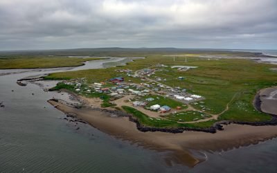
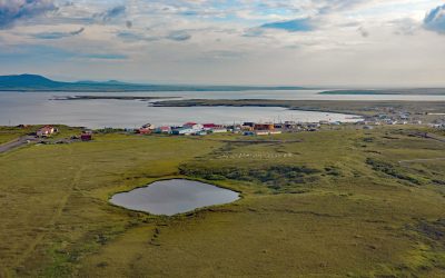
Mekoryuk, Nunivak Island
Mekoryuk is a community situated at the western entrance to Shoal Bay on the northern shore of Nunivak Island in the Bering Sea, about 153 miles (246 km) west-southwest of Bethel and 80 miles (129 km) south of Hooper Bay, Alaska.
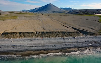
Lost River Mine, York Mountains
Lost River starts at an elevation of 1400 feet (427 m) on the south flank of the York Mountains on the Seward Peninsula and flows south for 9.5 miles (15 km) to the Bering Sea, about 86 miles (138 km) northwest of Nome and 31 miles (50 km) southeast of Wales, Alaska.

Tongue Point, Semiahmoo Spit
Tongue Point is at the end of Semiahmoo Spit, a sand bar of 125 acres (51 ha) and about 1 mile (1.6 km) long that partially encloses Drayton Harbor, about 21 miles (34 km) northwest of Bellingham and 1 mile (1.6 km) west of Blaine, Washington.
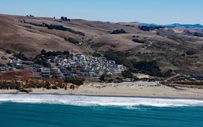
Dillon Beach, Bodega Bay
Dillon Beach is a community situated along Dillon Creek that starts at an elevation of 430 feet (131 m) and flows generally west for 1.3 miles (2 km) to Bodega Bay near the mouth of Tomales Bay, about 43 miles (69 km) north-northwest of San Francisco and 7 miles (11 km) south-southeast of the community of Bodega Bay, California.

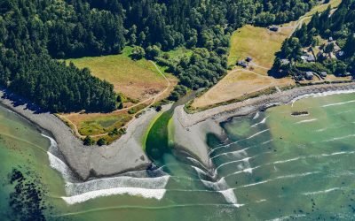
New Dungeness Light Station, Dungeness Spit
New Dungeness Light Station is located on Dungeness Spit in Dungeness National Wildlife Refuge on the southern coast of the Strait of Juan de Fuca, about 17 miles (27 km) west-northwest of Port Townsend and 7 miles (11 km) north of Sequim, Washington.
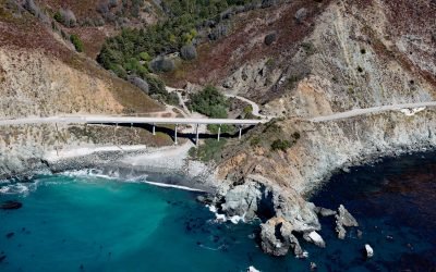
Limekiln State Park, Rockland Landing
Limekiln State Park is 716 acres (290 ha) on the Big Sur coast at Rockland Landing, about 31 miles (50 km) northwest of San Simeon and 2 miles (3.2 km) south of Lucia, California.
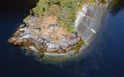
Octopus Point, Sansum Narrows
Octopus Point is a headland on the western shore of Sansum Narrows between Maple Bay on Vancouver Island to the west and Burgoyne Bay on Saltspring Island to the east, about 27 miles (44 km) north-northwest of Victoria and 2.5 miles (4 km) southeast of Maple Bay, British Columbia.
Saint Michael, Norton Sound
Saint Michael is a community situated on the eastern coast of Saint Michael Island, on Saint Michael Bay which is on the southern coast of Norton Sound, about 47 miles (76 km) southwest of Unalakleet and 8 miles (13 km) east-southeast of Stebbins, Alaska.
Lyre River, Low Point
Lyre River starts at the outlet of Lake Crescent in Olympic National Park and flows roughly northwest for 5 miles (8 km) to Low Point on the Strait of Juan de Fuca draining a watershed of 43,200 acres (17,482 ha), about 21 miles (34 km) southeast of Clallam Bay and 19 miles (31 km) west of Port Angeles, Washington.
About the background graphic
This ‘warming stripe’ graphic is a visual representation of the change in global temperature from 1850 (top) to 2019 (bottom). Each stripe represents the average global temperature for one year. The average temperature from 1971-2000 is set as the boundary between blue and red. The colour scale goes from -0.7°C to +0.7°C. The data are from the UK Met Office HadCRUT4.6 dataset.
Click here for more information about the #warmingstripes.