Islands
Recent Articles
More Articles
Fort Glenn, Umnak Island
Fort Glenn was a World War II military base on the northeast coast of Umnak Island in the Eastern Aleutians, about 67 miles (108 km) southwest of Dutch Harbor and 49 miles (79 km) northeast of Nikolski, Alaska.
Jude Island, Alaska Peninsula
Jude Island is about 0.2 miles (0.3 km) across and located off the Alaska Peninsula between Unga and Wosnesenski islands, about 48 miles (77 km) northeast of King Cove and 24 miles (39 km) west-southwest of Sand Point, Alaska.

Mary Island, Revillagigedo Channel
Mary Island is the site of a historic lighthouse located between Felice Strait to the west and Revillagigedo Channel to the east, about 64 miles (103 km) north-northwest of Prince Rupert, British Columbia and 25 miles (40 km) southeast of Ketchikan, Alaska.

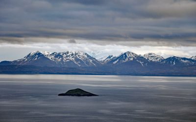
Stardust Bay, Sedanka Island
Stardust Bay is situated on the southeast coast of Sedanka Island, which is separated from Unalaska Island by Udagak Strait to the west and Beaver Inlet to the north, about 780 miles (1258 km) southwest of Anchorage and 16 miles (26 km) southeast of Dutch Harbor, Alaska.

Friendly Cove, Nootka Island
Friendly Cove is an embayment on Nootka Island situated at the northern entrance to Nootka Sound, and is the site of a historic lighthouse and the Yuquot National Historic Site of Canada, about 72 miles (116 km) south-southeast of Port McNeill and 45 miles (72 km) northwest of Tofino, British Columbia.

Cape Tanak, Umnak Island
Cape Tanak is a headland on the north coast of Umnak Island in the Eastern Aleutian Islands between Cape Idak to the east and Ashishik Point to the west, about 64 miles (103 km) southwest of Dutch Harbor and 56 miles (90 km) northeast of Nikolski, Alaska.

Cape Spencer, Cross Sound
Cape Spencer is a prominent headland in Glacier Bay National Park and Preserve marking the northern entrance to Cross Sound adjacent to an area with numerous offshore islets, rocks, and islands, one of which, near the entrance to Dicks Arm, is the site of a historic lighthouse, about 45 miles (73 km) northwest of Hoonah and 37 miles (60 km) southwest of Gustavus, Alaska.

Cape Saint Elias, Kayak Island
Cape Saint Elias comprises a prominent headland and Pinnacle Rock, and is the site of a historic lighthouse at the southwest end of Kayak Island, 172 miles (277 km) west of Yakutat and 62 miles (100 km) southeast of Cordova, Alaska.

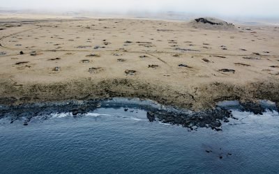
Delarof Harbor, Unga Island
Delarof Harbor is an embayment and the site of the historical village of Unga on the southeast coast of Unga Island, the largest of the Shumagin Islands, about 73 miles (118 km) southwest of Perryville and 9.5 miles (15 km) south of Sand Point, Alaska.

Eldred Rock Lighthouse, Lynn Canal
Eldred Rock is a small island and site of a historic lighthouse situated adjacent to Sullivan Island in Lynn Canal, between the Chilkat Range to the west and the Kakuhan Range to the east, about 55 miles (89 km) northwest of Juneau and 20 miles (32 km) south-southeast of Haines, Alaska.
About the background graphic
This ‘warming stripe’ graphic is a visual representation of the change in global temperature from 1850 (top) to 2019 (bottom). Each stripe represents the average global temperature for one year. The average temperature from 1971-2000 is set as the boundary between blue and red. The colour scale goes from -0.7°C to +0.7°C. The data are from the UK Met Office HadCRUT4.6 dataset.
Click here for more information about the #warmingstripes.