Lighthouses
Recent Articles
More Articles
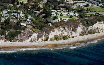
Santa Barbara Lighthouse, Santa Barbara
The Santa Barbara Lighthouse is located between the East Mesa and West Mesa neighborhoods, about 2 miles (3 km) west of Santa Barbara Harbor, in the City of Santa Barbara, California.
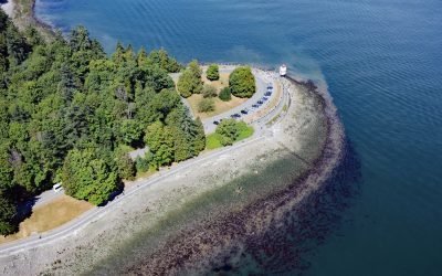
Brockton Point, Stanley Park
Brockton Point is a prominent peninsula in Stanley Park, located on the southern coast of Burrard Inlet, about 19 miles (30 km) north of Tsawwassen and 2.6 miles (4 km) southeast of West Vancouver, British Columbia.
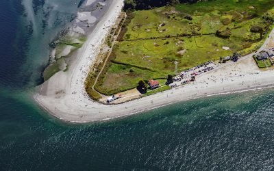
Point No Point, Admiralty Inlet
Point No Point is a sand spit on the northern end of the Kitsap Peninsula, between Norwegian Point to the northwest and Pilot Point to the southeast, near the southern end of Admiralty Inlet that connects the Salish Sea with Puget Sound, about 8 miles (13 km) north of Kingston and 1.3 miles (2.1 km) southeast of Hansville, Washington.
Shelter Cove, Point Delgada
Shelter Cove is an isolated community on Point Delgada on the Lost Coast between Deadman Gulch to the south and Telegraph Creek to the north, about 54 miles (87 km) south of Eureka and 43 miles (69 km) north-northwest of Fort Bragg, California.
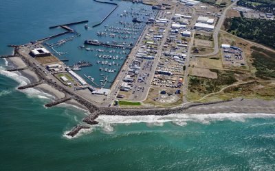
Westport, Point Chehalis
Westport is a community located on Point Chehalis, a peninsula between South Bay and the Pacific Ocean that partially encloses Grays Harbor from the south, about 53 miles (85 km) north-northwest of Astoria and 15 miles (24 km) west-southwest of Aberdeen, Washington.
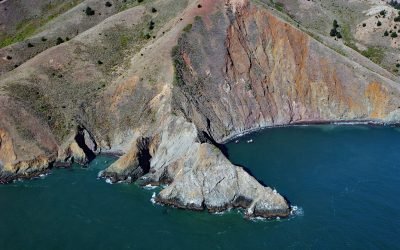
Point Diablo, Marin Headlands
Point Diablo extends about 600 feet (183 m) south from the Marin Headlands roughly midway between Point Bonita to the west and Lime Point to the east, about 6 miles (10 km) northwest of San Francisco and 2.7 miles (4 km) south-southwest of Sausalito, California.
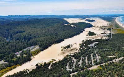
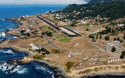
Umpqua River, Winchester Bay
Umpqua River flows generally west-northwest for 111 miles (179 km), draining a watershed of 2.4 million acres (1 million ha), from the Cascade Mountains through the Coast Range to Winchester Bay in the Oregon Dunes, about 20 miles (32 km) north of Coos Bay and 5.5 miles (9 km) southwest of Reedsport, Oregon.
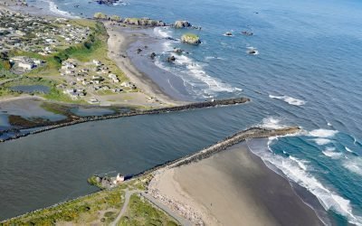
Coquille River, Bandon
Coquille River drains a mountainous watershed of about 6.8 million acres (2.7 million ha) with at least 26 named tributaries and flows for about 36 miles (58 km) from the confluence of the North Fork and South Fork to the Pacific Ocean at Bandon, about 26 miles (42 km) north of Port Orford and 20 miles (32 km) southwest of Coos Bay, Oregon.
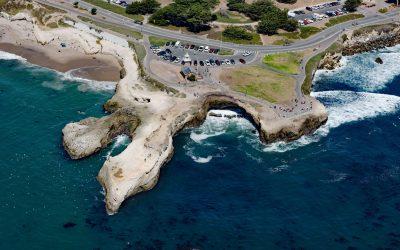
Lighthouse Point Park, Point Santa Cruz
Lighthouse Point Park is located on Point Santa Cruz, adjacent to Lighthouse Field State Beach at the northern boundary of Monterey Bay, about 25 miles (40 km) north-northwest of Monterey and in Santa Cruz, California.
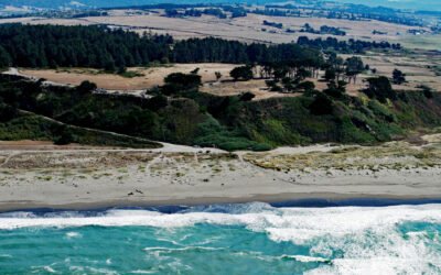
Table Bluff, Humboldt Bay
Table Bluff is a promontory and coastal plateau less than 1 mile (1.6 km) wide, with an elevation of 163 feet (50 m), at the base of South Spit, which encloses the southern portion of Humboldt Bay, about 9 miles (15 km) southwest of Eureka and 4.5 miles (7 km) northwest of Loleta, California.
About the background graphic
This ‘warming stripe’ graphic is a visual representation of the change in global temperature from 1850 (top) to 2019 (bottom). Each stripe represents the average global temperature for one year. The average temperature from 1971-2000 is set as the boundary between blue and red. The colour scale goes from -0.7°C to +0.7°C. The data are from the UK Met Office HadCRUT4.6 dataset.
Click here for more information about the #warmingstripes.