
Oregon
Recent Articles
More Articles
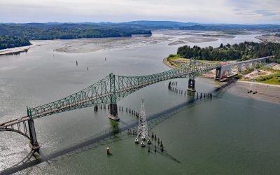
North Bend, Coos Bay
North Bend is one of several communities on Coos Bay, an estuary on the southern Oregon coast, about 22 miles (35 km) south of Reedsport and 3 miles (4.8 km) north of the city of Coos Bay, Oregon.
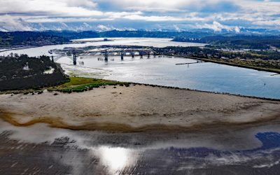
Newport, Yaquina Bay
Newport is a coastal community on Yaquina Bay on the central Oregon coast, about 39 miles (63 km) west of Corvallis and 23 miles (37 km) south of Lincoln City, Oregon.
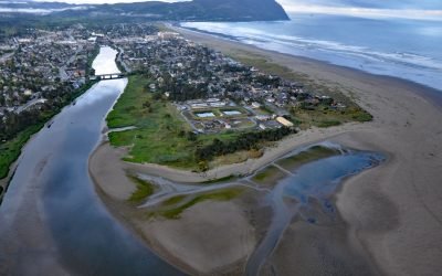
Necanicum River, Seaside
Necanicum River is approximately 21 miles (34 km) long draining a watershed of 84 square miles (21,756 ha), and forms the first estuary south of the Columbia River about 70 miles (113 km) northwest of Portland and 13 miles (21 km) southwest of Astoria at the coastal community of Seaside, Oregon.
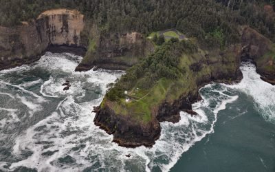
Cape Meares Lighthouse, Cape Meares
Cape Meares is the site of a historic lighthouse on a prominent headland that forms a high steep bluff on the south end of Tillamook Bay, about 48 miles (77 km) south of Astoria and 7 miles (11 km) west-northwest of Tillamook, Oregon.
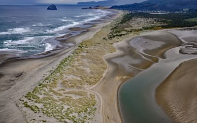
Nestucca Bay, Pacific City
Nestucca Bay is an estuary of about 1,000 acres (405 ha) formed by a sand spit located where the Nestucca River meets the Pacific Ocean, about 38 miles (61 km) west of McMinnville and at Pacific City, Oregon.
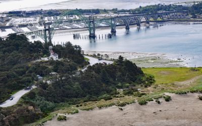
Yaquina Bay Light, Newport
Yaquina Bay Light is located on the north shore of the entrance to Yaquina Bay, about 40 miles (65 km) west of Corvallis and 1 mile (1.6 km) southwest of Newport, Oregon.
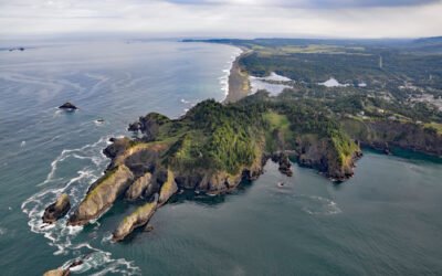
Nellies Cove, The Heads
Nellies Cove is situated on the south side of a rocky headland known as The Heads, between Agate Beach to the north and Port Orford to the south, and is the site of a historic lifeboat station in Port Orford Heads State Park, about 23 miles (37 km) north of Gold Beach and 1 mile (1.6 km) southwest of Port Orford, Oregon.

Lone Ranch Beach, Cape Ferrelo
Lone Ranch Beach is a sand and gravel deposit at Cape Ferrelo situated between Lone Ranch Creek to the north and Ram Creek to the south in Samuel H. Boardman State Scenic Corridor, about 22 miles (35 km) south of Gold Beach and 5 miles (8 km) northwest of Brookings, Oregon.

Netarts Spit, Cape Lookout State Park
Netarts Spit is in Cape Lookout State Park and extends north for 6 miles (10 km) from Cape Lookout, forming Netarts Bay, an estuary of 2,179 acres (883 ha) for several minor streams draining the western flank of an unnamed peninsula separating Tillamook Bay from the Pacific Ocean, about 53 miles (85 km) south of Astoria and 5.7 miles (9 km) west-southwest of Tillamook, Oregon.

Floras Creek, New River
Floras Creek starts from an elevation of roughly 2,786 feet (849 m) on the north flank of Edson Butte in the Oregon Coast Range and flows generally west for 13 miles (21 km), draining a watershed of 51,652 acres (20,903 ha) to the outlet of Floras Lake where the stream makes a sharp turn to the north and becomes the New River, about 12 miles (19 km) north of Port Orford and 3 miles (5 km) west-southwest of Langlois, Oregon.
About the background graphic
This ‘warming stripe’ graphic is a visual representation of the change in global temperature from 1850 (top) to 2019 (bottom). Each stripe represents the average global temperature for one year. The average temperature from 1971-2000 is set as the boundary between blue and red. The colour scale goes from -0.7°C to +0.7°C. The data are from the UK Met Office HadCRUT4.6 dataset.
Click here for more information about the #warmingstripes.