Rivers
Recent Articles
More Articles
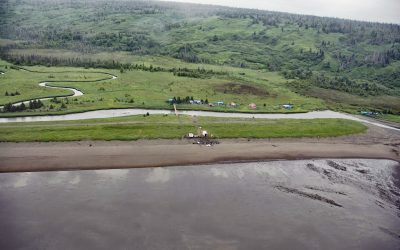
Polly Creek, Cook Inlet
Polly Creek and Little Polly Creek drain a combined watershed of 16,113 acres (6,521 ha), on the southern flank of an unnamed ridge that extends southeast from the summit of Mount Redoubt, and flow generally south for 9 miles (14.5 km) and 8 miles (12.8 km) respectively to the western shore of Cook Inlet, about 56 miles (90 km) northwest of Homer and 46 miles (74 km) southwest of Kenai, Alaska.
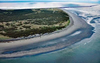
Clatsop Spit, Columbia River Bar
Clatsop Spit is part of Fort Stevens State Park that projects north from the south bank of the Columbia River and the submerged portion forms the Columbia River Bar, about 80 miles (129 km) northwest of Portland and 9 miles (15 km) west-northwest of Astoria, Oregon.
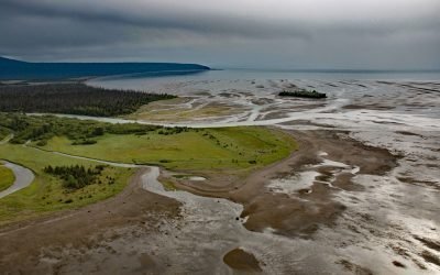
Amakdedori Creek, Kamishak Bay
Amakdedori Creek drains a watershed of 17,781 acres (7,196 ha) on the eastern flank of the Aleutian Range and flows southeast for 10 miles (16 km) to Kamishak Bay, about 26 miles (42 km) southwest of Augustine Island, and 95 miles (153 km) southwest of Homer, Alaska.
Crescent River, Lake Clark National Park and Preserve
Crescent River is formed by the junction of the North Fork and Lake Fork tributaries, that start in Lake Clark National Park and Preserve, and flows southeast for 12 miles (19 km) to the northern shore of Tuxedni Bay near the entrance on the western coast of Cook Inlet, about 55 miles (89 km) northwest of Homer and 51 miles (82 km) southwest of Kenai, Alaska.

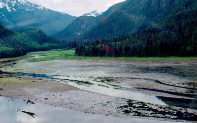
Bradley River, Kachemak Bay
Bradley River is located on the Kenai Peninsula and flows generally northwest for 7 miles (11 km) from Bradley Lake at an elevation of 1,090 feet (332 m) to Kachemak Bay, about 31 miles (50 km) southeast of Ninilchik and 25 miles (40 km) northeast of Homer, Alaska.

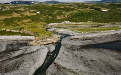
Red River, Lake Clark National Park and Preserve
Red River starts from the terminus of Red Glacier on the eastern flank of Mount Iliamna and flows southeast for 7 miles (11.3 km) through Lake Clark National Park and Preserve to the western shore of Cook Inlet, about 126 miles (203 km) southwest of Anchorage and 48 miles (77 km) northwest of Homer, Alaska.
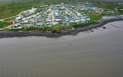
Toksook Bay, Nelson Island
Toksook Bay is a Yup’ik community on Nelson Island, in the Yukon-Kuskokwim Delta, about 112 miles (181 km) west-southwest of Bethel and 13.5 miles (22 km) west-northwest of Nightmute, Alaska.
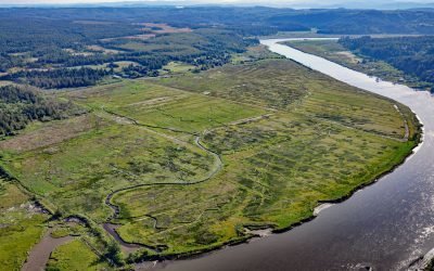
Coquille River Estuary, Bandon
The Coquille River, located in the Coast Range near Bandon, drains a watershed of 37,760 acres (15,281 ha), and flows to the Pacific Ocean approximately 20 miles (32 km) north of Cape Blanco, Oregon.

Pudding Creek, Fort Bragg
Pudding Creek is a small coastal watershed in Mendocino County that drains 18 square miles (4,662 ha) before entering the Pacific Ocean about 2.4 miles (3.9 km) southwest of Cleone and 1 mile (1.6 km) north of Fort Bragg, California.
Kiltuish River, Gardner Canal
Kiltuish River originates in the Kitimat Ranges and flows about 16 miles (25 km) north to the Pacific Ocean at Kiltuish Inlet, an arm of Gardner Canal, about 103 miles (166 km) southeast of Prince Rupert and 51 miles (82 km) south of Kitimat, British Columbia.
About the background graphic
This ‘warming stripe’ graphic is a visual representation of the change in global temperature from 1850 (top) to 2019 (bottom). Each stripe represents the average global temperature for one year. The average temperature from 1971-2000 is set as the boundary between blue and red. The colour scale goes from -0.7°C to +0.7°C. The data are from the UK Met Office HadCRUT4.6 dataset.
Click here for more information about the #warmingstripes.