Rivers
Recent Articles
More Articles
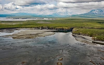
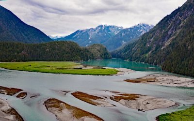
Paint River, Akjemguiga Cove
Paint River starts at the confluence of the Middle and South Forks and flows generally east for 17 miles (27 km), draining a watershed of 40,854 acres (16,533 ha), to Akjemguiga Cove in Kamishak Bay between McNeil Cove to the south and Amakdedulia Cove to the north, about 101 miles (163 km) southwest of Homer and 94 miles (152 km) northeast of King Salmon, Alaska.
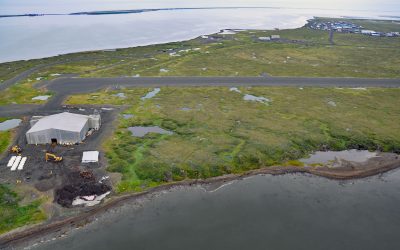
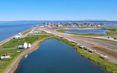
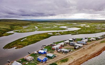
Point Lay Village, Kokolik River
Point Lay Village is a community at the mouth of the Kokolik River on Kasegaluk Lagoon, about 94 miles (152 km) southwest of Wainwright and 134 miles (216 km) northeast of Point Hope, Alaska.
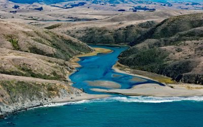
Estero Americano, Bodega Bay
Estero Americano is an estuary about 4 miles (6.5 km) long that connects to Bodega Bay and is fed by Americano Creek that starts at an elevation of roughly 250 feet (76 m) in the coastal hills of Sonoma and Marin Counties and flows west for 11 miles (18 km) draining a watershed of 24,277 acres (9,825 ha), about 19 miles (31 km) southwest of Santa Rosa and 3.7 miles (6 km) northwest of Dillion Beach, California.
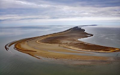
Solivik Island, Utukok Pass
Solivik Island is an Arctic barrier island that extends southwest for 16.5 miles (27 km) from Icy Cape Pass in the north to Utukok Pass in the south and forms the northern portion of Kasegaluk Lagoon, about 69 miles (111 km) southwest of Wainwright and 28 miles (45 km) north-northeast of Point Lay, Alaska.
Kitlope River, Gardner Canal
Kitlope River starts from the Kitimat Ranges and flows generally northwest to the head of Gardner Canal, about 125 miles (202 km) southeast of Prince Rupert and 75 miles (121 km) north of Bella Bella, British Columbia.
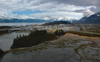
Valdez, Mineral Creek
Valdez is a community situated on the outwash fan of Mineral Creek on the north shore and near the head of Port Valdez in northeastern Prince William Sound, about 82 miles (132 km) east-northeast of Whittier and 46 miles (74 km) north-northwest of Cordova, Alaska.
Kotzebue, Baldwin Peninsula
Kotzebue is a community situated between Cape Blossom to the south and Pipe Spit to the east near the tip of the Baldwin Peninsula that separates Kotzebue Sound from Hotham Inlet, about 149 miles (240 km) southeast of Point Hope and 73 miles (117 km) west-northwest of Selawik, Alaska.
Campbell Creek, Turnagain Arm
Campbell Creek starts at the confluence of the North and South forks in Campbell Park on the western flank of the Chugach Mountains and flows generally southwest for 10 miles (16 km) through the city of Anchorage to Campbell Lake, and the lake outflow then enters Turnagain Arm about 8 miles (13 km) northwest of Potter and 6.5 miles (10.5 km) south-southwest of downtown Anchorage, Alaska.
Deering, Kotzebue Sound
Deering is a community situated on a barrier spit at the mouth of the Inmachuk River on Kotzebue Sound on the northern coast of the Seward Peninsula between Cape Deceit to the west and Ninemile Point to the east, about 155 miles (250 km) east-northeast of Point Hope and 57 miles (92 km) south of Kotzebue, Alaska.
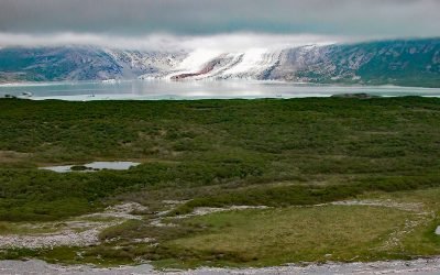
Fourpeaked Glacier, Shelikof Strait
Fourpeaked Glacier starts from the eastern flank of Fourpeaked Mountain with a summit elevation of 6771 feet (2,064 m) and flows generally east for 6 miles (10 km) to a proglacial lake about 2.5 miles (4 km) long that is drained by a river that flows another 0.8 miles (1.3 km) to Shelikof Strait in Katmai National Park and Preserve, about 90 miles (145 km) southwest of Homer and 77 miles (124 km) northwest of Kodiak, Alaska.
About the background graphic
This ‘warming stripe’ graphic is a visual representation of the change in global temperature from 1850 (top) to 2019 (bottom). Each stripe represents the average global temperature for one year. The average temperature from 1971-2000 is set as the boundary between blue and red. The colour scale goes from -0.7°C to +0.7°C. The data are from the UK Met Office HadCRUT4.6 dataset.
Click here for more information about the #warmingstripes.