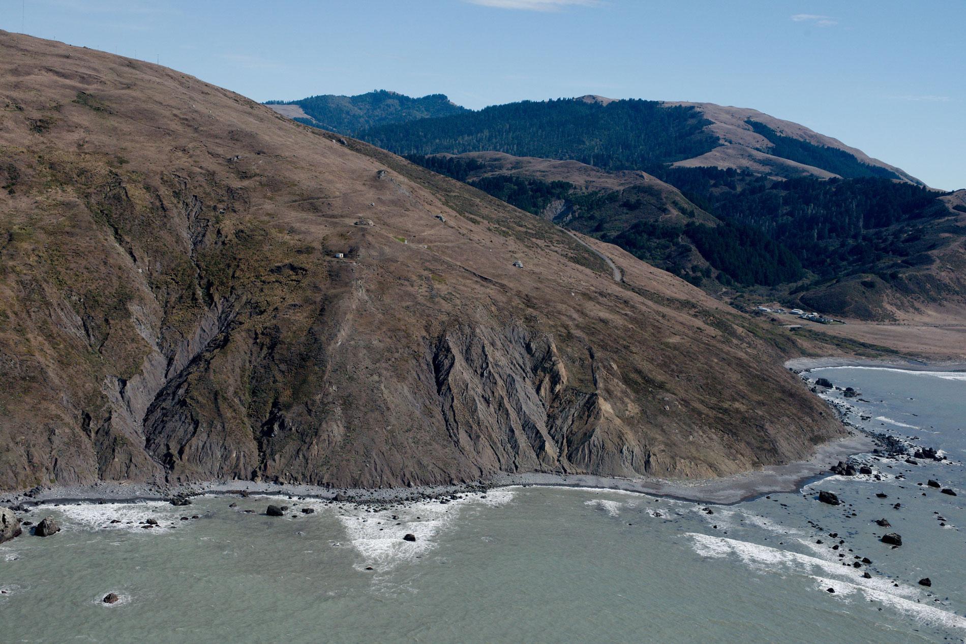
Cape Mendocino is a major headland on the Lost Coast and the westernmost point in California, situated between Bear River to the north and Mattole River to south, about 210 miles (338 km) northwest of San Francisco, and 28 miles (45 km) southwest of Eureka, California. Spanish maps from 1587 show a Cabo Mendocino in the general region and the name is reputedly to honor Don Antonio de Mendoza, the viceroy of New Spain in 1542, who sent two galleons from Acapulco to the Philippines, then returned following the prevailing westerly winds at 40 degrees north latitude and made landfall at the cape and then turned south to Acapulco. Subsequently, the cape became an important navigational marker for hundreds of ships. The headland is formed by rocks of the Franciscan Formation consisting of greywacke sandstones, shales, and conglomerates which have experienced low-grade metamorphism. Cape Mendocino is situated in one of the most seismically active regions in North America due to the proximity of the Mendocino Triple Junction, an area where three tectonic plates come together. The San Andreas Fault runs south from the junction, separating the Pacific Plate to the west from the North American Plate to the east. The Cascadia subduction zone lies to the north, where the Gorda Plate is being subducted under the North American plate. The Mendocino Fault runs west from the triple junction separating the Gorda Plate to the north from the Pacific Plate to the south.
The archaeological record suggests that humans have inhabited this area for over 6,000 years, and perhaps as long as 9,000 years in the Bear River valley. The Mattole people have been in the region since the 16th century when the first Spaniards arrived. They inhabited the Mattole River watershed to the south and the Bear River watershed to the north which meet at an elevation of 1,050 feet (320 m) at Rainbow Ridge in the Northern Coast Ranges. The Mattole built permanent houses made of redwood and inhabited at least 7 villages along the Bear River and at least an equal number along the Mattole River. Their traditional diet was diverse, but the main food source has always been salmon and Pacific lamprey, seasonally augmented by hunting for deer and marine mammals. They made nets to catch fish and wove baskets to store food. In 1851, Redick McKee joined a three-man commission created by the Federal Government in 1850 to draft treaties with California tribes in response to the repeating cycle of violence and reprisals then ongoing between Euro-American settlers and the tribes. In 1856, the Mendocino reservation was established with 25,000 acres (10,117 ha) but by 1859, settlers were illegally encroaching and the reservation was discontinued in 1866.
In 1860, the side-wheel steamship SS Northerner was northbound from San Francisco to the Columbia River but steered to close to the coast in dense fog and struck a submerged rock north of Cape Mendocino and sank. In response, the U.S. Lighthouse Board acquired 171 acres (69 ha) of remote rangeland on Cape Mendocino for a lighthouse reserve. In 1867, the side-wheel lighthouse tender Shubrick was bound for Cape Mendocino loaded with men and supplies for construction of the light station when it struck a rock 30 miles (48 km) south of the cape in a dense fog. The captain purposefully ran the ship aground and the ship was eventually salvaged but all the building materials were lost. A few months later, new supplies were landed at the base of the headland and hauled up the steep slope to an elevation of 422 feet (129 m). The headland slopes are so steep that level plateaus had to be blasted out of the hill for each building that included a lighthouse, carpenter shop, an oil house, a barn, and keeper residences. After World War II, the original first-order Fresnel lens was replaced by an automated rotating aerobeacon. In 1998, the historical lighthouse building was relocated to Shelter Cove at Point Delgada. The automated beacon was removed in 2013, the original structures were dismantled, and all that remains are the oil house, building platforms, and an access road. Read more here and here. Explore more of Cape Mendocino and the Lost Coast of California here:

