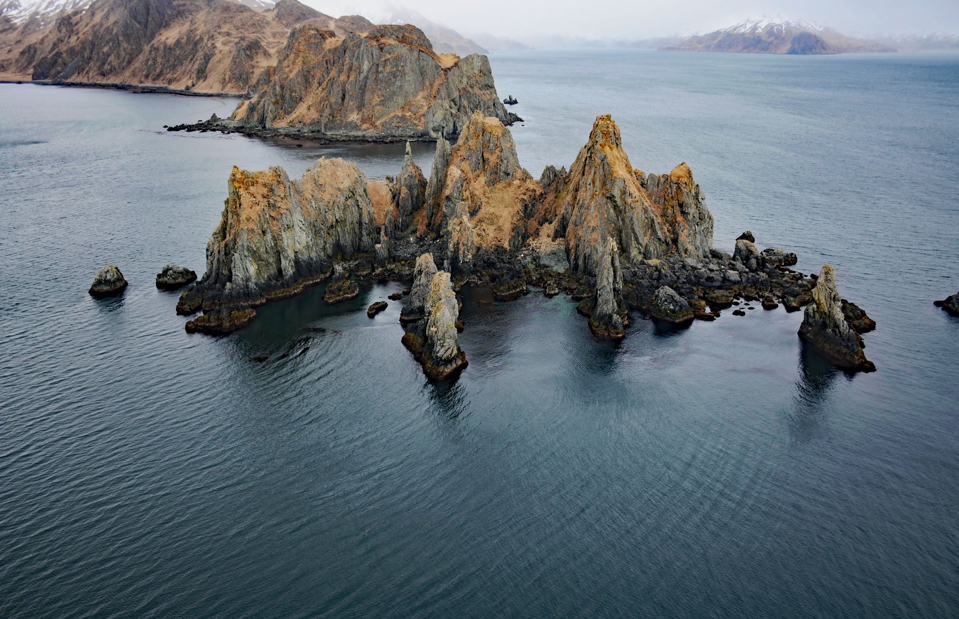
Cathedral Rocks is an island 0.3 miles (0.5 km) west of Cathedral Point on the northern shore of Makushin Bay, on the west coast of Unalaska Island in the Eastern Aleutians, about 98 miles (158 km) northwest of Nikolski and 18 miles (29 km) southwest of Dutch Harbor, Alaska. The island was named by the U.S. Navy Aleutian Island Survey Expedition of 1934 for the church-like appearance of the erosion sculpted volcanic rocks. Makushin Bay was named by Captain Pyotr Kuzmich Krenitsyn and Lieutenant Mikhail Levashov of the Imperial Russian Navy and was transliterated in 1792 as “Makyshinskaia Bay” by Reverend Coxe. In 1892, Lieutenant Gavril Sarychev published the name as Guba Makushinskaya, meaning Makushin Bay. The name may have been taken from the Russian word Makushka, meaning the crown or top, possibly referring to Makushin Volcano.
Makushin Volcano is an ice-covered stratovolcano with an elevation of 6,680 feet (2,036 m) that dominates the northwestern part of Unalaska Island. The Aleut name for the volcano is Aigagin, a derivative of the word Aigak according to Richard Henry Geoghegan. Makushin is also the Russian name for the former Aleut village of Ignichiinax. This village was evacuated during World War II to prevent their capture by the Imperial Japanese Army. The villagers were transported to Southeast Alaska and interned in a camp at Ward Lake near Ketchikan. Makushin Volcano has erupted at least two dozen times over the past several thousand years, with the last eruption occurring in 1995. The volcano is a potential geothermal energy resource for the communities of Unalaska and Dutch Harbor and several development projects have been proposed.
On December 8, 2004, the Malaysian-flagged freighter Selendang Ayu, carrying 66,000 tons of soybeans and more than 500,000 gallons of fuel went aground and split in two off Makushin Bay after its engine failed. Six crew members died when a U.S. Coast Guard rescue helicopter was engulfed by a breaking wave. Ultimately, 350,000 gallons (1,300,000 L) of bunker and diesel oil spilled, much of it washing ashore on 86 miles (139 km) of beaches in Makushin Bay and Skan Bay. This resulted in the death of thousands of birds, an unknown number of marine mammals, and the contamination of commercial fish grounds. Read more here and here. Explore more of Cathedral Rocks and Makushin Bay here:

