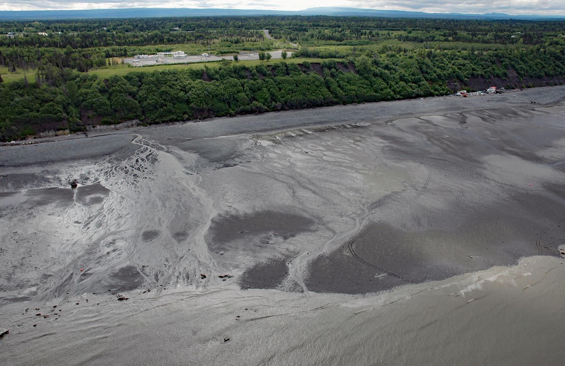
Corea Creek drains a fen at an elevation of 200 feet (60 m) on the Kenai Peninsula and flows generally southwest for 2.4 miles (4 km) to the eastern shore of Cook Inlet and the site of a historic shipwreck, about 37 miles (60 km) north of Homer and 5 miles (8 km) south-southwest of Clam Gulch, Alaska. Corea Creek is named after the three-masted bark Corea that wrecked on the beach at the stream mouth in 1890. The beach is backed by a steep eroding bluff topped by relatively flat marsh lands and fens. A fen is a wetland fed by mineral-rich ground or surface water and is one of the main types of wetlands along with marshes, swamps, and bogs. Underlying the several feet of peat are unconsolidated sediments that were deposited in an ancient glacial lake associated with the last glacial maximum and consist of clay, silt, and fine sand. The glacial lake sediments cover bedrock representing the Sterling Formation that developed during the Miocene and Pliocene. These rocks are exposed at the mouth of the creek where stream erosion has incised the bedrock to sea level. The Sterling Formation is up to 9,800 feet (3,000 m) thick and consists of weakly lithified sandstone, siltstone, mudstone, carbonaceous shale, volcanic ash, and layers of lignite coal typically less than 3 feet (1 m) thick.
Corea was a wooden bark-rigged sailing ship 133 feet (41 m) long, with a beam of 38 feet (12 m), and draft of 18 feet (5.5 m) built in Boston in 1868. In 1885, the ship was owned by the Arctic Fishing Company and began making supply and passenger runs from San Francisco to Kasilof in Cook Inlet. On March 27, 1890, Corea departed San Francisco for Cook Inlet under the command of Captain Robert H. Wheeler and loaded with cannery supplies, 97 passengers, and 19 crew. The passengers were mostly Chinese cannery laborers. On April 23, Corea ran aground on a sandbar that extends about 6 miles (10 km) south from the southern tip of Kalgin Island in Cook Inlet. The ship was refloated on the next high tide but was leaking badly and filling with sea water despite all hands manning the pumps, so the captain sailed the ship 24 miles (38 km) to the eastern shore of Cook Inlet and purposely beached the vessel. The shipwrecked passengers and crew established a camp on the beach and were eventually rescued by the steamer Francis Cutting. The ship reputedly carried sheets of metal about 14 inches (36 cm) wide and approximately 20 inches (50 cm) long, called ‘flat cans’, that were to be rolled and welded into salmon cans at the cannery. The locals reputedly salvaged many of them for use as cabin roofing shingles. On May 20, the steamer Karluk brought news of the shipwreck to San Francisco.
The eastern shore of Cook Inlet is a significant natural gas producer for southcentral Alaska and one gas production well is situated on the bluff above the mouth of Corea Creek. The Ninilchik gas field was discovered in 2001 and commercial gas production began in 2003. The primary reservoir is the non-marine Tyonek Formation that developed during the Oligocene-Miocene. Fluvial deposits of interbedded sandstone, siltstone, and coal comprise a gas-prone section up to 3,500 feet (1,067 m) thick. Although Cook Inlet is no longer a major oil producer, and the forecasted demand for natural gas is likely to exceed production by 2027, the U.S. Geological Survey estimates there are about 19 trillion cubic feet of recoverable natural gas. Complications that make Cook Inlet a challenging environment for oil and gas production include seasonal ice, heavy sediment loads, potential conflicts with fishing activities, and the endangered Cook Inlet beluga whale. Many of these issues can be avoided by directional shore-based drilling and production facilities but the long-term future for Cook Inlet is with the relatively underutilized renewable resources such as geothermal, tidal, and wind energy. Read more here and here. Explore more of Corea Creek and Clam Gulch here:

