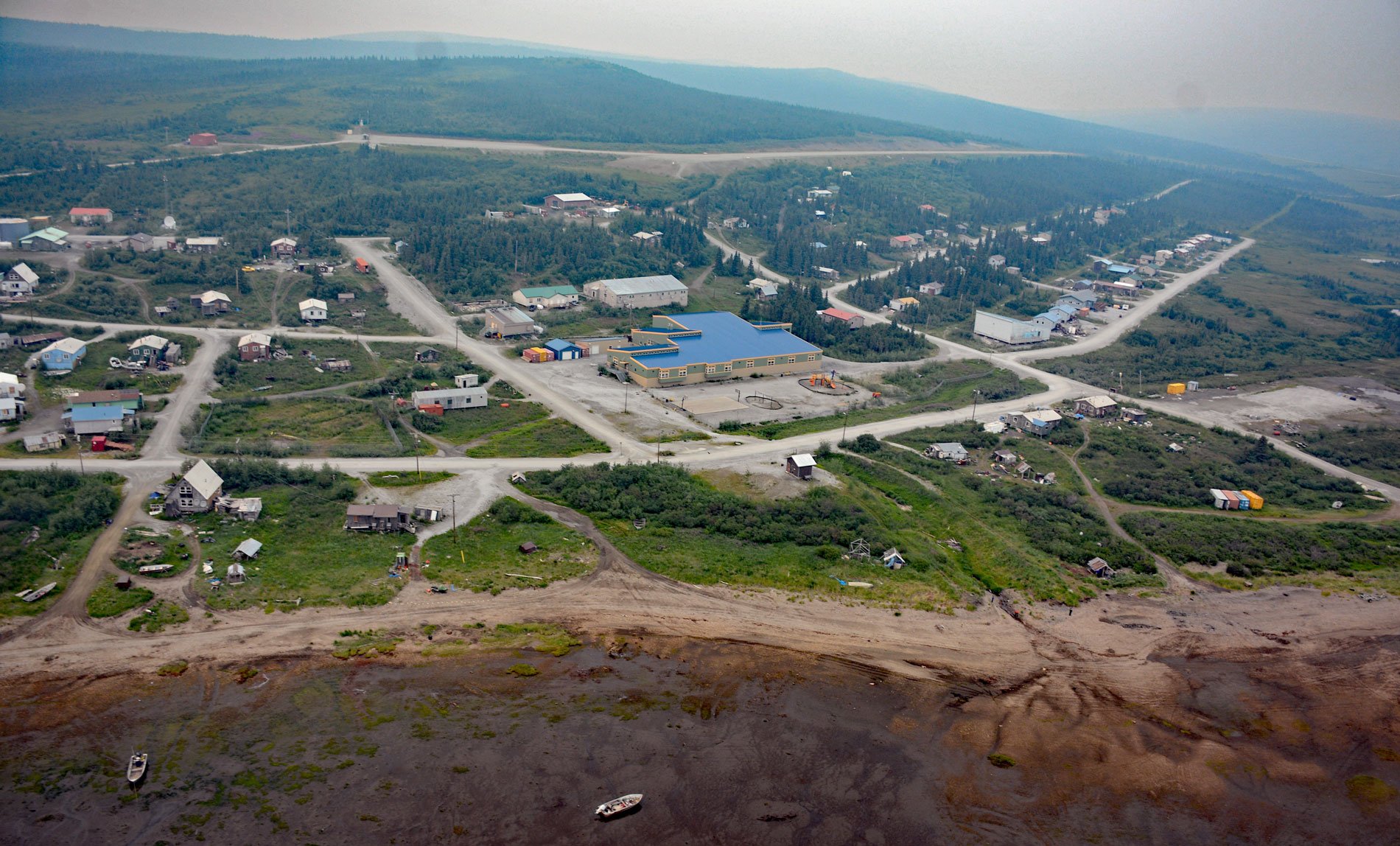
Koyuk is a mixed Yup’ik and Iñupiat community situated at the head of Norton Bay on the right bank of the Koyuk River estuary on the Seward Peninsula, about 129 miles (208 km) east-northeast of Nome and 40 miles (64 km) north of Shaktoolik, Alaska. The village was first reported in 1844 by Lieutenant Lavrenty A. Zagoskin of the Imperial Russian Navy, who recorded the name as ‘Kuynkhakmiut’, meaning ‘Kuynkhak people’. In 1865, Baron Otto von Bendeleben with the Western Union Telegraph Expedition wrote the name ‘Konyukmute’. The Koyuk River starts from an elevation of roughly 1526 feet (465 m) at a watershed divide between the Lost Jim Lava Flow to the north and the Bendeleben Mountains to the south and flows generally southeast for 115 miles (185 km) to Norton Bay. The river name was first reported in 1852 by Captain Mikhail D. Tebenkov as ‘Kuyguk’. The Western Union Telegraph Expedition spelled the name ‘Koikpak’, which means ‘big river’. The present spelling comes from Alfred H. Brooks with the U.S. Geological Survey in 1900. Norton Bay was named for Norton Sound, which in turn was named in 1778 by Captain James Cook in honor of Sir Fletcher Norton who was the Speaker of the House of Commons of Great Britain at that time.
During the Last Glacial Maximum of the late Pleistocene, approximately 10 to 25 thousand years ago, the sea level was roughly 300 feet (91 m) lower than today. At that time, the Seward Peninsula was connected to the Asian continent via the Bering Land Bridge, or Beringia, which formed a flat, grassy, treeless plain. Archaeological evidence suggests that a small human population of at most a few thousand people arrived in Beringia from eastern Siberia before expanding into the settlement of the Americas sometime after 16,500 years ago but before the bridge was covered by the sea about 11,000 years ago. Archaeologists have identified evidence of humans in the Bering Land Bridge National Preserve from 12,000 years ago. The prehistorical Iyatayet site on Cape Denbigh, about 33 miles (53 km) south of Koyuk, has evidence of human habitation from 6,000 to 8,000 years ago. The Malemiut, Kauweramiut, and Unalikmiut peoples settled on the Seward Peninsula approximately 4,000 years ago and were historically semi-nomadic, following a seasonal migration pattern dictated by the availability of food resources. Many present-day residents of the Seward Peninsula, including those of Koyuk, consider the Malemiut, Kauweramiut, and Unalikmiut peoples their ancestors and speak a dialect of the Inupiaq language and maintain a traditional subsistence lifestyle.
In the mid-1800s, northbound whalers would stop at the villages on the Seward Peninsula and hire local men to hunt for them, introduce liquor and repeating rifles, and trade for walrus ivory. As the whaling industry grew, hunting of local wildlife increased to supply the whalers with meat, fur, baleen, and ivory. The marine and terrestrial mammal populations declined rapidly due to increased hunting pressure, and muskoxen and caribou were virtually eliminated on the Peninsula. In 1865, William H. Ennis of the Western Union Telegraph Expedition reported that the village at the mouth of the Koyuk River had been abandoned for 13 years and was deserted on account of the smallpox epidemic that wiped out the entire population. In 1879, a trading post was established at the river mouth by the Alaska Commercial Company. In 1891, reindeer were imported from Chukotna Russia as a means for Alaska Natives to produce a predictable meat supply and to provide economic development. By 1896, approximately 1,200 reindeer had been introduced to the Seward Peninsula, and in about 30 years this population increased to 242,000. Around 1900, the trading post at the mouth of the Koyuk River was called Norton Bay Station and supplies were lightered to shore from ocean-going ships anchored in Norton Bay. In 1915, river steamers transported supplies and miners 40 miles (64 km) upriver to Dime Landing in support of the gold and platinum prospects on Dime Creek at Haycock. The everyday lives and traditions of people in Koyuk are now being threatened by the impacts of climate change. Higher average air temperatures are associated with later freeze-up of sea and shore ice, and the ice that does form is generally thinner than in decades past. During the region’s stormy autumn months, solid ice is not in place and waves build higher and strike the land with more force, eroding beaches or overtopping beach dunes, occasionally leading to flooding. Read more here and here. Explore more of Koyuk and Norton Bay here:

