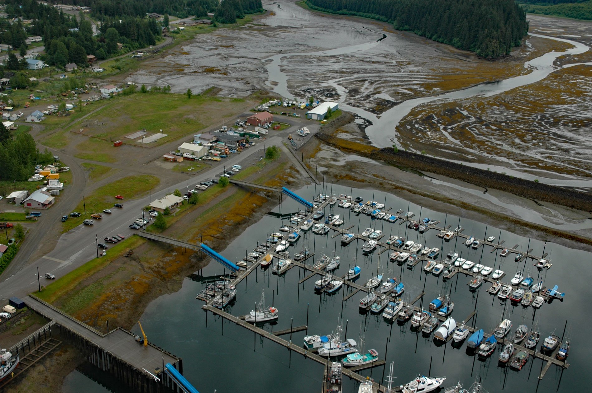
Hoonah is a community situated on the eastern shore of Port Frederick on the northeastern coast of Chichagof Island in the Alexander Archipelago of Southeast Alaska, about 40 miles (64 km) west-southwest of Juneau and 24 miles (39 km) south-southeast of Gustavus, Alaska. The name ‘Hoonah’ is derived from the name of the Tlingit tribe ‘Huna Káawu‘ in the locally distinct dialect, or more generally ‘Xunaa Kwáan‘, meaning people from the direction of the north wind. The Tlingit name for the village is Gaaw T’ak Aan. Port Frederick is a deglaciated fjord that extends 20 miles (32 km) south-southwest from Icy Strait to the north and is separated from Tenakee Inlet to the south by a tidal creek 0.8 miles (1.3 km) long and a 0.1 mile (0.15 km) portage trail. The fjord was named in 1794, by Captain George Vancouver for Adolphus Frederick, the son of King George III of England. The Tlingit name for the fjord is ‘Komtok Hon’. Chichagof Island is named after Admiral Vasili Chichagov, a Russian Arctic explorer in the 18th century, who never visited Alaska. The northeastern part of the island is formed by rocks representing the Alexander terrane that consists of Precambrian to Middle Jurassic sedimentary, volcanic, and plutonic rocks interpreted to represent intermittent volcanic arc activity on a fragment of tectonic crust that drifted across the proto-Pacific Ocean and eventually attached to the North American Plate.
According to Tlingit oral tradition, the ancestral home of the Xunaa Kwáan people was in Glacier Bay but was destroyed by advancing glaciers. The archaeological record suggests that humans inhabited the north shore of Icy Strait roughly 10,000 years ago. Historical accounts by European explorers documented that Xunaa Kwáan territory included the northern portion of Chichigof Island, the mainland shore of Cross Sound and Icy Strait, and extended as far north as Lituya Bay in the Gulf of Alaska and south to Lisianski Strait that separates Yakobi Island from Baranof Island. Hoonah has been the primary permanent settlement of the Xunaa Kwáan people since the earliest recorded history. In the early 1900s, several other villages were also documented, including a settlement in Excursion Inlet, one just east of the mouth of Excursion Inlet at Homeshore, one at the mouth of the Alsek River, and one north of Dry Bay. Between 1880 and 1890, disease epidemics dramatically reduced the indigenous population in Southeast Alaska. The total combined population of the Hoonah villages fell from 900 in 1880 to 425 in 1890. This depopulation, along with missionary and government services, led to the consolidation of outlying Xunaa Kwáan villages and mass relocation to Hoonah. In 1880, the Northwest Trading Company opened the first store in Hoonah, the Presbyterian Home Mission and School were built in 1881, and a post office was established in 1901. In 1912, the Hoonah Packing Company built a large salmon cannery 1.5 miles (2.4 km) north of Hoonah and operated the facility until 1923. Icy Strait Packing Company took ownership of the facility in 1934. In 1944, a fire destroyed much of the community, and the federal government assisted in rebuilding the village.
The Xunaa Kwáan Tlingit historically had subsistence fish camps in the Hoonah area, including Glacier Bay and much of Icy Strait. Salmon were perhaps the most important resource for the Tlingit but steelhead, herring, herring eggs, eulachon, and Dolly Varden were also caught. The Tlingit also utilized marine mammals such as seals, deepwater fish such as halibut, marine invertebrates such as chitons, and plants such as seaweed, beach asparagus, and goose tongue. A system of property ownership was in place over subsistence sites, including streams, halibut banks, berry patches, hunting areas, and intertidal areas. There are variations among Tlingit on the theme of clan ownership of fishing sites. In the islands of the Alexander Archipelago, where most streams are short and fishing was concentrated primarily at the mouth, the stream and estuary were owned by a clan or house. On the mainland, where larger rivers such as the Alsek, Chilkat, Taku, Stikine, and Unuk are found, fishing sites or locations, not the entire river, are owned. In most cases, several families within a related clan would customarily join efforts at a specific location to harvest and process salmon returning to their camp annually. Hoonah residents harvest all five species of Pacific salmon for subsistence food. Traditionally, fish traps, gaffs, and spears were used to catch salmon. Today, more often beach seines and purse seines are used to catch sockeye, chum, and pink salmon, and troll gear or rod and reel are used to catch Chinook and coho. Read more here and here. Explore more of Hoonah and Port Frederick here:

