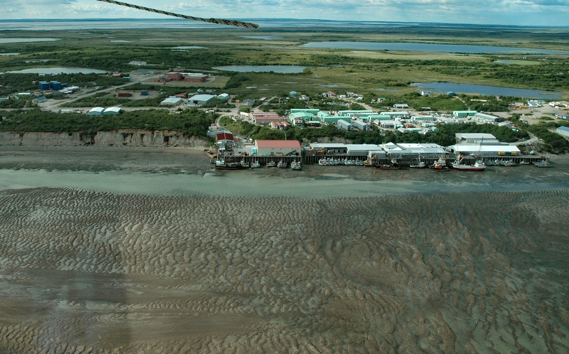
Naknek is a community situated on a bluff overlooking the northern bank of the mouth of the Naknek River, at Kvichak Bay which forms the northeastern arm of Bristol Bay, about 56 miles (90 km) southeast of Dillingham and 13 miles (21 km) west-northwest of King Salmon, Alaska. Naknek River starts from the outlet of Naknek Lake and flows generally west-northwest for 35 miles (56 km) to Kvichak Bay, draining a watershed of 2,398,984 acres (970,834 ha) on the western slope of the Aleutian Range on the Alaska Peninsula. The river and lake are both known for an abundant population of Pacific salmon, especially sockeye salmon. The lower elevations of the watershed are formed by unconsolidated colluvial, glacial, marine, lacustrine, and aeolian deposits of gravel, sand, and silt. The area includes extensive redeposited pumice and ash initially deposited during the 1912 Novarupta eruption that occurred about 6.59 miles (10.61 km) from the peak of Mount Katmai volcano. Katmai volcano is built on the sedimentary rocks of the Naknek Formation of Late Jurassic age, which are exposed just west of the caldera rim at an elevation of about 5,000 feet (1,520 m), as well as north and southeast of the crater. The Naknek Formation is the most extensive rock unit on the Alaska Peninsula and was deposited in shallow marine and non-marine water as the Alaska-Aleutian Ranges batholith was uplifted to the northwest. Much of the volcano is mantled by snow and ice and several valley glaciers radiate out from the flanks.
There is evidence of seasonal camps along the Kvichak River by people of the Paleo-Arctic tradition dating from 8,000 years ago. These people likely arrived following herds of caribou. By 6,000 years ago, ancestors of the Kodiak and Aleutian traditions made seasonal use of the Naknek area, probably utilizing both caribou and marine mammals. By 1900 BC, ancestors of historic Yup’ik populations settled in the area. Evidence of permanent settlements and salmon fishing in the Naknek area starts around 400 BC. By the 1800s, the Russian-American Company had established trading posts in the area and historical records indicate there were two ethnic Yup’ik groups on the Naknek River, the Aglumiut in the lower Naknek drainage and the original Peninsula Yup’ik in the upper watershed. The Aglumiut originally inhabited coastal areas between Norton Sound and the mouth of the Kuskokwim River but sometime around 1800 AD they migrated to the Alaska Peninsula when conflicts with the Kuskowagmiut and the Kiatagamiut of the Nushagak River forced at least some Aglumiut to migrate initially to Nunivak Island and subsequently southeast along the adjacent mainland coast as far as the Egigik River on the Alaska Peninsula. The Peninsula Yup’ik inhabited the upper Naknek drainage and were likely affected by the arrival of the Aglumiut and colonization of the lower river. However, little is known about the original Yup’i inhabitants, possibly indicating that the Aglumiut were more important to Russian economic interests. In 1821, the village of ‘Naugeik’ was noted by Mikhail N. Vasilyev on the north bank of the river near Kvichak Bay. The village was later spelled Naknek on charts by the Russian Imperial Navy.
The Alaska Purchase in 1867 transferred the territory from Russia to the United States, and shortly thereafter, the commercial fishing industry began in the region, and the community of Naknek rapidly developed as a shipping and supply center. The first salmon cannery opened on the Naknek River in 1890. The Homestead Act enabled canneries to acquire land for their plants and also made land available to other institutions and individuals including the Russian Orthodox Church. Native people arrived from surrounding villages to build shelters on the church property and were eventually sold lots in what became the center of Naknek. The original Yup’ik inhabitants of the area were joined by new residents who arrived to assist in the construction of canneries. The lack of fishermen and cannery labor led to importing crews from outside Alaska, substantially increasing the non-Native presence in the community, especially during the summer salmon season. Today, Naknek is a commercial fishing industry hub of Bristol Bay and a large cargo hub for Southwest Alaska. The coastline is macro tidal, making it primarily influenced by tides ranging more than 20 feet (6 m). The community of Naknek is perched on coastal bluffs that experience undercutting from waves and high-water events as well as slumping and failure from runoff. The wake from large fishing and cargo vessels is a direct cause of erosion along the river banks and adjacent bluffs. Read more here and here. Explore more of Naknek and Kvichak Bay here:

