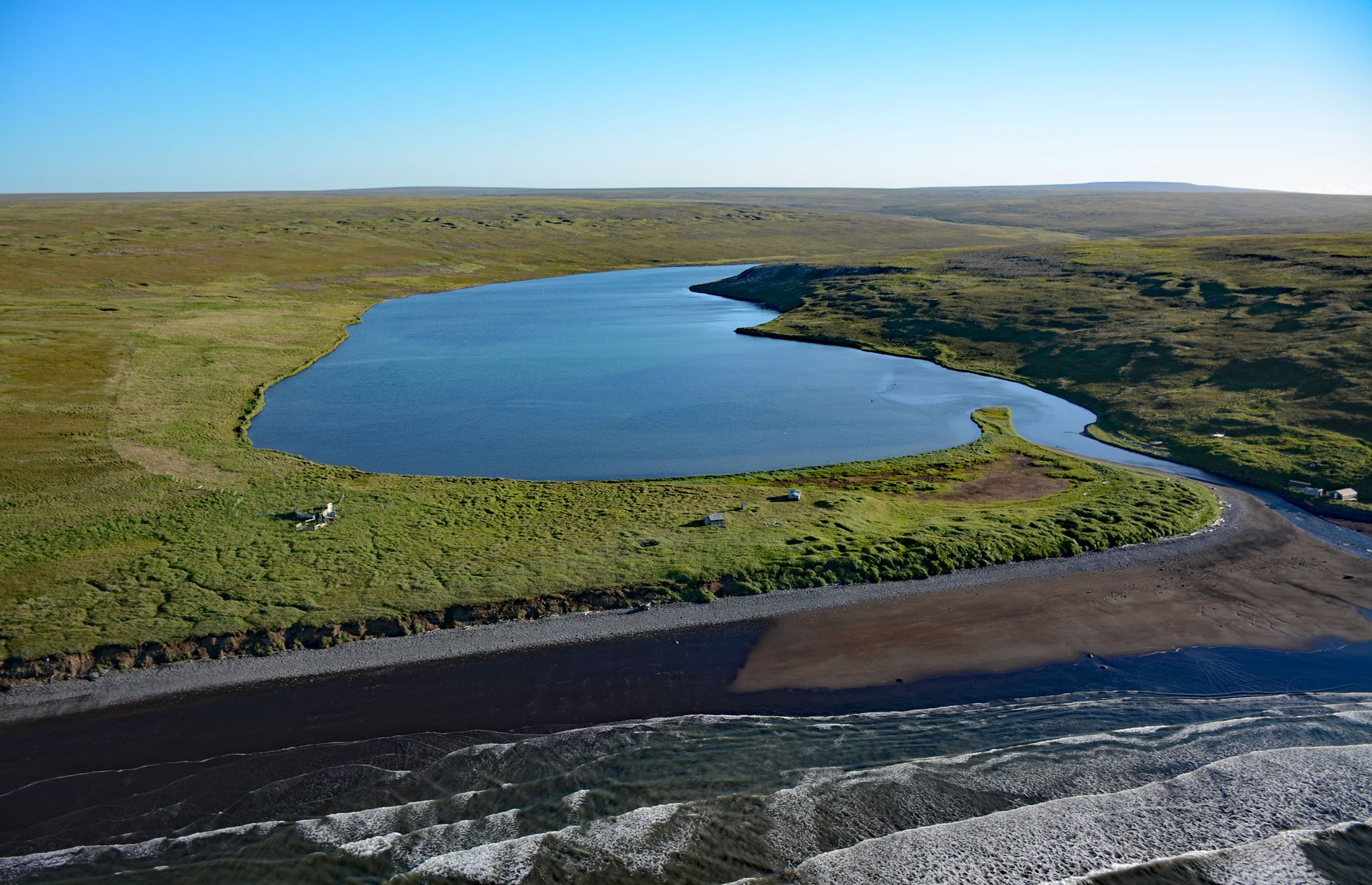
Nash Harbor is a historic settlement situated at the outlet of a lagoon on the south shore of an embayment also named Nash Harbor bounded by Cape Algonquin to the west and Chingeeruk Point to the east, on the north coast of Nunivak Island, about 96 miles (155 km) south-southwest of Hooper Bay and 30 miles (48 km) southwest of Mekoryuk, Alaska. The lagoon is an estuary of a creek that starts from Lukthlukrit Marsh at an elevation of roughly 500 feet (152 m) and flows generally north for 7 miles (11 km). Nunivak Island is a treeless, permafrost-covered volcanic field located about 30 miles (48 km) offshore from the Yukon-Kuskokwim Delta. The western end of Nunivak Island is composed of tholeiite basalt that developed during the Pliocene and consists of massive, columnar-jointed flows. The rest of the island is mostly basalt flows that developed during the Pleistocene and consist of columnar jointed tholeiite and alkali-olivine basalt flows. Nash Harbor has been seasonally inhabited over the past 150 years primarily in the autumn for seal hunting. The name is possibly derived from the Nunivak Cupʼig word ‘nashak’ referring to the hood of a coat or parka. Nash Harbor village is comprised of two parcels of land separated by the lagoon with Ellikarrmiut located to the east, and Qimugglugpagmiut located to the west. Ellikamniut represents the older of the two parcels and was abandoned by 1900 because of disease epidemics. Qimugglugpagmiut was occupied from the early 20th century until its abandonment in 1959.
The area encompassing Bristol Bay, Nunivak Island, and the Yukon-Kuskokwim Delta forms the core of the Modern Central Yup’ik and Cup’ik cultures which are likely descended from the Western Thule Tradition which originated in northern Alaska and spread south along the Bering Sea coast to the Alaska Peninsula about 1,000 years ago. The incoming Western Thule Tradition replaced or subsumed the earlier Norton Culre, which represents the earliest long-term occupation of the Bering Sea coast north of the Alaska Peninsula beginning around 2500 years ago. Nunivak Island is the home of the Nuniwarmiut, a Central Yup’ik people with a distinct culture and who speak a subdialect of Yup’ik known locally as Cup’ig. The Nuniwarmiut were participants in the Bow and Arrow Wars, a regional internecine conflict that affected much of southwestern Alaska from the early 17th century until the early 19th century. In 1821, Nunivak Island was discovered by Russian explorers, but the first extended contact with Euro-American culture did not occur until 1920 when reindeer were introduced to the island by the Lomen Reindeer Company along with a privately operated trading post. The Bureau of Indian Affairs built the island’s first school at Nash Harbor in 1923, the island became a National Wildlife Reservation in 1929, muskox were introduced in 1935, and the first missionary arrived in 1937 from the Swedish Evangelical Covenant Church.
The school at Nash Harbor was permanently closed by 1957 when enrollment was deemed insufficient to maintain two island schools. Most families were forced to enroll their children in the Mekoryuk school and, except for one family, Nash Harbor was abandoned. At the time of its abandonment, only three western-style wooden-frame houses were occupied at Nash Harbor while seven traditional semi-subterranean houses were in use. Once these families moved to Mekoryuk, this quickly changed with only few sod houses still in use by the mid-1960s. The abandonment of villages and consolidation of the island population at Mekoryuk was similar to the state-wide pattern. Nash Harbor continues to be used seasonally by several families for hunting and gathering subsistence foods such as cliff and tundra greens, berries, fish, and waterfowl. Subsistence herring and halibut fisheries and the seasonal harvest of reindeer and a few muskox add to their diet. Contact with mainland people is now quite common. An airstrip was built at Mekoryuk in 1957 and the island is linked to the mainland by daily air service with many Nuniwanniut now residing in Bethel and Anchorage. Read more here and here. Explore more of Nash Harbor and Nunivak Island here:

