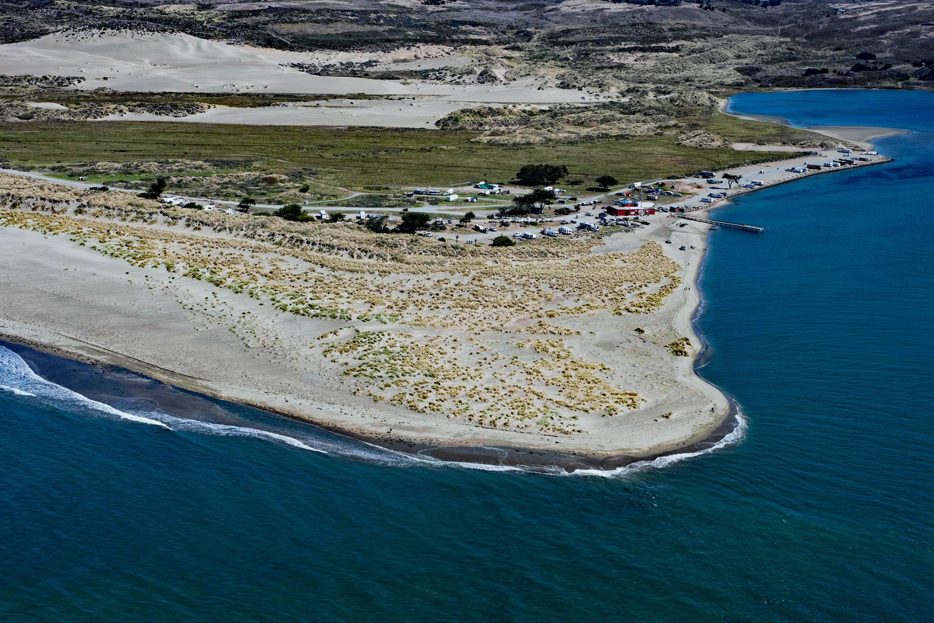
Lawson’s Landing is a recreational area and campground on 75 acres (30 ha) in the Tomales Dunes Complex on Tomales Bay at Sand Point, about 20 miles (32 km) southwest of Santa Rosa and 1 mile (1.6 km) south of Dillion Beach, California. The landing is named after the Lawson family who have been in the area since the early 1900s and have owned 960 acres (388 ha) at Sand Point since 1942. The Tomales Dunes occupy most of the property and are a complex of several distinct habitats including a high dune known as Little Sugarloaf with an elevation of 230 feet (70 m), mobile dunes, vegetated dune, and dune wetlands. The mobile dunes are constantly shifting and slowly moving inland. The prevailing westerly winds carve depressions in the unvegetated sand where fresh water accumulates fed by groundwater, rain, or intermittent surface streams. These depressions develop into rich and unique seasonal wetlands, ranging from freshwater ponds to marshes, and wet meadows collectively known as dune slacks. The same subterranean waters that feed the slacks have also created a dune canyon which is recut and reshaped in wet winters by a rain-fed underground spring, the only such dune canyon in central California.
The Coast Miwok people had a presence at Sand Point long before Europeans arrived in the Americas. It is thought that their villages were located within the greater Dillon Beach area and at Sand Point. In 1817, Mission San Rafael Arcángel was founded by Father Vicente Francisco de Sarría. In 1833, the mission lands were turned over to the Mexican government after the Mexican War of Independence and secularized. In 1837, Jean J. Vioget, a Swiss sailor and surveyor, came to California and made the first survey and map of Yerba Buena which later was named San Francisco. In 1842, he applied to Governor Juan B. Alvarado for a tract of land in northern Marin and was given a Mexican Land Grant of 26,759 acres (10,829 ha) called Rancho Blucher. The grant extended along the coast from Estero Americano in the north to Estero de San Antonio in the south. In 1847, Vioget sold Rancho Blucher to Captain Stephen Smith, grantee of Rancho Bodega directly to the north. In 1855, Smith died and the property was eventually sold off in smaller parcels. In 1911, the property was bought by the California Eucalyptus Plantation Company and later was leased by Sylvester and Carrie Lawson who established a cattle ranch.
Lawson’s Landing was established in 1928 by Sylvestor Lawson’s son Walter, and his wife, Nita as a fishing and boating destination. By 1942, the entire beachfront property was owned by the Lawson’s. The family-owned campground at Sand Point has been operating since 1957 and the landing is still operated by Walter’s descendants to this day as a campground with a store and boating access to Tomales Bay. The campground has a long history of unpermitted development that began in the early 1960s and expanded over the years to accommodate up to 1,000 camping vehicles. In 2008, a development plan for Lawson’s Landing was approved by the County of Marin after more than a decade of debate over environmental issues centering on the need to set camping limits and provide long-term protections for the dunes and wetlands. In 2011, the California Coastal Commission approved a coastal development plan to allow cattle grazing but also includes a conservation easement of 465 acres, an oceanfront campground of 75 acres, and the removal of 167
residential trailers. The plan was the result of many years of negotiation to resolve complicated and controversial enforcement, permitting, and related habitat and recreation issues at Lawson’s Landing. Read more here and here. Explore more of Lawson’s Landing and Sand Point here:

