Beaches
Recent Articles
More Articles
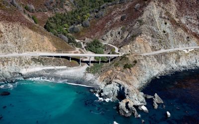
Limekiln State Park, Rockland Landing
Limekiln State Park is 716 acres (290 ha) on the Big Sur coast at Rockland Landing, about 31 miles (50 km) northwest of San Simeon and 2 miles (3.2 km) south of Lucia, California.
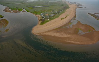
Moses Point, Kwiniuk River
Moses Point is a fish camp, used mostly by residents of Elim, situated at the mouth of the Kwiniuk River on the northern shore of Norton Bay, about 100 miles (160 km) east of Nome and 31 miles (50 km) southwest of Koyuk, Alaska.
Umkumiut, Nelson Island
Umkumiut is a seasonally occupied Yup’ik fish camp in Kangirlvar Bay, also known as Toksook Bay, located on the western shore of Nelson Island in the Bering Sea, between Atrnak Point to the north and Chinigyak Cape to the south, about 118 miles (190 km) west-southwest of Bethel and 3.8 miles (6 km) southwest of Toksook Bay, Alaska.
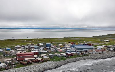
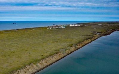
Shishmaref, Sarichef Island
Shishmaref is an Iñupiat community situated on Sarichef Island, a barrier island between Shishmaref Inlet to the south and the Chukchi Sea to the north, on the northern coast of the Seward Peninsula in the Bering Land Bridge National Preserve, about 105 miles (169 km) southwest of Kotzebue and 73 miles (117 km) northeast of Wales, Alaska.
Wainwright, Kuk River
Wainwright is an Iñupiat community on the Chukchi Sea coastline situated on a barrier beach adjacent to Wainwright Inlet and the Kuk River, about 94 miles (151 km) northeast of Point Lay and 86 miles (138 km) southwest of Utqiaġvik, Alaska.
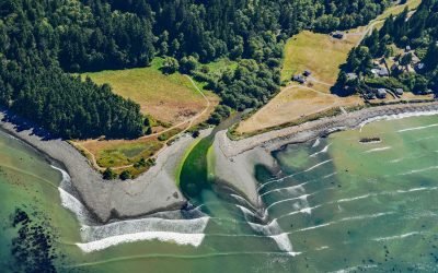
Lyre River, Low Point
Lyre River starts at the outlet of Lake Crescent in Olympic National Park and flows roughly northwest for 5 miles (8 km) to Low Point on the Strait of Juan de Fuca draining a watershed of 43,200 acres (17,482 ha), about 21 miles (34 km) southeast of Clallam Bay and 19 miles (31 km) west of Port Angeles, Washington.

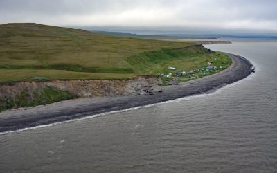
Nikolski, Umnak Island
Nikolski is a community located near the southwest end of Umnak Island, one of the Fox Islands in the eastern Aleutian Islands, about 910 miles (1,468 km) southwest of Anchorage and 116 miles (187 km) southwest of Dutch Harbor, Alaska.

Klamath River, Requa
Klamath River flows for 257 miles (415 km) from a broad patchwork of lakes and marshes at the edge of the Oregon high desert, through the Cascade Range and the Klamath Mountains, and enters the Pacific Ocean at the community of Requa, about 52 miles (84 km) north of Eureka and 16 miles (26 km) south-southeast of Crescent City, California.
Tigara Peninsula, Chukchi Sea
Tigara Peninsula is a prominent point of land extending west for 13 miles (21 km) from the mouth of the Kukpuk River on the Cape Lisburne peninsula into the Chukchi Sea, about 320 miles (516 km) southwest of Utqiaġvik and 151 miles (244 km) northwest of Kotzebue, Alaska.
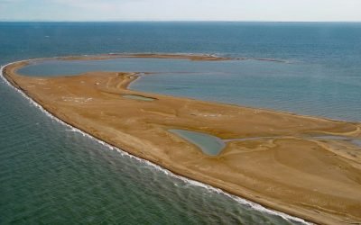
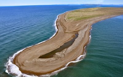
Reindeer Island, Stefansson Sound
Reindeer Island is about 2 miles (3.2 km) long and is the westernmost of the six Midway Islands in Stefansson Sound on the Beaufort Sea coast, about 196 miles (316 km) southeast of Utqiaġvik and 21 miles (34 km) north of Deadhorse, Alaska.
About the background graphic
This ‘warming stripe’ graphic is a visual representation of the change in global temperature from 1850 (top) to 2019 (bottom). Each stripe represents the average global temperature for one year. The average temperature from 1971-2000 is set as the boundary between blue and red. The colour scale goes from -0.7°C to +0.7°C. The data are from the UK Met Office HadCRUT4.6 dataset.
Click here for more information about the #warmingstripes.