by CoastView | May 20, 2024 | 2024, Alaska, Coastal Features, Embayments, Natural History
Mount Pavlof is a stratovolcano in the Aleutian Range on the Alaska Peninsula near Pavlof Bay, about 57 miles (92 km) west of Sand Point and 34 miles (55 km) northeast of Cold Bay, Alaska. It has been one of the most active volcanoes in North America, and in the past...

by CoastView | May 19, 2024 | 2024, Alaska, Embayments, Historical, Islands
Winter Harbor is an embayment about 0.3 miles (0.5 km) wide on the west coast of Prince of Wales Island, near the south entrance to Tuxekan Passage, about 66 miles (106 km) northwest of Ketchikan and 15 miles (24 km) north-northwest of Klawock, Alaska. The name was...

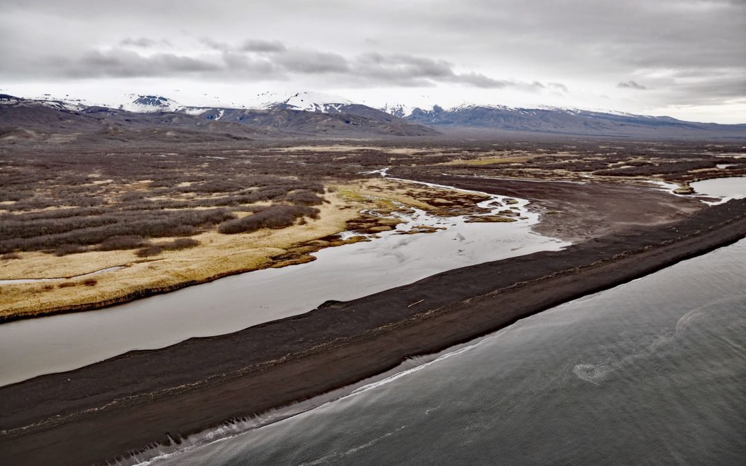
by CoastView | May 16, 2024 | 2024, Alaska, Beaches, Coastal Features
Patton Bay is about 4 miles (6.5 km) wide, located on the southeast coast of Montague Island, about 75 miles (121 km) southwest of Cordova and 70 miles (113 km) southeast of Seward, Alaska. The bay was named in 1937 by the U.S. Coast and Geodetic Survey for Rear...

by CoastView | May 14, 2024 | 2024, Alaska, Beaches, Embayments, Parks
Hallo Bay is a bight in Shelikof Strait on the south coast of the Alaska Peninsula in Katmai National Park and Preserve, about 122 miles (197 km) southwest of Homer and 76 miles (123 km) northwest of Kodiak, Alaska. The name was first published in 1868 by the U.S....

by CoastView | May 13, 2024 | 2024, Alaska, Glaciers, Parks, Rivers
Dangerous River starts at Harlequin Lake in the Brabazon Mountains of the Fairweather Range and flows southwest for 16 miles (26 km) to the Gulf of Alaska, about 102 miles (165 km) northwest of Gustavus and 50 miles (81 km) southeast of Yakutat, Alaska. The name was...

by CoastView | May 12, 2024 | 2024, Alaska, Glaciers, Historical
La Perouse Glacier descends from Mount La Perouse in the Fairweather Range and in Glacier Bay National Park and Preserve, about 116 miles (187 km) southeast of Yakutat and 40 miles (65 km) northwest of Gustavus, Alaska. The glacier starts on the south slope of Mount...