
by CoastView | Jan 16, 2026 | 2026, Alaska, Climate Change, Coastal Features, Communities, Embayments, Islands, January 2026, Land Use, Natural History, Rivers
Listen to the article here https://coastview.org/wp-content/uploads/2025/12/ToksookBay.mp3 Toksook Bay is a Yup’ik speaking community located on Nelson Island in the Yukon-Kuskokwim Delta, approximately 112 miles (181 km) west-southwest of Bethel and 13.5 miles...
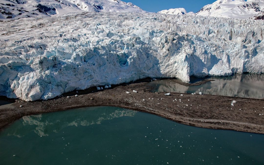
by CoastView | Jan 3, 2026 | 2026, Alaska, Climate Change, Coastal Features, Embayments, Glaciers, January 2026
Listen to the article here https://coastview.org/wp-content/uploads/2025/12/HarrimanGlacier.mp3 Harriman Glacier is 8 miles (13 km) long and trends northeast to its terminus at the head of Harriman Fjord in Prince William Sound, about 74 miles (119 km) west-southwest...
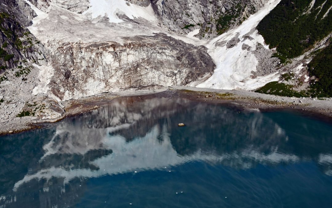
by CoastView | Nov 3, 2025 | 2025, Alaska, Climate Change, Coastal Features, Embayments, Glaciers, Historical, Land Use, Natural History, November 2025, Parks
Listen to the article here https://coastview.org/wp-content/uploads/2025/07/Anchor-Glacier.mp3 Anchor Glacier flows east for 3 miles (5 km) to Northwestern Fjord, which is located approximately 52 miles (84 km) east-northeast of Homer and 32 miles (52 km) southwest of...
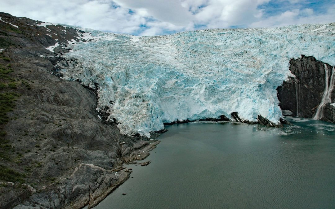
by CoastView | Oct 13, 2025 | 2025, Alaska, Climate Change, Coastal Features, Embayments, Glaciers, Historical, Natural History, October 2025
Listen to the article here https://coastview.org/wp-content/uploads/2025/06/Blackstone-Glacier.mp3 Blackstone Glacier flows north for 7 miles (11 km), terminating at tidewater at the head of Blackstone Bay, about 87 miles (140 km) west-southwest of Valdez and 8 miles...
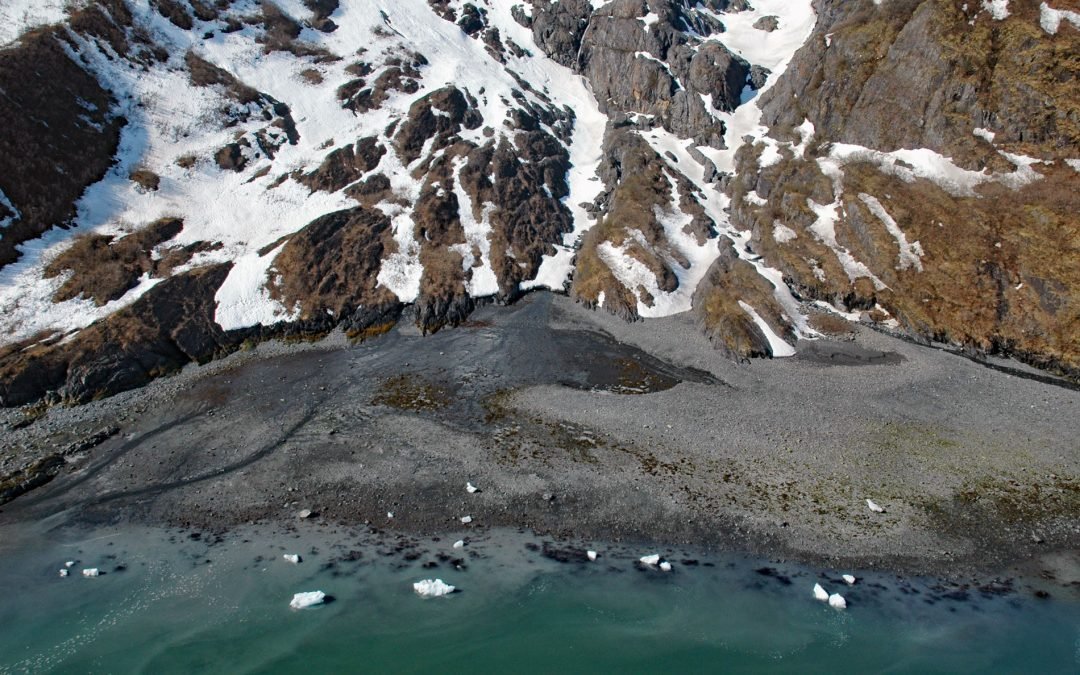
by CoastView | Oct 9, 2025 | 2025, Alaska, Climate Change, Coastal Features, Embayments, Glaciers, Historical, Land Use, Natural History, October 2025
Listen to the article here https://coastview.org/wp-content/uploads/2025/06/Cataract-Glacier.mp3 Cataract Glacier flows to the southern shore of Surprise Inlet, a fjord in Prince William Sound, about 51 miles (82 km) east-southeast of Anchorage and 20 miles (32 km)...

by CoastView | Aug 16, 2025 | 2025, Alaska, Climate Change, Coastal Features, Embayments, Glaciers, Kachemak, Land Use, Natural History, Parks
Listen to the article here https://coastview.org/wp-content/uploads/2025/06/Mallard-Bay.mp3 Mallard Bay is on the southern shore of Kachemak Bay on the Kenai Peninsula and adjacent to the mouth of the Portlock River, approximately 14 miles (23 km) east-northeast of...