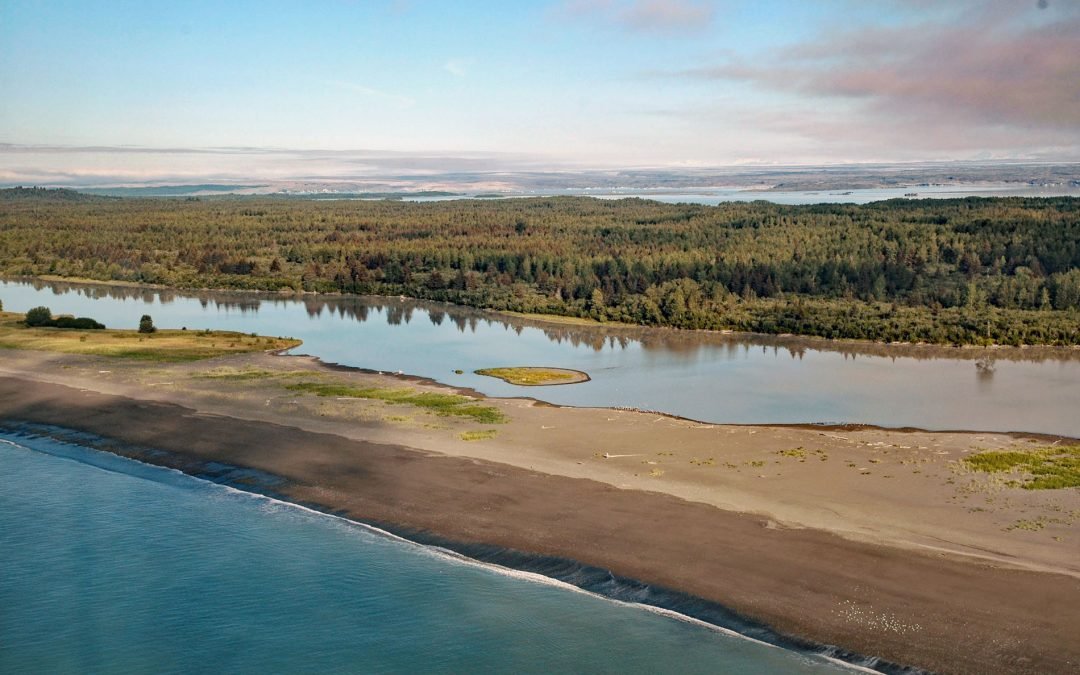
by CoastView | Apr 14, 2024 | 2024, Alaska, Beaches, Biodiversity, Coastal Features, Glaciers, Land Use, Natural History, Parks, Rivers
Sudden Stream drains the Malaspina Coastal Plain, flowing generally south for 2 miles (3.2 km) from the outlet of Malaspina Lake, a proglacial lake at the terminus of the Malaspina Glacier, to a lagoon formed by a barrier spit called Schooner Beach on Yakutat Bay,...
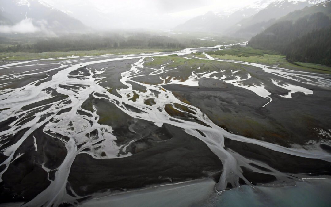
by CoastView | Apr 10, 2024 | 2024, Alaska, Beaches, Coastal Features, Developments, Embayments, Glaciers, Land Use, Mines, Natural History, Parks
Nuka River starts from Bradley Pass in the Kenai Mountains at an elevation of roughly 1400 feet (427 m) and flows generally south for 10 miles (16 km), draining a watershed of 34,503 acres (13,963 ha), to Beauty Bay between Storm Mountain to the north and Mount Diablo...
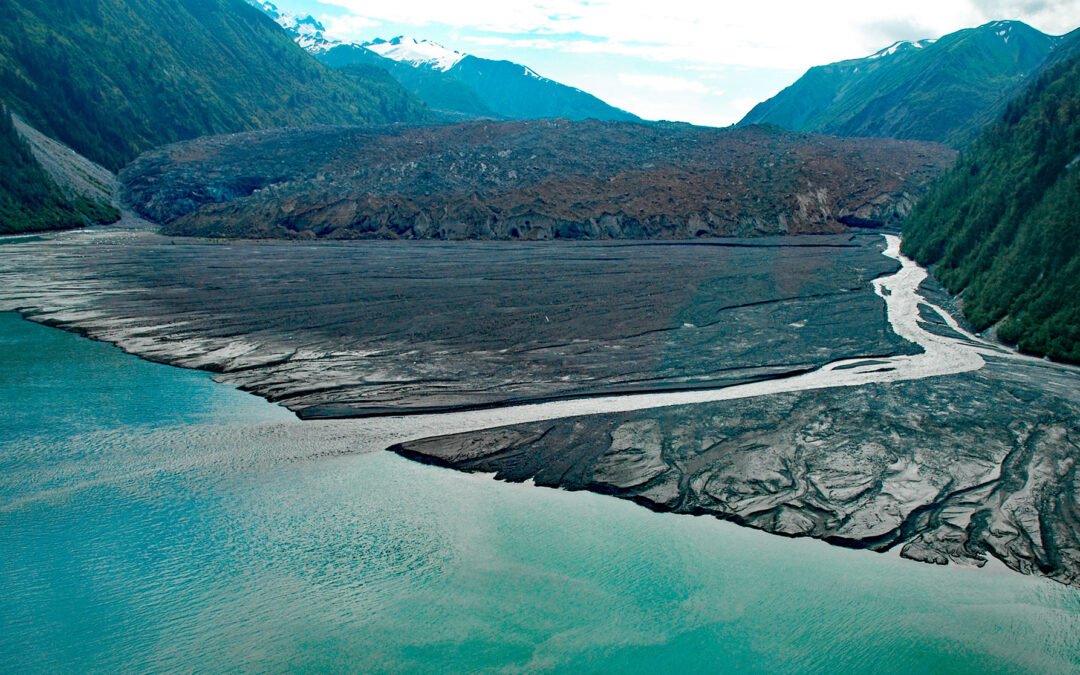
by CoastView | Apr 9, 2024 | 2024, Alaska, Climate Change, Coastal Features, Embayments, Glaciers, Natural History, Parks
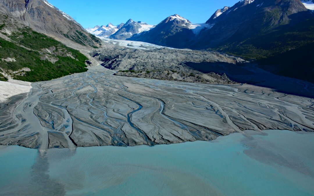
North Crillon Glacier starts from a cirque at an elevation near 6,200 feet (1,890 m) on the west flank of Mount Crillon in the Fairweather Range, and flows generally southwest for 9 miles (15 km) and then makes an abrupt turn to the north and continues for another 3...
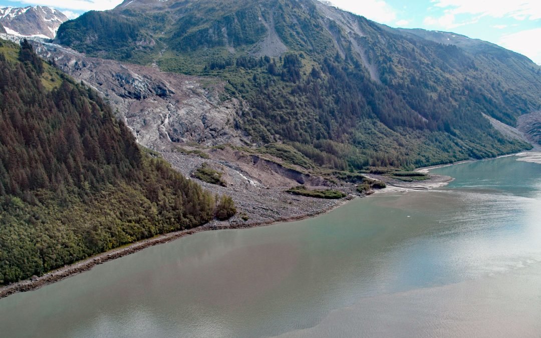
by CoastView | Apr 1, 2024 | 2024, Alaska, Climate Change, Coastal Features, Embayments, Glaciers, Land Use, Natural History, Parks
Cascade Glacier starts from the western slope of Peak 7788 (2,374 m) in the Fairweather Range and flows generally west for 2.6 miles (4 km) to the head of Lituya Bay in Glacier Bay National Park and Preserve, about 97 miles (156 km) southeast of Yakutat and 67 miles...

by CoastView | Mar 28, 2024 | 2024, Alaska, Climate Change, Coastal Features, Embayments, Glaciers, Natural History, Parks
Lawrence Glacier starts from several cirques situated at the northern extent of the Kenai Mountains at an elevation of roughly 3,000 feet (915 m) and flows generally northwest for 2.4 miles (4 km) to within a few hundred feet of tidewater at the south end of Willard...
by CoastView | Mar 25, 2024 | 2024, Alaska, Coastal Features, Embayments, Glaciers, Land Use, Natural History, Parks
Rendu Glacier starts in the Fairweather Range at an elevation of roughly 4600 feet (1400 m) in British Columbia and flows generally southeast for about 1 mile (1.6 km) to the United States border between Mount Barnard to the southwest and Boundary Peak 159 to the...