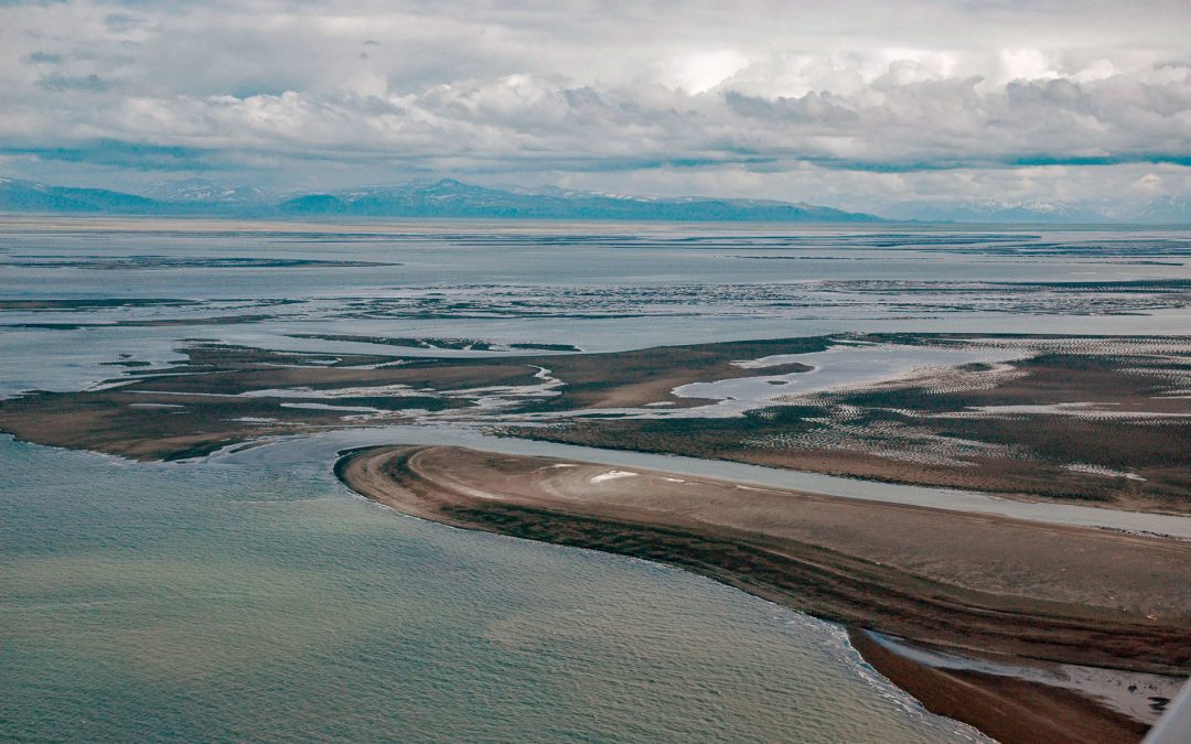
by CoastView | Mar 1, 2026 | 2026, Alaska, Communities, Embayments, Historical, Land Use, March 2026, Natural History
Listen to the article here https://coastview.org/wp-content/uploads/2026/01/PortHeiden.mp3 Port Heiden is an embayment on the northern coast of the Alaska Peninsula that extends 9 miles (14 km) south-east from Bristol Bay between Strogonof Point and the community of...
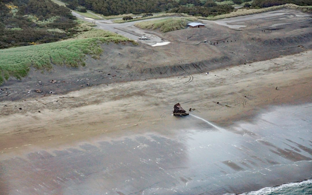
by CoastView | Feb 28, 2026 | 2026, Beaches, Historical, Land Use, March 2026, Oregon, Parks, Shipwrecks
Listen to the article here https://coastview.org/wp-content/uploads/2026/01/PeterIredale.mp3 Peter Iredale was a British four-masted bark that ran aground in 1906 on Clatsop Spit, about 7 miles (11 km) west of Astoria and 2 miles (3 km) south-west of Hammond, Oregon....

by CoastView | Feb 25, 2026 | 2026, Alaska, Coastal Features, Embayments, February 2026, Historical, Natural History, Parks
Listen to the article here https://coastview.org/wp-content/uploads/2026/01/LituyaBay.mp3 Lituya Bay is a fjord on the outer coast of Southeast Alaska in Glacier Bay National Park and Preserve, about 97 miles (156 km) south-east of Yakutat and 70 miles (113 km)...
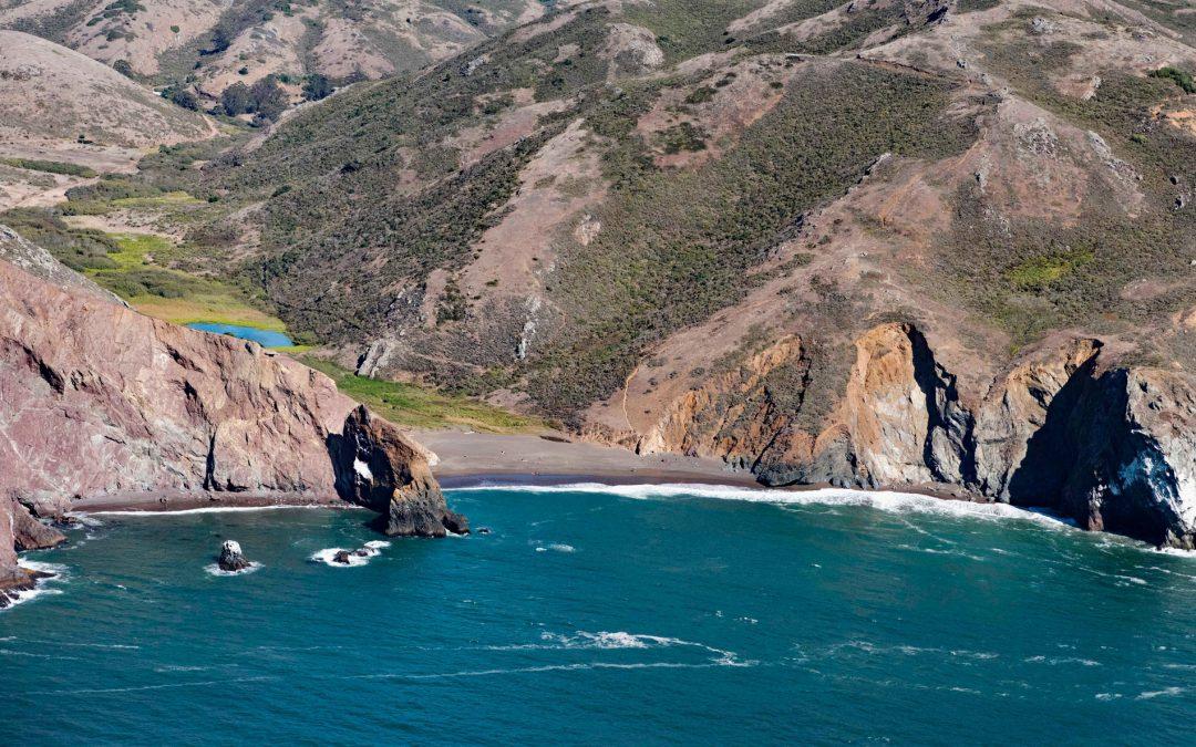
by CoastView | Feb 23, 2026 | 2026, Beaches, Best of 2023, California, Embayments, February 2026, Historical, Land Use, Parks, Shipwrecks
Listen to the article here https://coastview.org/wp-content/uploads/2026/01/TennesseeCove-1.mp3 Tennessee Cove is an embayment with a sandy beach roughly 600 feet (180 m) long on the Pacific Ocean, between Pirates Cove to the north and Rodeo Cove to the south, in the...
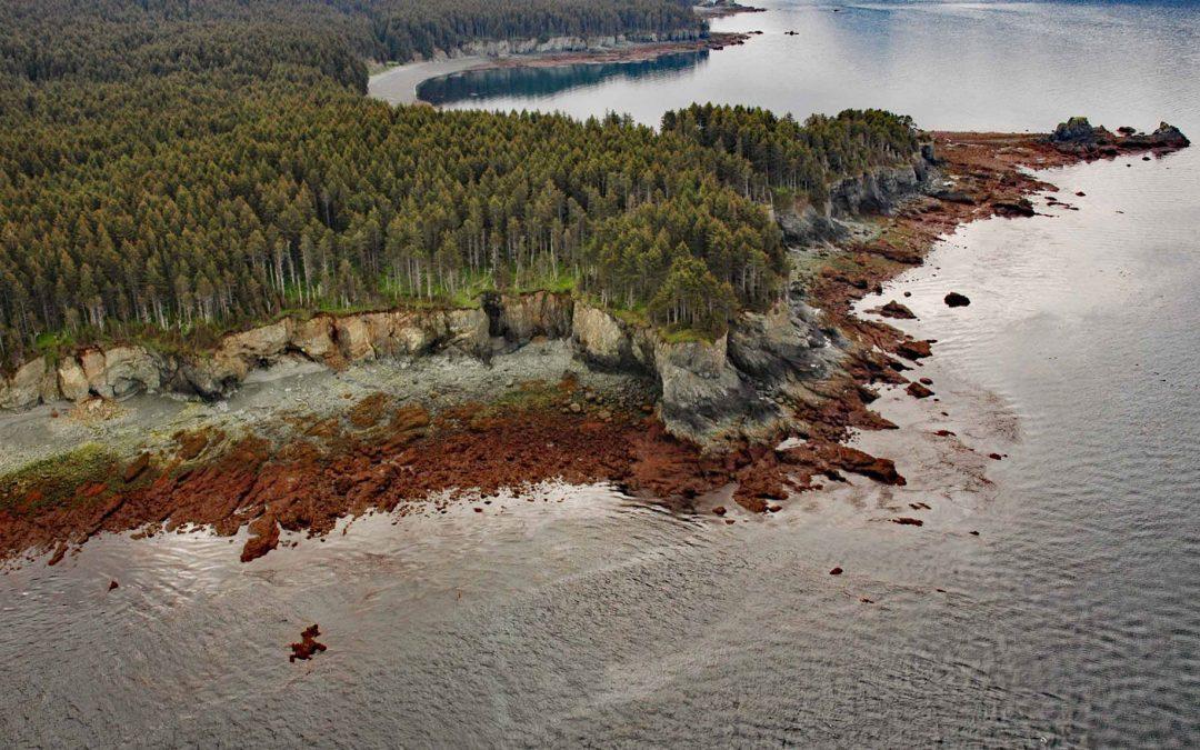
by CoastView | Feb 20, 2026 | 2026, Alaska, Coastal Features, February 2026, Headlands, Historical, Kachemak, Shipwrecks
Listen to the article here https://coastview.org/wp-content/uploads/2026/01/DangerousCape.mp3 Dangerous Cape is a headland rising 66 feet (20 m) on the southern Kenai Peninsula, at the northern entrance to Port Graham near the mouth of Kachemak Bay, about 22 miles (35...

by CoastView | Feb 19, 2026 | 2026, British Columbia, Coastal Features, February 2026, Headlands, Historical, Lighthouses
Listen to the article here https://coastview.org/wp-content/uploads/2026/01/PachenaPoint.mp3 Pachena Point Lighthouse sits on the west coast of Vancouver Island in Pacific Rim National Park Reserve, about 82 miles (132 km) northwest of Victoria and 8 miles (13 km)...