by CoastView | Dec 31, 2024 | 2024, Beaches, Biodiversity, Coastal Features, Developments, Embayments, Historical, Land Use, Natural History, Oregon, Parks
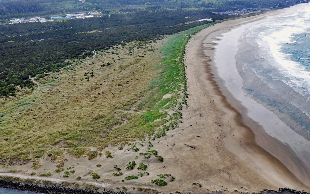
South Beach is a state park south of the jetty protecting the mouth of Yaquina Bay and extending for 1 mile (1.6 km) along the Pacific coast, about 12 miles (19 km) north of Waldport and 2 miles (3.2 km) south-southwest of Newport, Oregon. The beach continues south...
by CoastView | Dec 4, 2024 | 2024, Beaches, Biodiversity, Coastal Features, Headlands, Historical, Islands, Land Use, Oregon, Parks
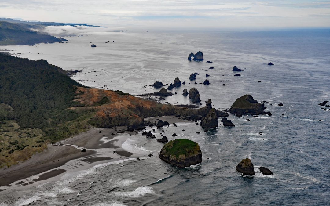
Crook Point is a prominent headland within the Oregon Islands National Wildlife Refuge that includes 1.4 miles (2.3 km) of shoreline with sandy beaches and areas of rocky intertidal, offshore rocks, islets, and subtidal reefs with kelp beds, about 15 miles (24 km)...
by CoastView | Nov 21, 2024 | 2024, Coastal Features, Headlands, Historical, Land Use, Oregon, Parks
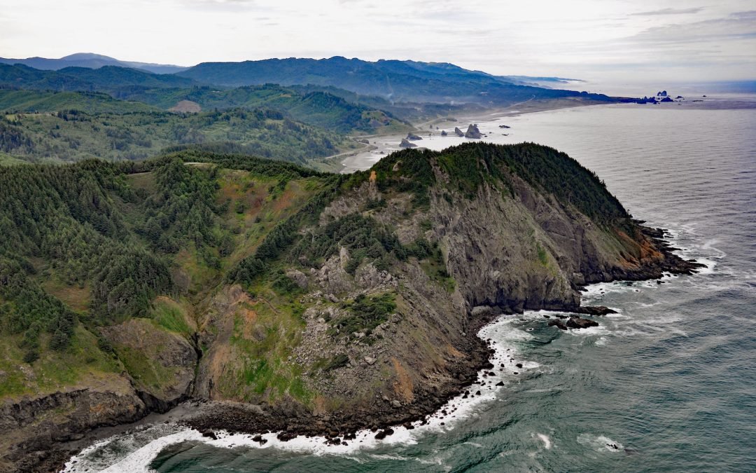
Cape Sebastian is a prominent headland with an elevation of about 640 feet (195 m) and is one of the 11 named capes along the Oregon coast, about 6.7 miles (10.8 km) south of Gold Beach and 3 miles (4.8 km) north of Pistol River, Oregon. The most conspicuous headlands...

by CoastView | Nov 7, 2024 | 2024, Coastal Features, Developments, Headlands, Historical, Land Use, Oregon, Parks
Humbug Mountain rises 1,758 feet (536 m) from sea level on the southern coast of Oregon and lies entirely within Humbug Mountain State Park, about 21 miles (34 km) north of Gold Beach and 6 miles (10 km) south of Port Orford, Oregon. The mountain was originally known...
by CoastView | Oct 12, 2024 | 2024, Coastal Features, Developments, Headlands, Historical, Land Use, Oregon, Parks
Tillamook Head is a steep rocky promontory with an elevation of approximately 1,200 feet (366 m), located in Ecola State Park, about 5 miles (8 km) southwest of Seaside and 4 miles (6.4 km) north-northwest of Cannon Beach, Oregon. The promontory is named after the...

by CoastView | Oct 6, 2024 | 2024, Biodiversity, Coastal Features, Developments, Headlands, Historical, Land Use, Oregon, Sea Caves
Sea Lion Caves are a connected system of sea caves and caverns open to the Pacific Ocean at Sea Lion Point, about 36 miles (58 km) south of Newport and 11 miles (18 km) north of Florence, Oregon. The cave system extends for 1315 feet (401 m) and is the longest in the...