by CoastView | Sep 17, 2023 | 2023, Headlands, Islands, Lighthouses, Washington
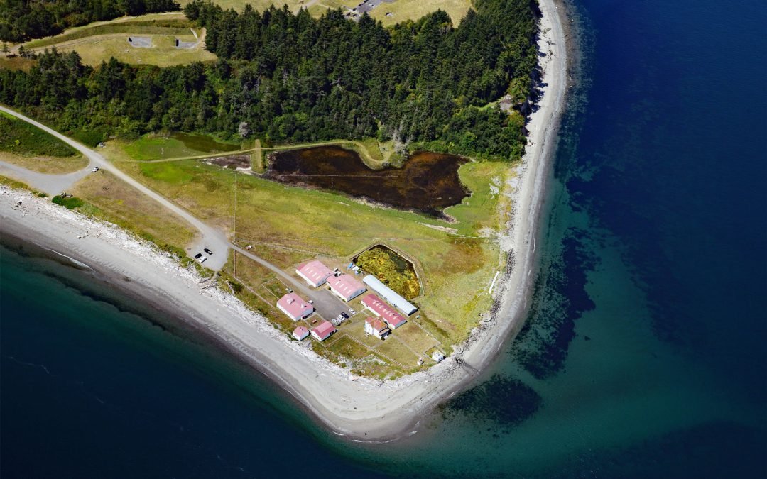
Marrowstone Point is a low broad spit on the north shore of Marrowstone Island that marks the entrance to Port Townsend Bay from Admiralty Inlet, about 38 miles (61 km) north-northwest of Seattle and 3 miles (4.8 km) southeast of Port Townsend, Washington. Captain...
by CoastView | Sep 3, 2023 | 2023, Historical, Islands, Rivers, Washington
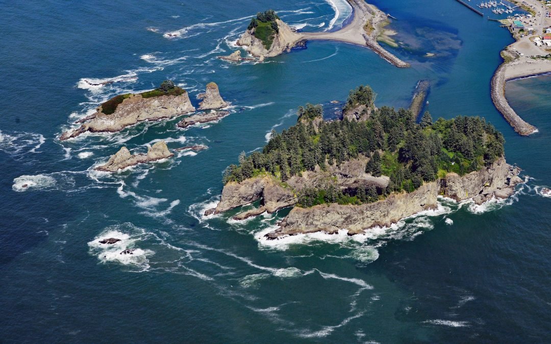
James Island has an elevation of over 160 feet (50 m) and is located at the mouth of the Quillayute River, about 32 miles (52 km) south of Neah Bay and 0.6 miles (1 km) west of La Push, Washington. The island reputedly was named for Francis Wilcox James, a lighthouse...
by CoastView | Aug 21, 2023 | 2023, Coastal Features, Headlands, Washington
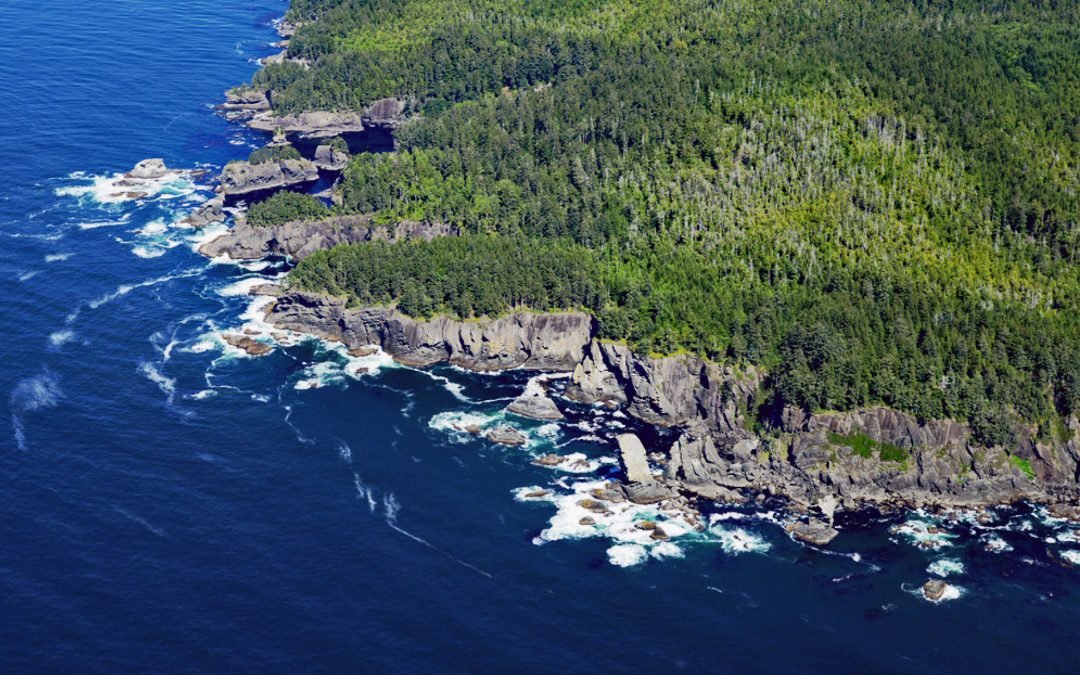
Fuca Pillar is a prominent rectangular sea stack on the west side of Cape Flattery, about 18 miles (29 km) southwest of Port Renfrew and 6 miles (10 km) west-northwest of Neah Bay, Washington. The Fuca Pillar is named for Ioannis Phokas, better known by the Spanish...
by CoastView | Jul 23, 2023 | 2026, Coastal Features, Developments, Historical, July 2026, Land Use, Natural History, Rivers, Washington
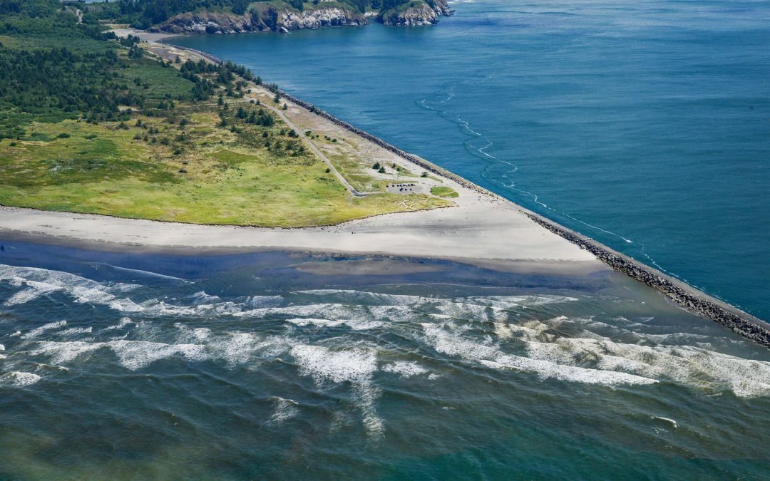
Listen to the article here https://coastview.org/wp-content/uploads/2026/03/PeacockSpit.mp3 Peacock Spit is the northern portion of a mostly submerged sand bar, generally called the Columbia Bar, at the mouth of the Columbia River, about 12 miles (19 km) northwest of...