Glaciers
Recent Articles
More Articles
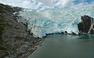
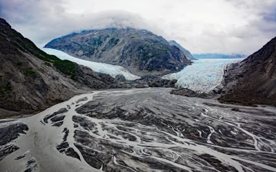
Blackstone Glacier, Blackstone Bay
Blackstone Glacier starts at an elevation of about 5,000 feet (1,500 m) in the Kenai Mountains and flows generally north for 7 miles (11 km) and terminates at tidewater at the head of Blackstone Bay, about 87 miles (140 km) west-southwest of Valdez and 8 miles (13 km) south of Whittier, Alaska.
Cataract Glacier, Surprise Inlet
Cataract Glacier starts from the north flank of Peak 5541 in the Chugach Mountains and flows northeast for 2.1 miles (3.4 km) through a steep valley to its terminus at the head of a stream that flows for another 0.5 miles (0.8 km) to the southern shore of Surprise Inlet in Prince William Sound, about 51 miles (82 km) east-southeast of Anchorage and 20 miles (32 km) northeast of Whittier, Alaska.
Tutka River, Kachemak Bay
Tutka River starts from an elevation of about 2800 feet (853 m) on the western flank of the Kenai Mountains and flows generally west to the head of Tutka Bay, a fjord on the southern coast of Kachemak Bay, about 18 miles (29 km) southeast of Homer and 15 miles (24 km) east of Seldovia, Alaska.
Southwestern Glacier, Northwestern Fjord
Southwestern Glacier is in Northwestern Fjord, a deep embayment in Kenai Fjords National Park and Preserve, about 50 miles (81 km) northeast of Homer and 33 miles (53 km) southwest of Seward, Alaska.
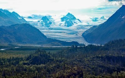
Morse and Muir Glaciers, Muir Inlet
Morse Glacier is in Glacier Bay National Park and Preserve, and starts in the Alsek Range of the Saint Elias Mountains, and flows south-southeast for 9 miles (14.5 km) to an exposed outwash plain near the terminus of the Muir Glacier at the head of Muir Inlet, about 53 miles (85 km) north of Gustavus, Alaska.
Amherst Glacier, College Fjord
Amherst Glacier flows northwest for 4 miles (6.5 km) from the Chugach Mountains to a terminus lake, 5.5 miles (9 km) northeast of Point Pakenham in Prince William Sound, and 52 miles (83 km) southwest of Valdez, Alaska.
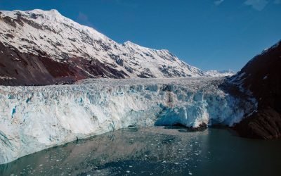
Barry Glacier, Harriman Fjord
Barry Glacier flows southwest for 16 miles (25 km) to Barry Arm of Harriman Fjord in northwestern Prince William Sound, about 33 miles (53 km) northeast of Whittier and 58 miles (93 km) east of Anchorage, Alaska.
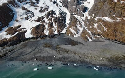
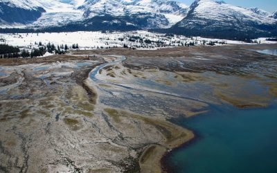
Mallard Bay, Portlock River
Mallard Bay dries at low tide to expose a mudflat situated southwest and adjacent to the mouth of Portlock River on the southern shore of Kachemak Bay on the Kenai Peninsula, about 14 miles (23 km) east-northeast of Homer and 4 miles (6 km) south-southwest of Bear Cove, Alaska.
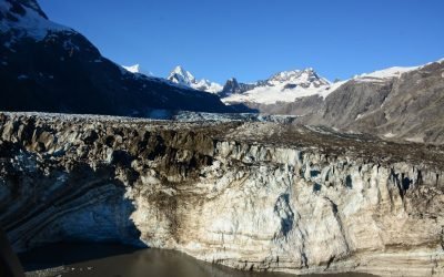
Johns Hopkins Glacier, Glacier Bay National Park and Preserve
Johns Hopkins Glacier starts at an elevation of about 8,000 feet (2,438 m) on the eastern flank of Mount Lituya in the Fairweather Range of the Saint Elias Mountains and flows generally east-northeast for 13 miles (21 km) to the head of Johns Hopkins Inlet in Glacier Bay National Park and Preserve, about 104 miles (167 km) southeast of Yakutat and 58 miles (93 km) northwest of Gustavus, Alaska.
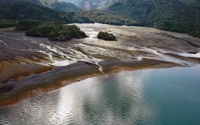
Grewingk Glacier, Kachemak Bay
Grewingk Glacier starts in the Kenai Mountains and flows generally northwest for 11 miles (18 km) to a proglacial lake about 2 miles (3.2 km) long that is drained by Grewingk Creek that flows 3.5 miles (6 km) to the southern shore of Kachemak Bay, about 25 miles (40 km) northeast of Seldovia and 16 miles (25 km) east-southeast of Homer, Alaska.
About the background graphic
This ‘warming stripe’ graphic is a visual representation of the change in global temperature from 1850 (top) to 2019 (bottom). Each stripe represents the average global temperature for one year. The average temperature from 1971-2000 is set as the boundary between blue and red. The colour scale goes from -0.7°C to +0.7°C. The data are from the UK Met Office HadCRUT4.6 dataset.
Click here for more information about the #warmingstripes.