Lighthouses
Recent Articles
More Articles
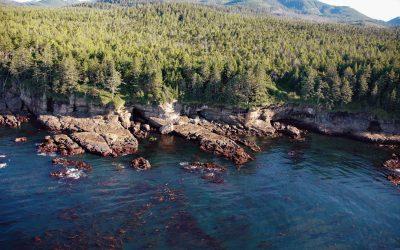
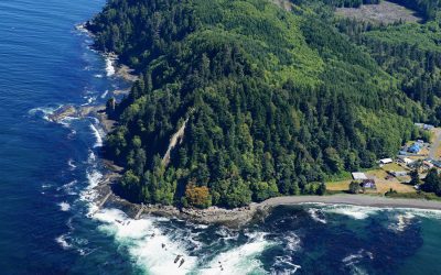
Valencia Bluffs, West Coast Trail
Valencia Bluffs are sea cliffs along the West Coast Trail in Pacific Rim National Park Reserve on Vancouver Island’s southwest shore, about 29 miles (47 km) northwest of Port Renfrew and 11 miles (18 km) southeast of Bamfield, British Columbia.
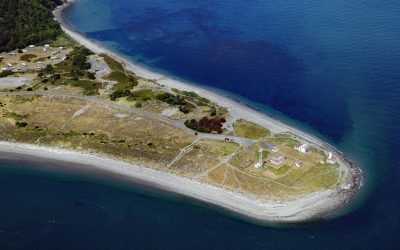
Point Wilson Light Station, Fort Worden
Point Wilson is the site of a historic light station on the grounds of former Fort Worden, situated on a low, broad sand spit that extends northeast for 1.5 miles (0.8 km) from the northern end of the Quimper Peninsula into Admiralty Inlet, about 31 miles (50 km) east of Port Angeles and 2 miles (3.2 km) north of Port Townsend, Washington.
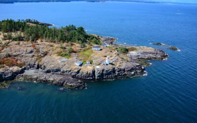
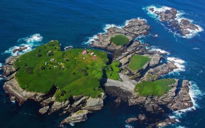
West Ballenas Island, Gulf Islands
West Balenas Island is the site of a historic lighthouse in the Balenas-Winchelsea Archipelago, and part of a proposed marine park in the Gulf Islands, about 15 miles northwest of Nanaimo and 7 miles northeast of Parksville, British Columbia.
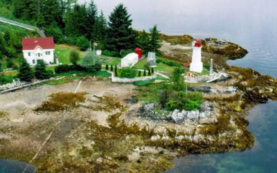
Dryad Point, Campbell Island
Dryad Point is on the northeastern point of Campbell Island and is the site of a historic lighthouse that marks the intersection of Lama Passage to the east and Seaforth Channel to the north on the Inside Passage, about 173 miles (278 km) southeast of Prince Rupert and 2 miles (3.2 km) northeast of Bella Bella, British Columbia.
Slip Point, Clallam Bay
Slip Point sits on the southern shore of the Strait of Juan de Fuca at the eastern end of Clallam Bay on the Olympic Peninsula, about 39 miles (63 km) west-northwest of Port Angeles and 0.7 miles (1 km) northeast of the community of Clallam Bay, Washington.
Tatoosh Island, Cape Flattery
Tatoosh Island is the largest of a small group of islands offshore from Cape Flattery and the site of a historic light station, situated on the Makah Reservation, about 34 miles (55 km) north of La Push and 6 miles (10 km) west-northwest of Neah Bay, Washington.
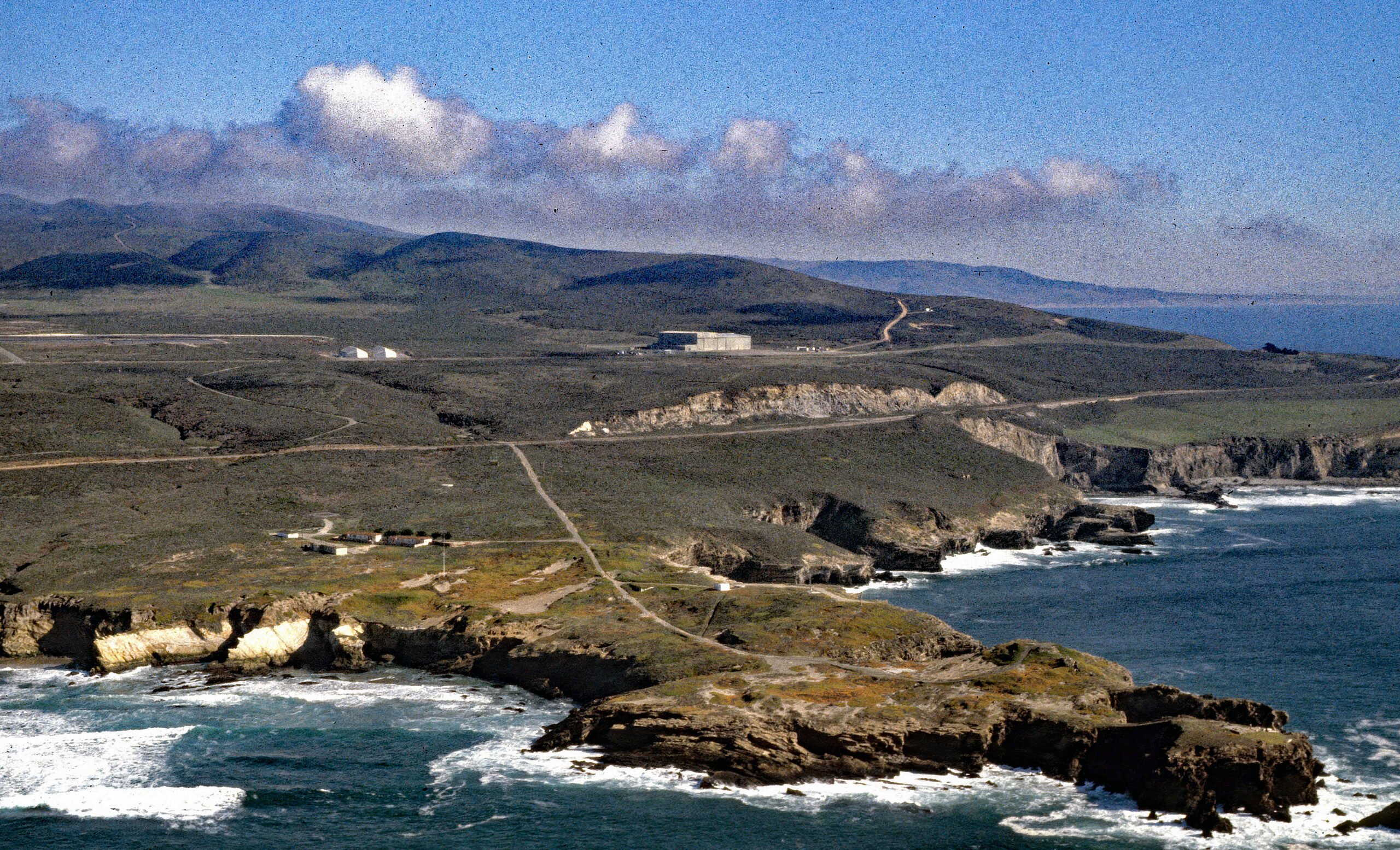
Point Arguello, Vandenberg Space Launch Complex
Point Arguello is a prominent headland and the site of Vandenberg Space Launch Complex, as well as a historical cattle ranch, lighthouse station, and a Loran station, about 55 miles (89 km) west-northwest of Santa Barbara and 12 miles (19 km) southwest of Lompoc, California.
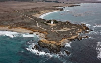
Point Piedras Blancas, San Simeon
Point Piedras Blancas is a prominent headland and the site of a historic light station within the California Coastal National Monument, and surrounded by the Hearst San Simeon State Park, about 73 miles (117 km) south-southeast of Monterey and 6 miles (10 km) west-northwest of San Simeon, California.
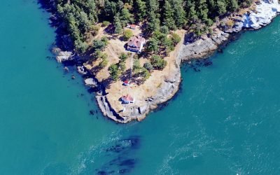
Turn Point, Boundary Pass
Turn Point is a headland with a historic light station on the northwest coast of Stuart Island overlooking Haro Strait to the west and Boundary Pass to the north, located on property that is part of the San Juan Islands National Monument, about 34 miles (55 km) west of Bellingham and 15 miles (24 km) northwest of Friday Harbor, Washington.
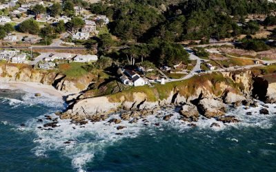
Point Montara Lighthouse, Montara
Point Montara Lighthouse is located in the coastal community of Montara, about 18 miles (29 km) south-southwest of San Francisco and 7 miles (11 km) northwest of Half Moon Bay, California.
About the background graphic
This ‘warming stripe’ graphic is a visual representation of the change in global temperature from 1850 (top) to 2019 (bottom). Each stripe represents the average global temperature for one year. The average temperature from 1971-2000 is set as the boundary between blue and red. The colour scale goes from -0.7°C to +0.7°C. The data are from the UK Met Office HadCRUT4.6 dataset.
Click here for more information about the #warmingstripes.