Lighthouses
Recent Articles
More Articles
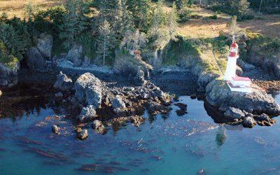
Sheringham Point, Strait of Juan de Fuca
Sheringham Point is the site of a historic lighthouse located on the southern shore of Vancouver Island and on the Strait of Juan de Fuca, between Otter Point to the east and Point No Point to the west, about 26 miles (42 km) west-southwest of Victoria and 7 miles (11 km) southeast of Jordon River, British Columbia.
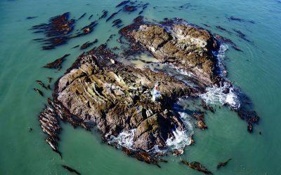
Lawyer Island, Malacca Passage
Lawyer Islands are located in Malacca Passage, part of the Canadian Inside Passage between Porcher Island to the south and the Tsimpsean Peninsula to the north and just off the mouth of the Skeena River, about 102 miles (165 km) southeast of Ketchikan and 13 miles (20 km) south of Prince Rupert, British Columbia.
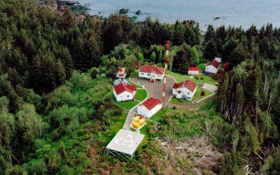
Cape Hinchinbrook, Hinchinbrook Island
Cape Hinchinbrook is a headland with a light station on the southwestern point of Hinchinbrook Island in Prince William Sound, about 79 miles (127 km) southeast of Whittier and 37 miles (60 km) southwest of Cordova, Alaska.
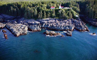
Guard Islands, Tongass Narrows
Guard Islands are separated from Vallenar Point at the northern tip of Gravina Island by Inside Passage, a channel that connects the northern entrance of Tongass Narrows to the east from Clarence Strait to the west, and are part of an island chain that includes Vallenar Rocks, about 73 miles (118 km) south-southeast of Wrangell and 10 miles (16 km) northwest of Ketchikan, Alaska.
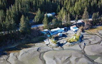
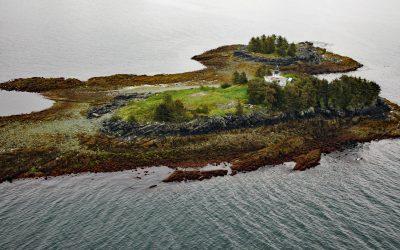
Cordova Rose, Odiak Slough
Cordova Rose is a landlocked barge that was converted to a guest lodge on the southern shore of Odiak Slough, a tidal embayment on Orca Inlet in Prince William Sound and adjacent to Eyak Lake, about 46 miles (74 km) south-southeast of Valdez and 0.5 miles (0.8 km) south of Cordova, Alaska.
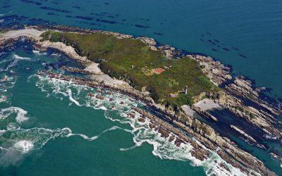
Cape Scott, Cape Scott Provincial Park
Cape Scott is a headland about 500 feet (150 m) high at the extreme northwestern point of Vancouver Island in Cape Scott Provincial Park, about 256 miles 412 km) south-southeast of Prince Rupert and 41 miles (66 km) west of Port Hardy, British Columbia.
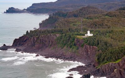
Pachena Point Lighthouse, Pacific Rim National Park Reserve
Pachena Point Light Station is located on the west coast of Vancouver Island in Pacific Rim National Park Reserve, about 82 miles (132 km) northwest of Victoria and 8 miles (13 km) south-southeast of Bamfield, British Columbia.
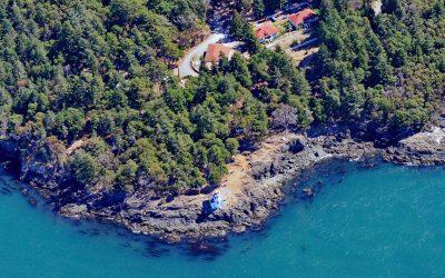
Lime Kiln Lighthouse, San Juan Island
Lime Kiln Light was established in 1919 on Lime Kiln Point, a day-use park of 36 acres (15 ha) overlooking Deadman Bay to the south and Haro Strait to the west on the west coast of San Juan Island, about 12 miles (19 km) northeast of Victoria and 6.4 miles (10 km) west-southwest of Friday Harbor, Washington.
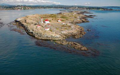
Staines Point, Trial Islands
Staines Point is the southern tip of the Trial Islands which comprise two islets separated by a narrow channel situated in the Strait of Juan de Fuca about 0.5 miles (0.8 km) offshore from the southern end of Vancouver Island at McNeill Bay, about 3.5 miles (5.6 km) southeast of Victoria and 2 miles (3.2 km) south-southeast of Oak Bay, British Columbia.
Destruction Island, Quillayute Needles National Wildlife Refuge
Destruction Island is part of the Quillayute Needles National Wildlife Refuge, located 3.5 miles (6 km) offshore from the Olympic Peninsula, about 56 miles (90 km) southwest of Port Angeles and 17 miles (27 km) south-southeast of La Push, Washington.
About the background graphic
This ‘warming stripe’ graphic is a visual representation of the change in global temperature from 1850 (top) to 2019 (bottom). Each stripe represents the average global temperature for one year. The average temperature from 1971-2000 is set as the boundary between blue and red. The colour scale goes from -0.7°C to +0.7°C. The data are from the UK Met Office HadCRUT4.6 dataset.
Click here for more information about the #warmingstripes.