
Rivers
Recent Articles
More Articles
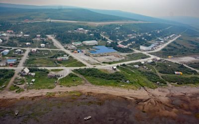
Koyuk, Norton Bay
Koyuk is an Iñupiaq community situated at the head of Norton Bay on the right bank of the Koyuk River estuary on the Seward Peninsula, about 129 miles (208 km) east-northeast of Nome and 40 miles (64 km) north of Shaktoolik, Alaska.

Rolph Slough, Nushagak Point
Rolph, or Ralph Slough is a tidal creek in an area of grass meadows and numerous unnamed sloughs that cut through vast mud flats on the left bank near the mouth of the Nushagak River at Nushagak Point, about 55 miles (89 km) west-northwest of Naknek and 6 miles (10 km) south of Dillingham, Alaska.
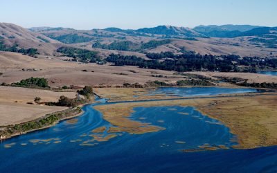
Point Reyes Station, Tomales Bay
Point Reyes Station is a community situated on the San Adreas Rift Zone at the head of Tomales Bay near the tidal estuary of Lagunitas Creek, about 29 miles (47 km) northwest of San Francisco and 3.5 miles (6 km) southeast of Inverness, California.
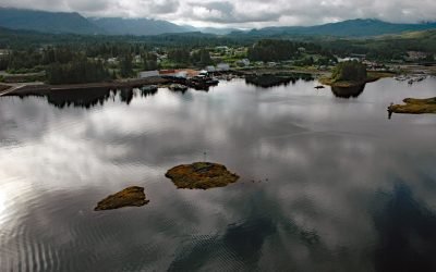
Klawock, Prince of Wales Island
Klawock is a community on the estuary of the Klawock River on the west coast of Prince of Wales Island in the Alexander Archipelago of Southeast Alaska, about 58 miles (93 km) northwest of Ketchikan and 6 miles (10 km) northeast of Craig, Alaska.
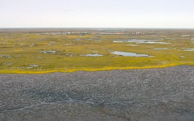
Kongiganak, Kuskokwim Bay
Kongiganak is a Central Yup’ik community situated on the eastern bank of the Kongnignanohk River that flows generally south for 40 miles (64 km) through a watershed of 29,718 acres (12,026 ha) in the Yukon Delta National Wildlife Refuge to the western shore of Kuskokwim Bay, about 69 miles (111 km) southwest of Bethel and 11 miles (18 km) east-northeast of Kwigillingok, Alaska.

Telegraph Point, Skeena River
Telegraph Point is the historical site of a telegraph station on the north bank of the Skeena River, about 48 miles (77 km) southwest of Terrace and 28 miles (45 km) southeast of Prince Rupert, British Columbia.

Dutton, Cottonwood Bay
Dutton is a historical mining camp at the mouth of Ptarmigan Creek at the head of Cottonwood Bay, about 78 miles (126 km) west of Homer and 18 miles (29 km) southeast of Pedro Bay, Alaska.
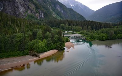
Exchamsiks River Provincial Park, Skeena River
Exchamsiks River Provincial Park is in the Coast Mountains at the mouth of the Exchamsiks River on the north side of the Skeena River, about 42 miles (68 km) east of Prince Rupert and 31 miles (50 km) southwest of Terrace, British Columbia.
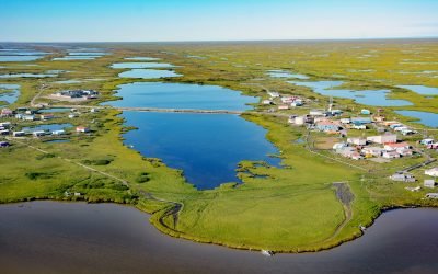
Nunam Iqua, Sheldon Point
Nunam Iqua is a small community on Sheldon Point located on the left bank of Kwemeluk Pass in the Yukon River delta, about 157 miles (253 km) northwest of Bethel and 12.4 miles (20 km) south-southwest of Alakanuk, Alaska.

Kustatan, West Foreland
Kustatan is a historical Dena’ina community on West Foreland, on the west side of Cook Inlet near the mouth of the Kustatan River, about 71 miles (115 km) southwest of Anchorage and 20 miles (32 km) northwest of Kenai, Alaska.
About the background graphic
This ‘warming stripe’ graphic is a visual representation of the change in global temperature from 1850 (top) to 2019 (bottom). Each stripe represents the average global temperature for one year. The average temperature from 1971-2000 is set as the boundary between blue and red. The colour scale goes from -0.7°C to +0.7°C. The data are from the UK Met Office HadCRUT4.6 dataset.
Click here for more information about the #warmingstripes.